ABOUT
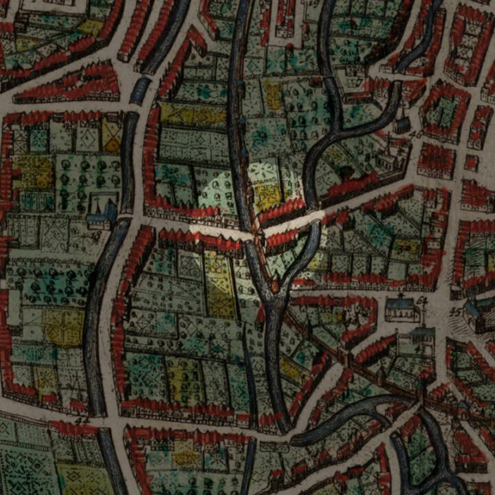
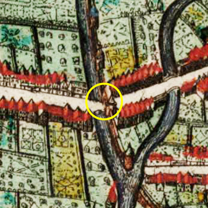
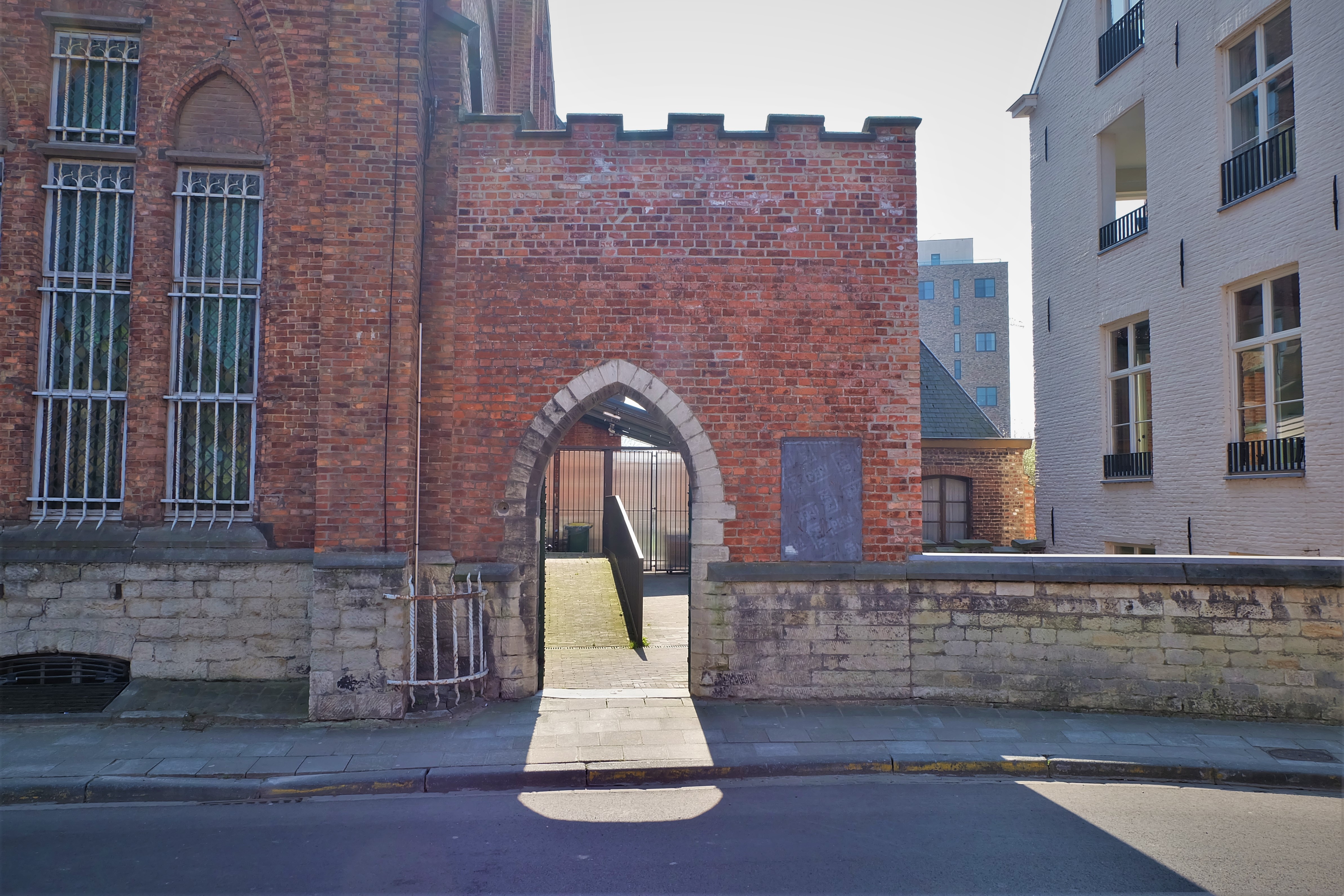
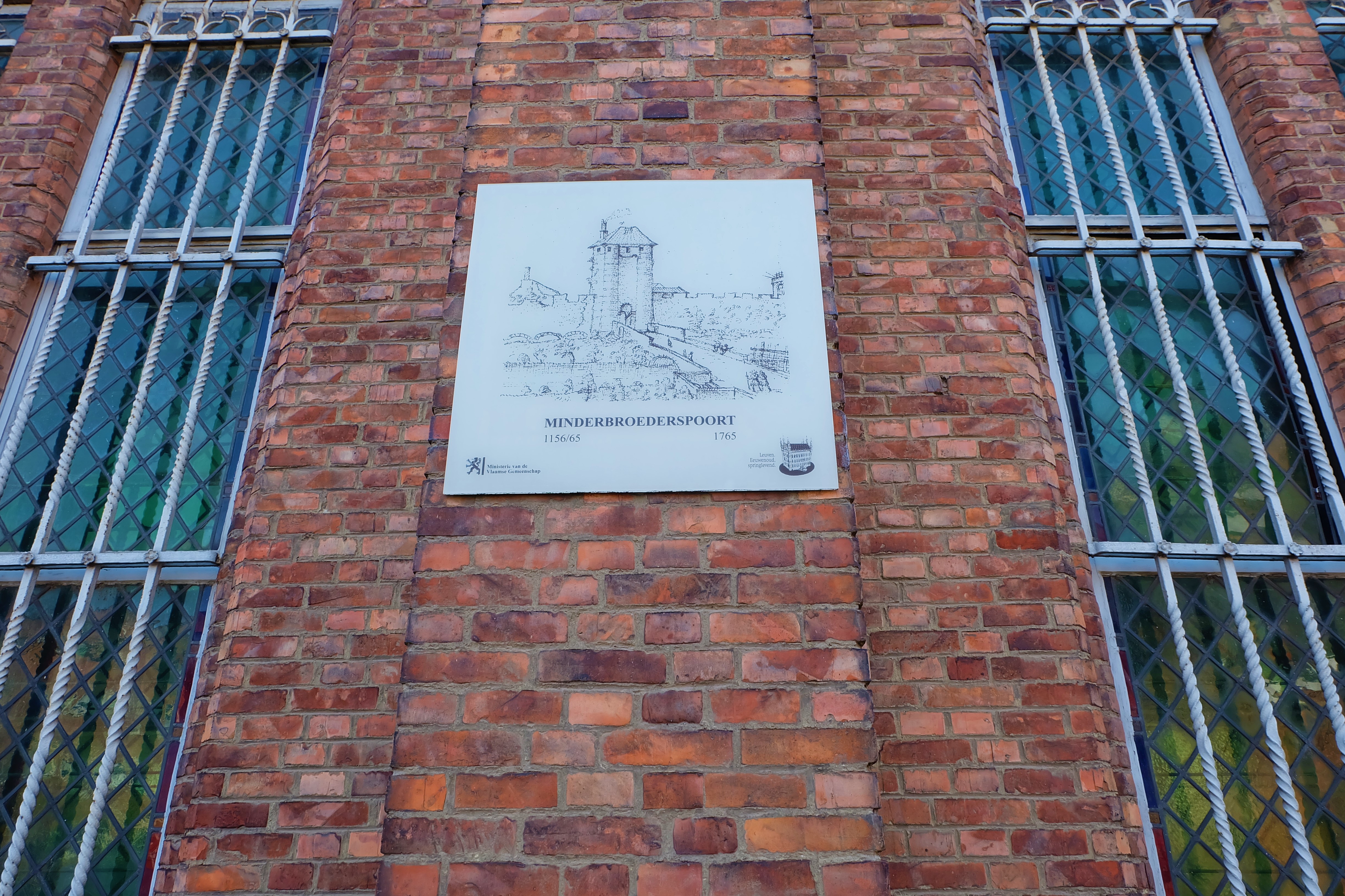
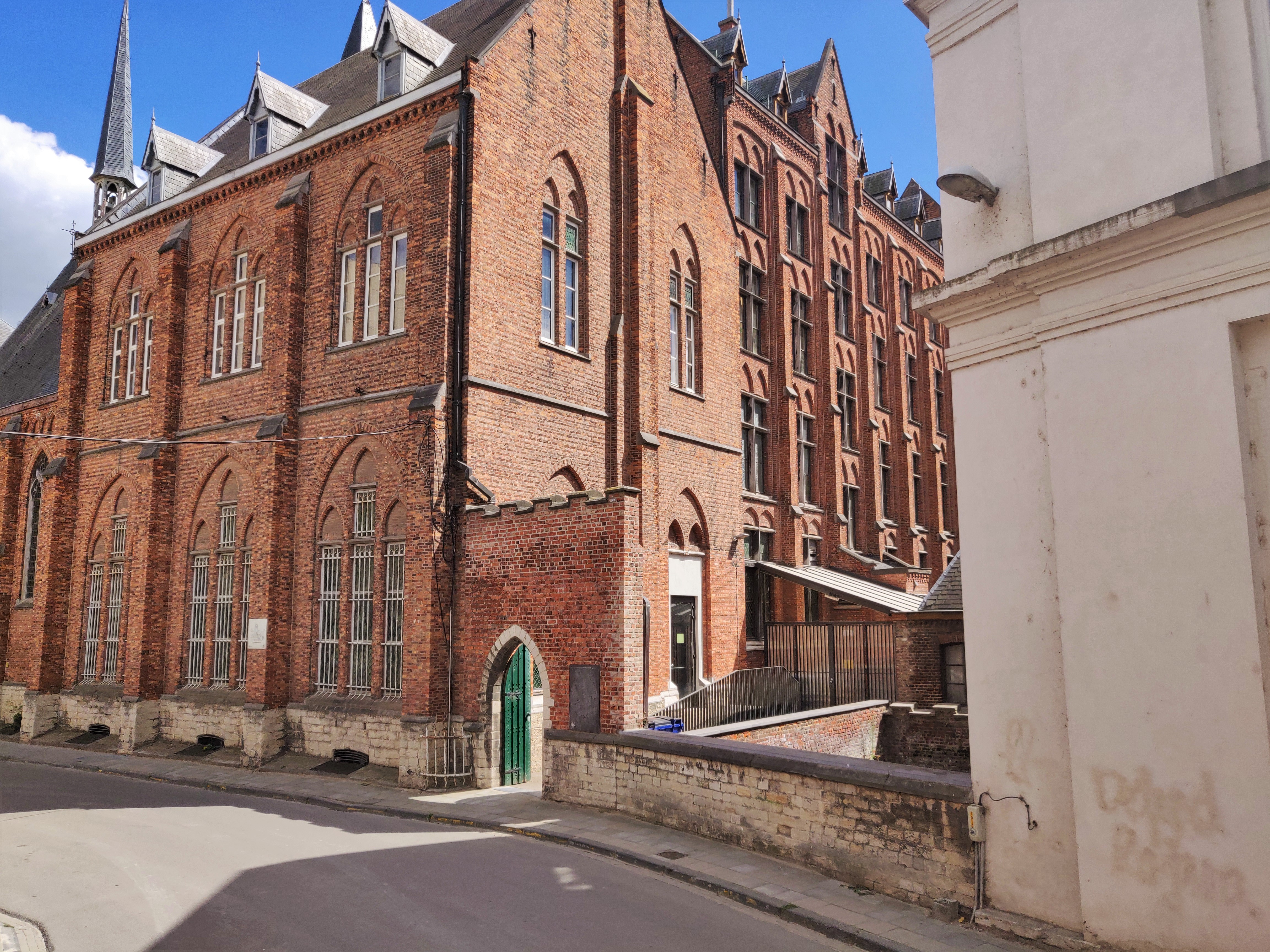
The Minderbroederspoort (Gate of the Friars Minor) was located on the Minderbroedersstraat, on top of the Little Dijle west of the Justus Lipsius College.
Origin
The First and Inner Defence Wall of Leuven: After 1190
In the Early Middle Ages, Leuven was defended by a primitive fence that stretched from the Aardappelmarkt (modern-day Vital Decosterstraat) to the Redingenstraat, while an arm of the River Dijle formed a natural border.
By the 13th century, when the city grew to be the permanent residence of the Count of Leuven and Brussels, the need for a stronger defense bulwark became urgent. Historians have traditionally dated the construction of Leuven’s first defense walls to be between 1156 and 1165, during the reign of Count Godfried III, due to the yearly tax he imposed on citizens for defense. However, the military features of Leuven’s wall such as anchor towers, arrowslits etc cannot date before the 1200s, making this estimate too early. It is now generally accepted that Leuven’s first city wall was built by Henry I (Henrik), the first Duke of Brabant (1190-1235). He also abolished his father’s defense tax in 1233.
Constructed with layers of sandstone from nearby Diegem and Zaventem and ironstone, the first defense wall was roughly 2,740 metres long with 31 watch towers, 11 city gates and 2 water gates.
The wall measures 1.70m thick and rests on a series of underground arches. On the field side, the wall rises to about 5m tall. On the inside, a continuous series of arches supported a three-foot-wide walkway. The wall had arrowslits that were reduced on the outside to a narrow opening of 90cm high and 5cm wide.
However, as the city grew rapidly in size, a second (outer) more impressive defence wall was built in 1357, rendering the inner wall somewhat redundant. But the inner wall and gates were not immediately torn down. Most of it only disappeared in the 18th and 19th centuries. Even so, we see more of Leuven’s inner city wall today than the more recent outer city wall. Very well-preserved remnants of the 12th-13th century wall can still be seen in the City Park, as well as in the Refugehof, the Handbooghof, in the Redingenstraat behind the Irish College, and on the Hertogensite. The outer city wall and gates were torn down completely in the 19th and 20th centuries to become today’s ring road around the city.
Below is the list of the gates of Leuven’s first city wall starting from the north going eastwards:
- Steenpoort
- Heilige-Geestpoort
- Sint-Michielspoort
- Proefstraatpoort
- Wolvenpoort
- Redingenpoort
- Broekstraatpoort/Liemingepoort
- Justus Lipsiustoren-Janseniustoren*
- Minderbroederspoort
- Biestpoort
- Minnepoort
- Borchtpoort
- Sint-Geertruisluis*
*water gates.
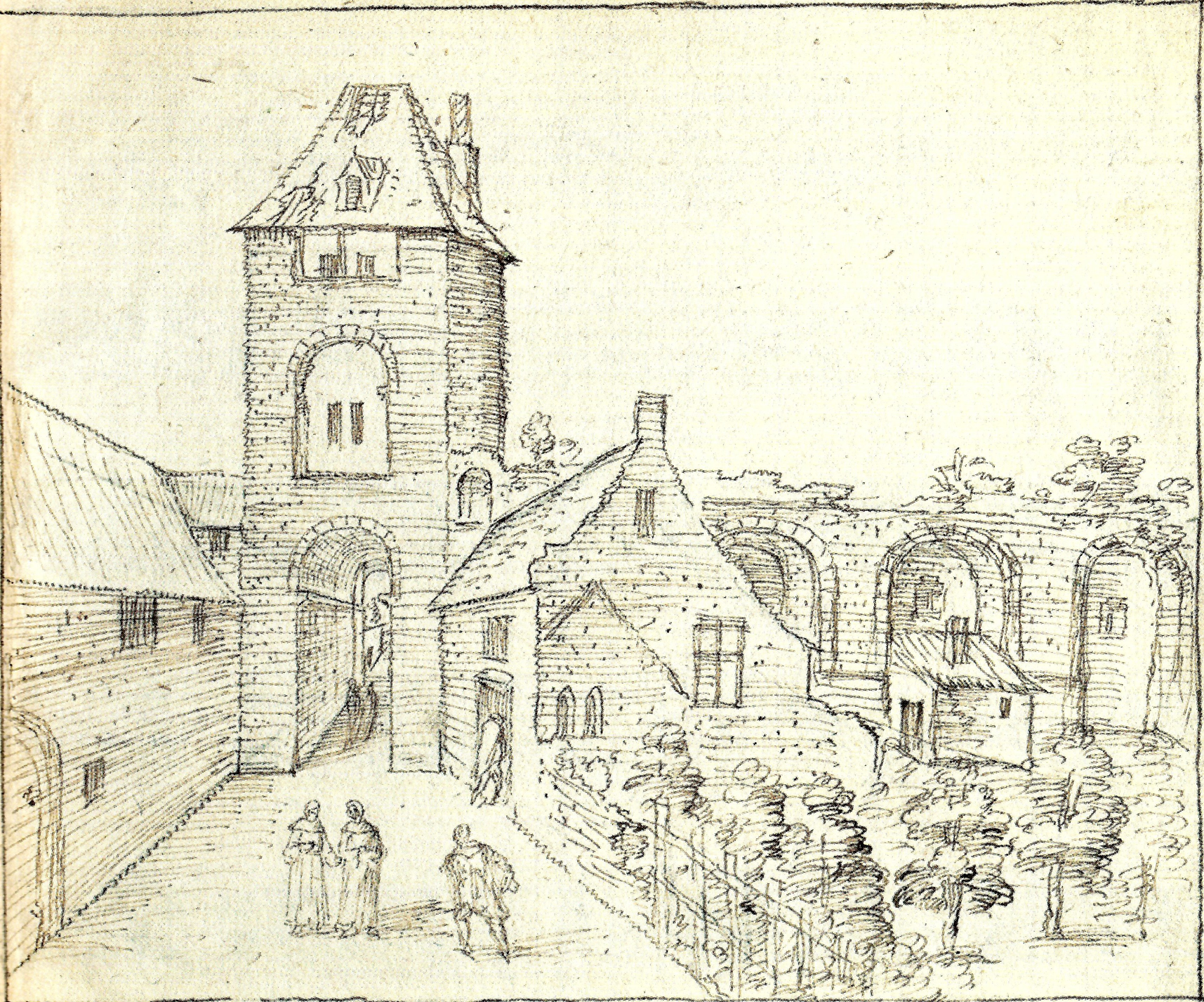
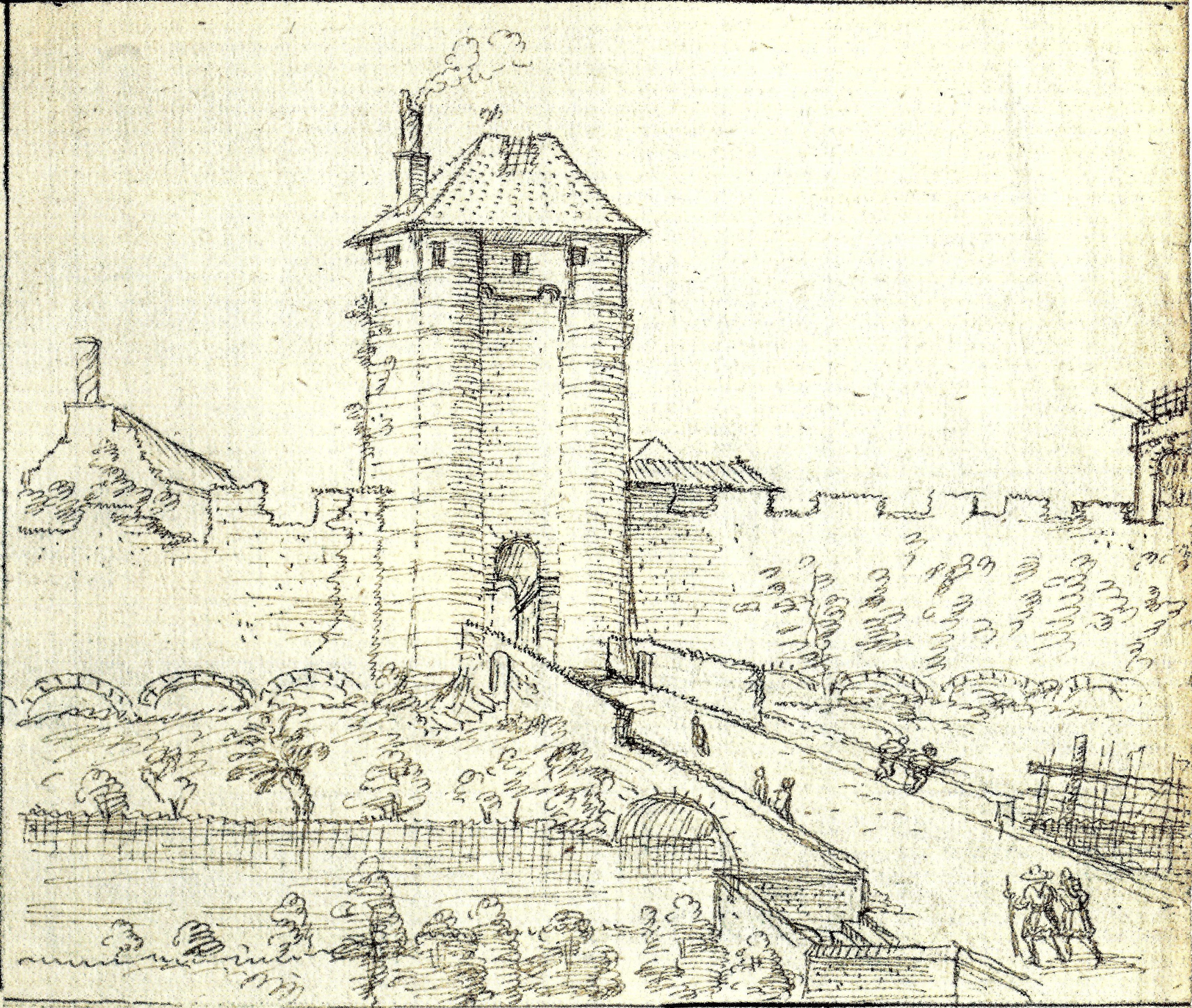
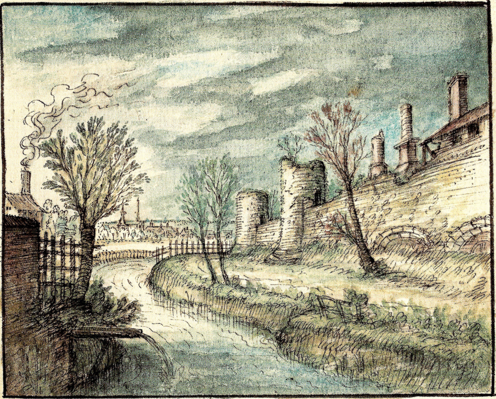
How did the Minderbroederspoort look like?
The Minderbroederspoort was a single tall tower that rose high above the adjoining wall. Like the Biestpoort further north, on either side of the bridge outside the gate, there is a trap door to allow for escape to the river banks should be gate be closed and the enemies were approaching. The left of the gate allowed for access directly into the property of the Minderbroedersklooster.
It is noteworthy here to mention how Leuven grew in the early middle ages, in relation to the location of the Minderbroederspoort. When Leuven was first mentioned in the records, it was composed of two centres: the Court that was located on Ten Hove, an island in the River Dijle; and a trading centre, that surrounded the Sint-Pieterskerk that was most likely a remnant of an old Roman trade route.
Count Lambert I (950-1015) was the first ruler of Leuven who was attested by historical records, and he was the one who expanded the County of Leuven after coming to power around the year 1000. He also did two things to merge the political and economic centres of Leuven: he first expanded Ten Hove to cover what is today Sint-Kwintenskerk, and he moved his palace to a bigger island north on the river, which became known as the ’s-Hertogeneiland (Duke’s Island). In this way, the old political centre was enlarged while power is now closer to the economic activities.
By the time the first city wall was built at the end of the 12th century (1165?) by Count Godfried III (1142-1190) of Leuven and Brussels, the city wall between Minderbroederspoort and the Biestpoort would have bordered the count’s palace grounds.
Under his son Henrik I, Leuven grew into the capital of the Duchy of Brabant in 1188, and the Duke ordered the construction of a castle on the Keizersberg in 1232, and he gave the island to the Dominicans who built the Predikherenkerk and their abbey.
What's so special about this place?
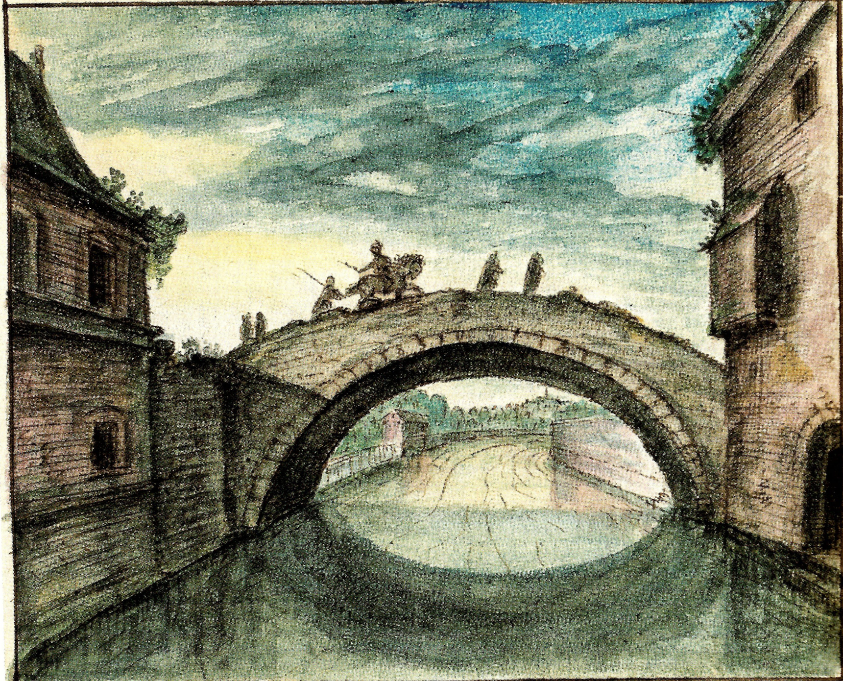
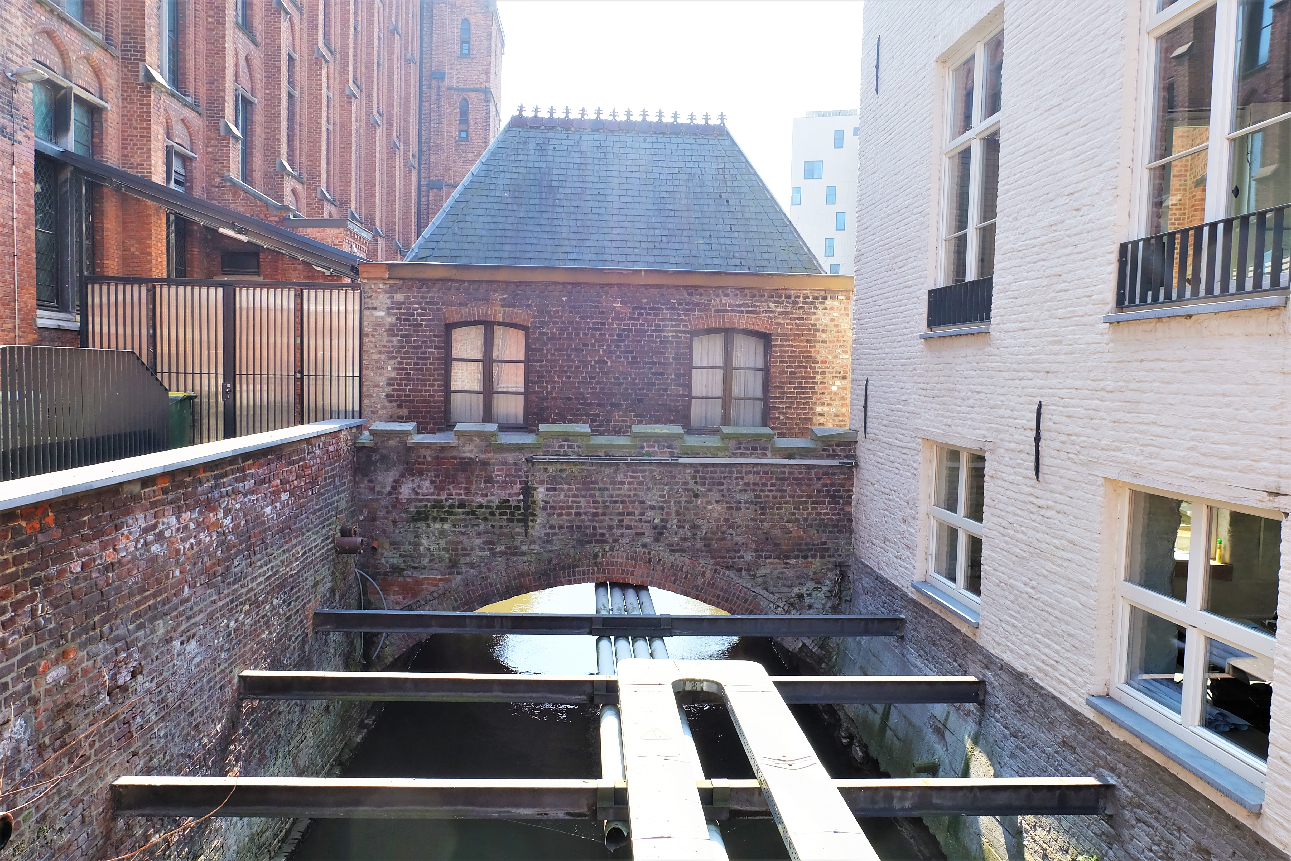
The Bridge over the Great Dijle
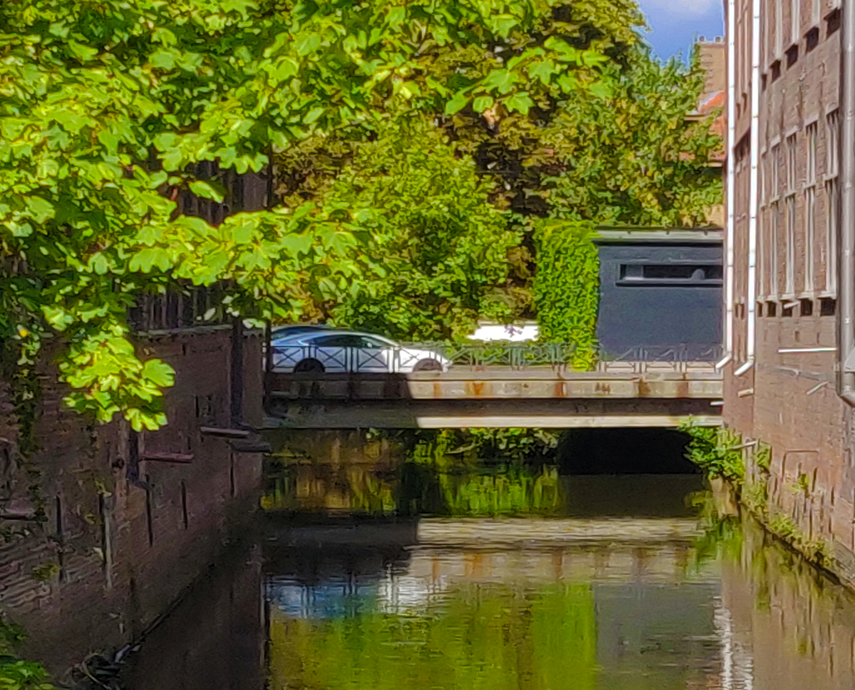
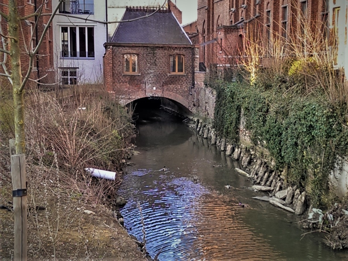
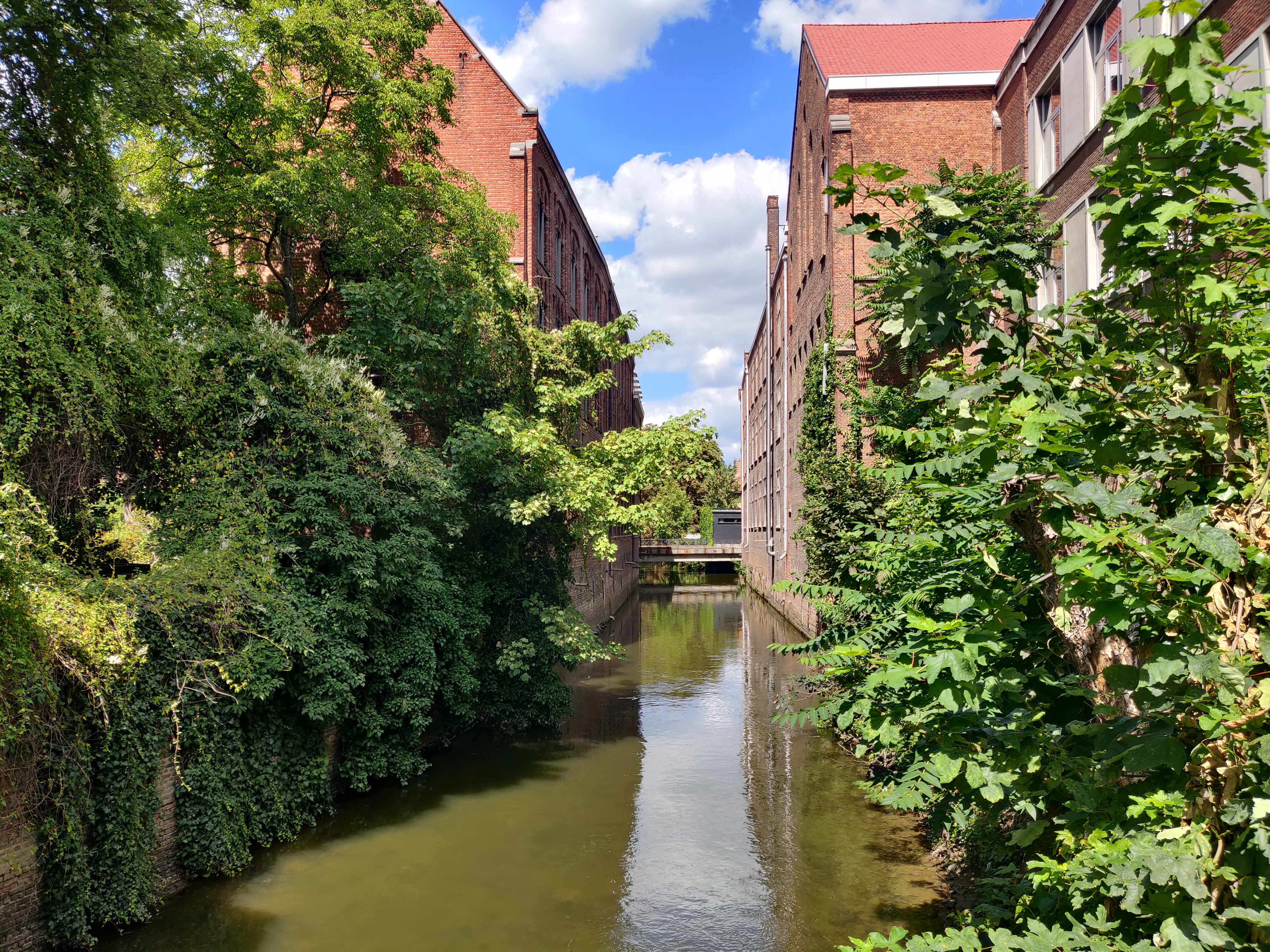
As mentioned above, the Dijle split into two at the Waterpoort (Water Gate): the left is the Kleine Dijle (Little Dijle) which flowed along the city wall as its moat until it reached under the Minderbroederspoort. After that it continues towards the Biestpoort, this part is now completely covered up although the water still flows. The right is the Grote Dijle (Great Dijle) that flowed towards the Brusselsestraat. In the Middles Ages, when you come into the city by boat after paying your toll at the Waterpoort, you will reach this beautiful semi-circular stone bridge across today’s Minderbroedersstraat. Today, it is just part of the street.
The Gate that kept changing Names
It is unclear what the name of the city gate was, before the Friars Minors built their monastery further up the street in 1231.
By 1591, the gate was called “Poorte leidende ter Capucijnen” (the gate leading to the Capuchin Monastery), which was at the end of the road across the River Voer.
After 1659 when the Ursulinenklooster (Convent of the Ursulines) established themselves right before the gate, the Minderbroederspoort became known as the “Ursulinnen-Binnen-Porte” (The Inner Gate of the Ursulines).
Like the other first city gates of Leuven, the Minderbroederspoort was never quite maintained before its demolition before the late 1700s. It was repaired once in 1363, and then again in the 15th century. Then in 1616, the city magistrate ordered the removal of the gate until the height of the inner city wall, to be cannibalized for the building of two houses next to the Tafelrond. On 26 August 1765, the city decided to completely demolish the 12th century structure.
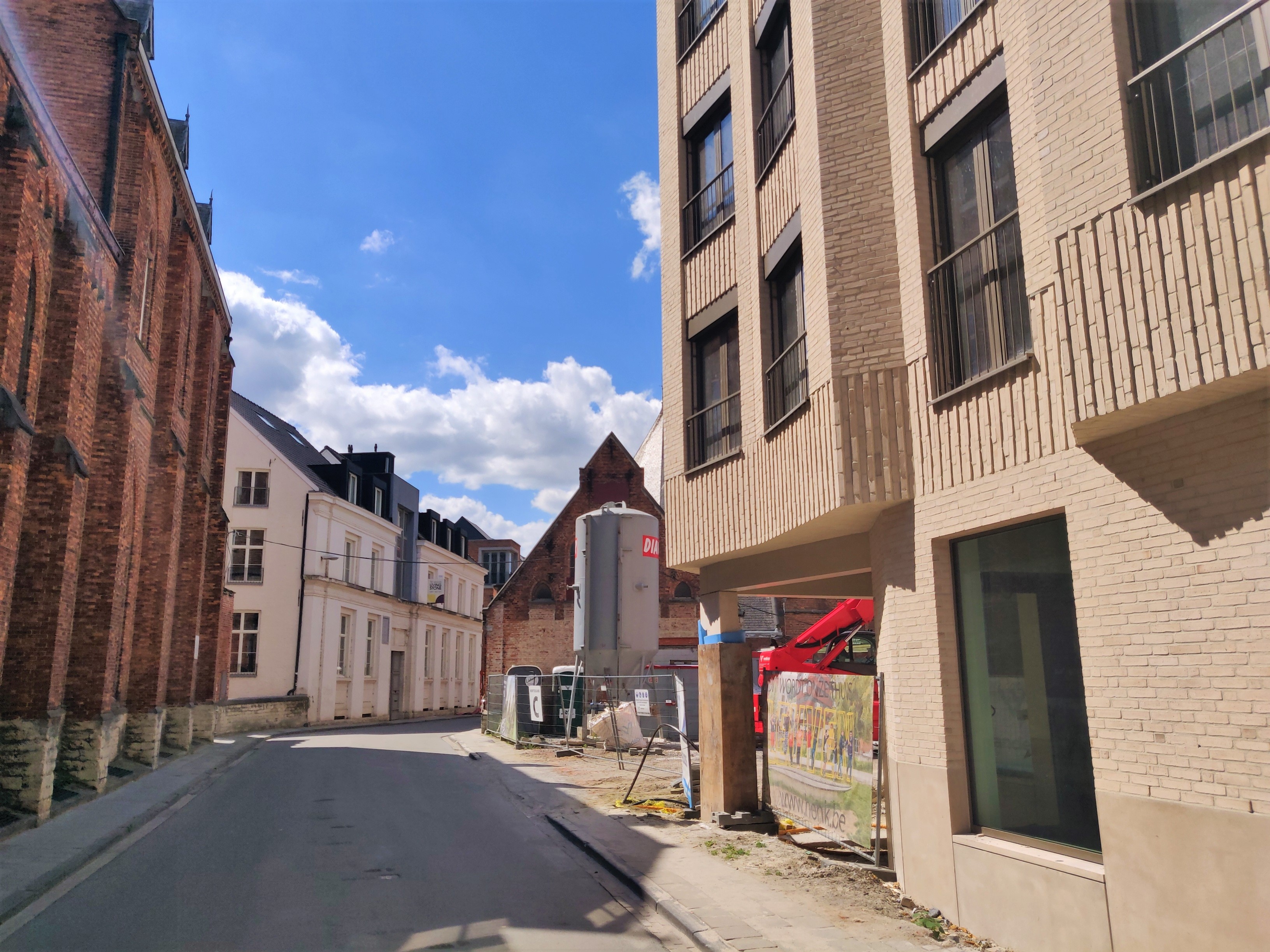
Current situation
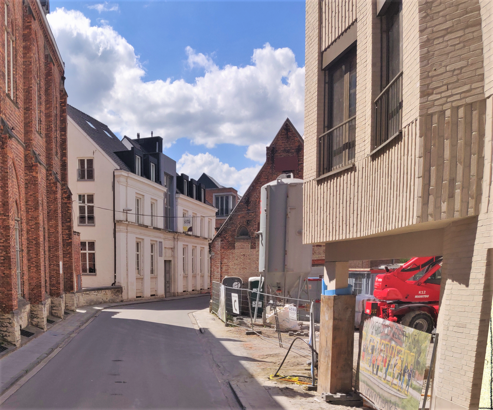
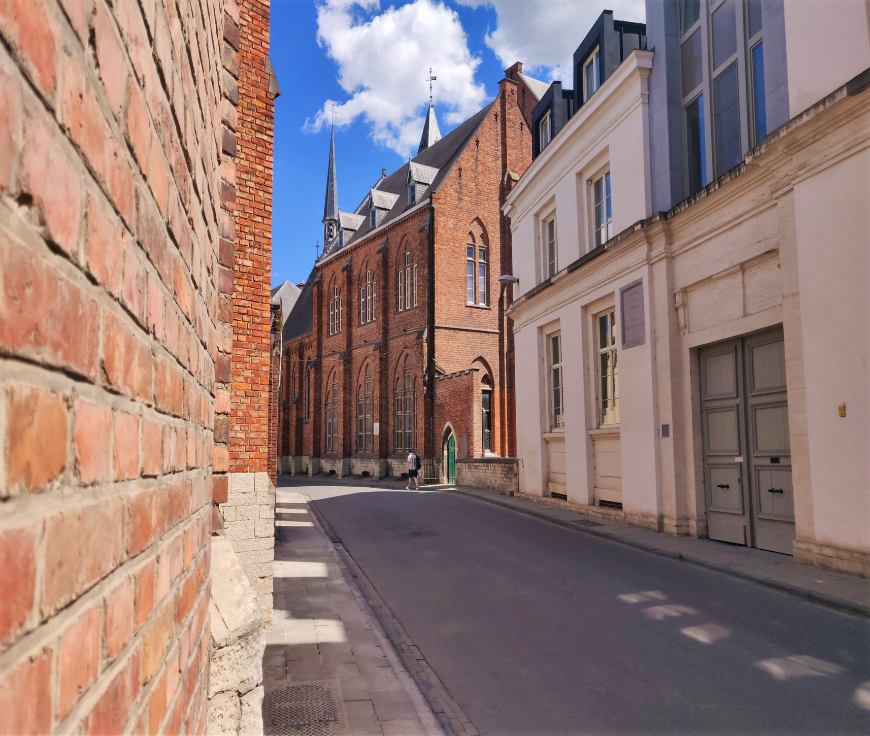
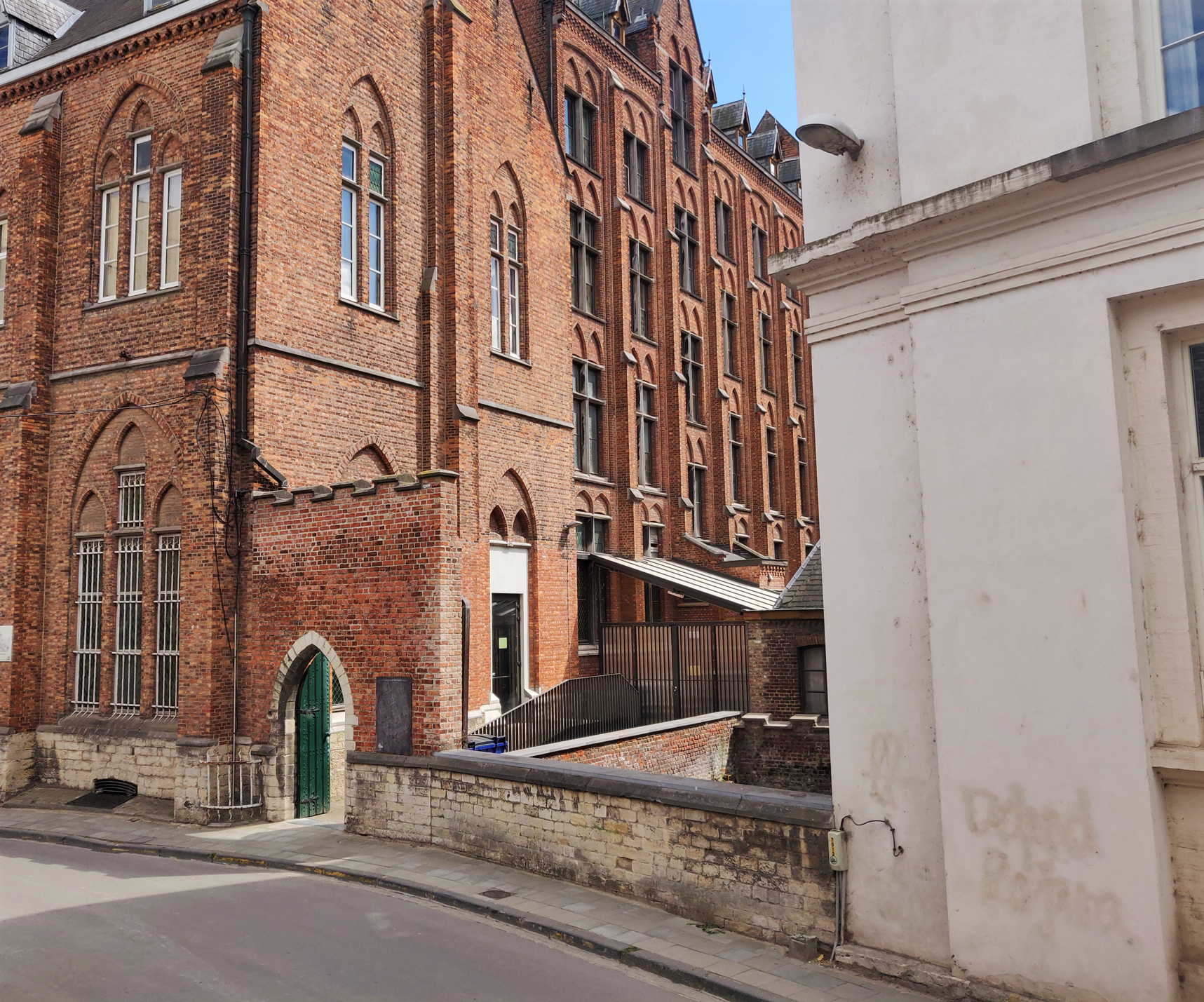
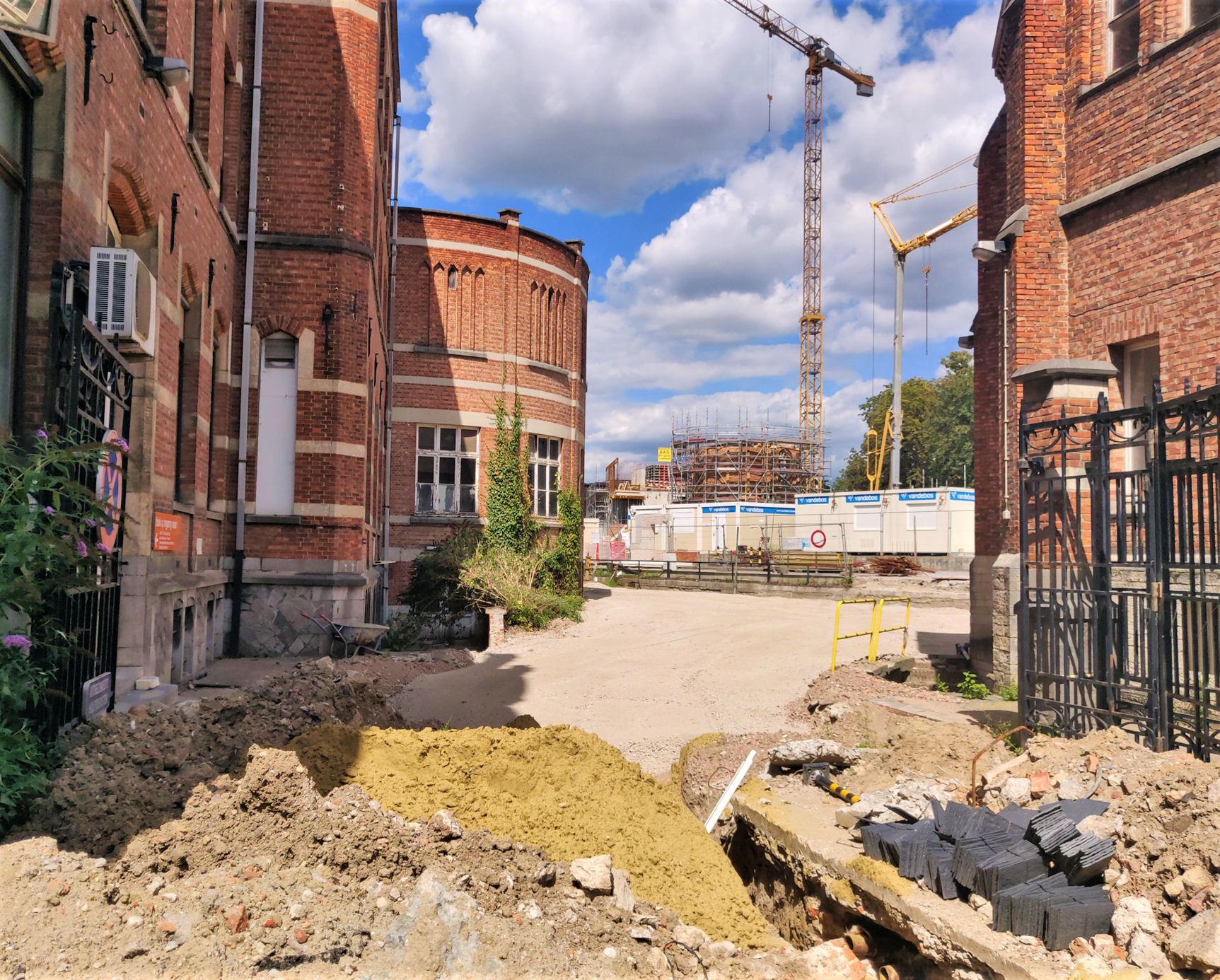
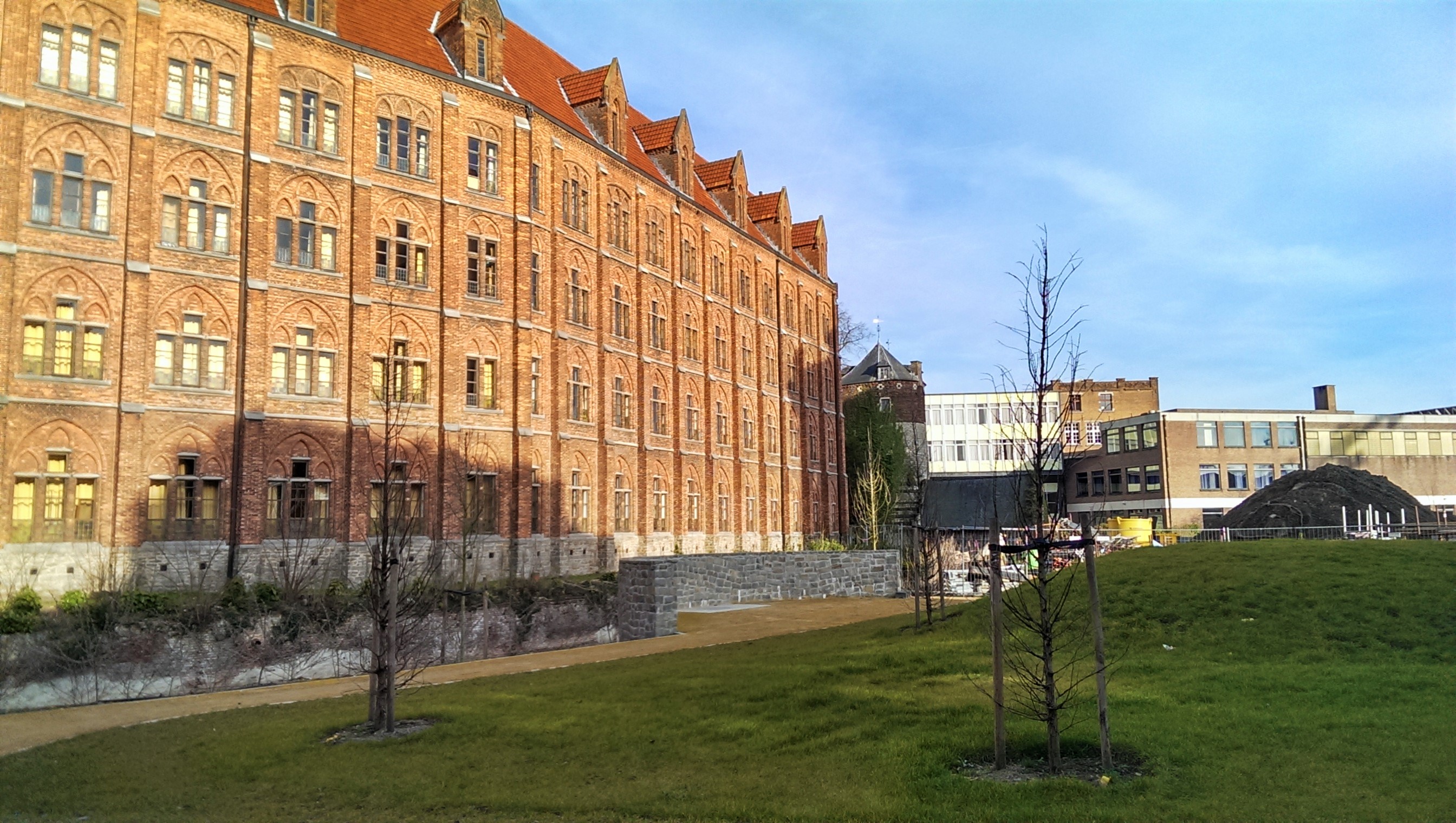
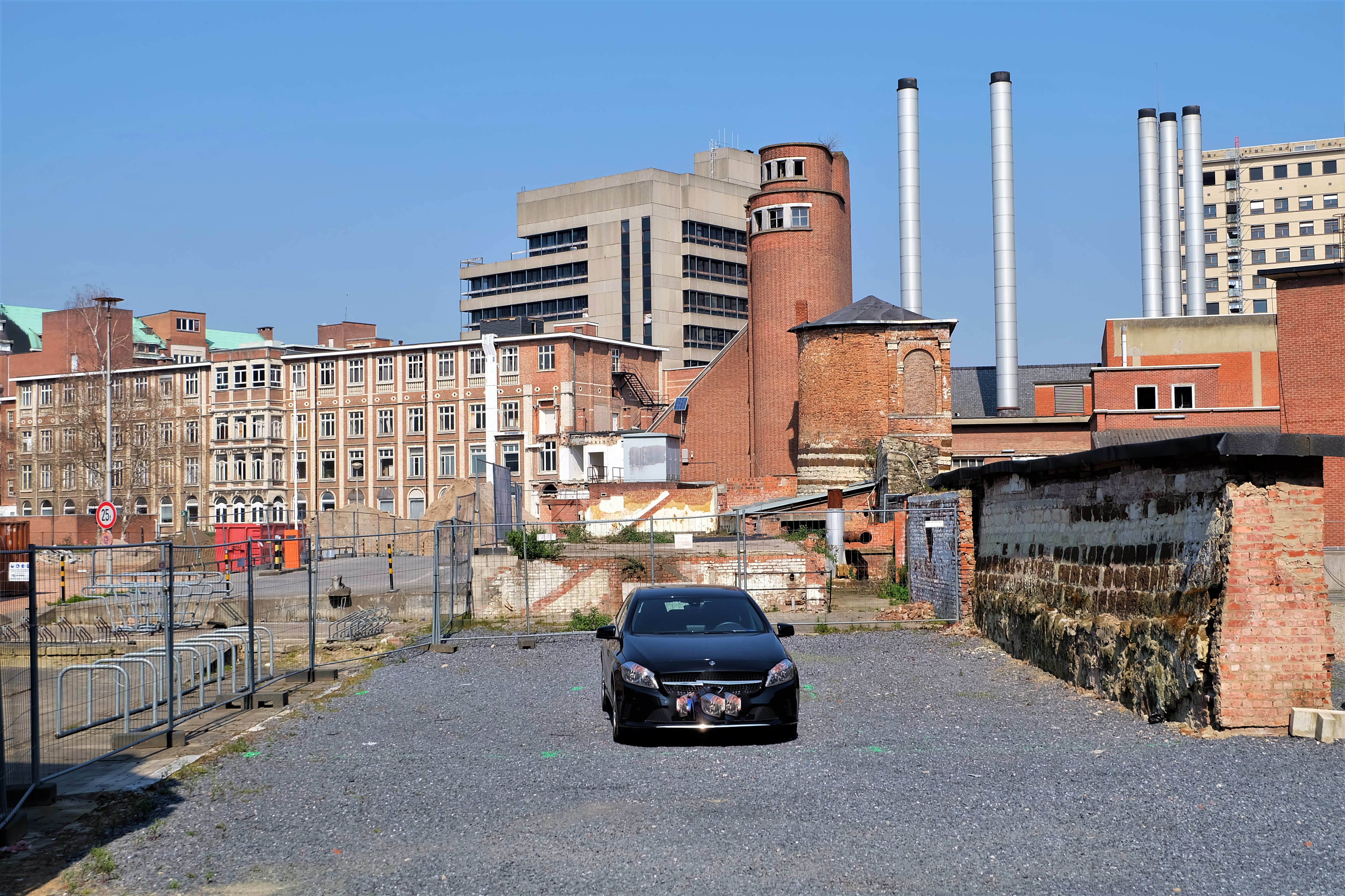
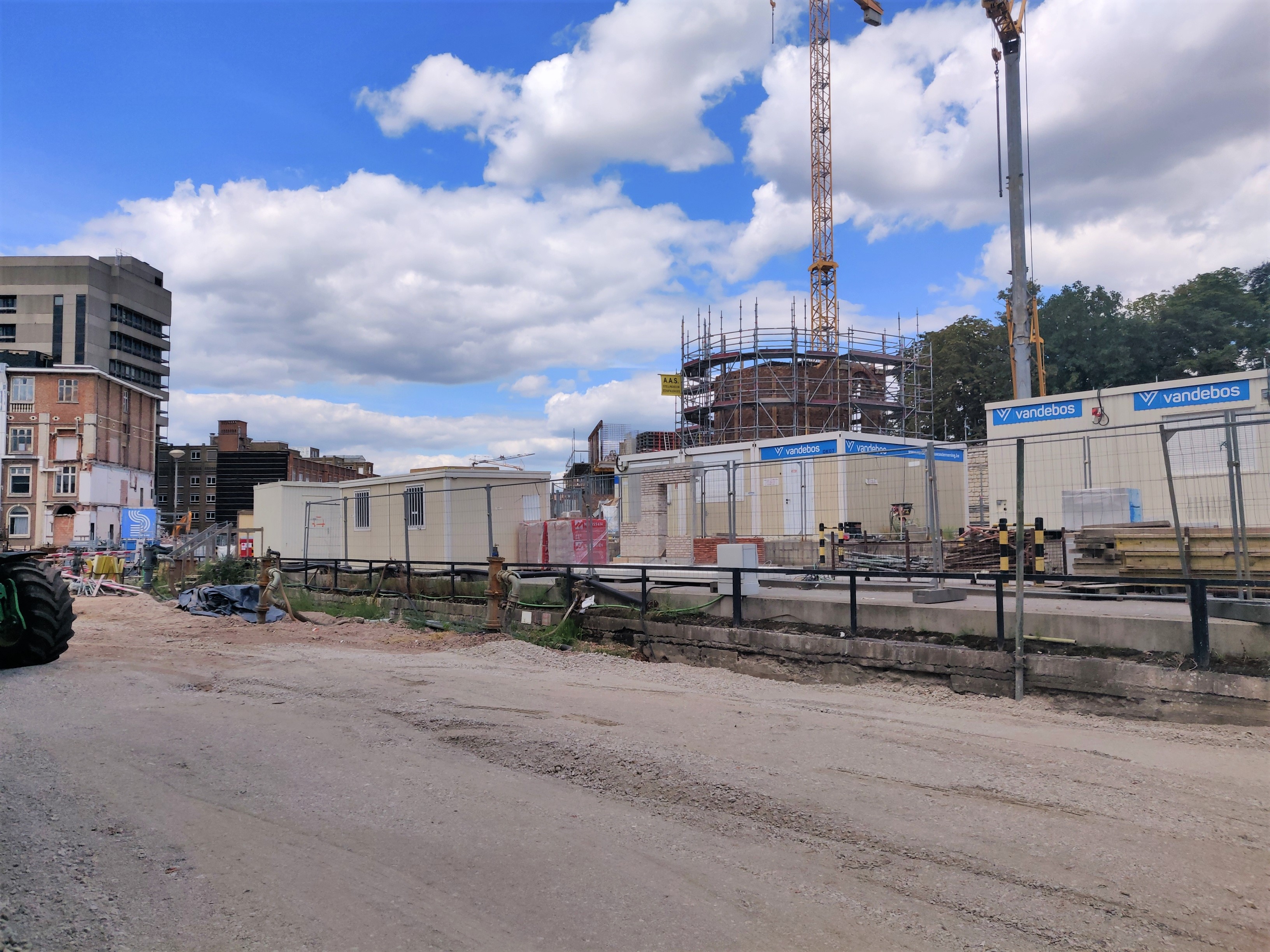
There is nothing left of the Minderbroederspoort. But fortunately, between the Minderbroederspoort and the Biestpoort, some watch towers and parts of the first city wall have been preserved, because it stood on the site of the former Sint-Pietersziekenhuis (St Peter’s Hospital).
The new development called the Hertogensite is restoring these heritage structures to their former glory.
Sources:
“Louvain dans le passé et dans le présent“, Edward van Even, 1895
“De Leuvense Prentenatlas: Zeventiende-eeuwse tekeningen uit de Koninklijke Bibliotheek te Brussel“, Evert Cockx, Gilbert Huybens, 2003
https://nl.wikipedia.org/wiki/Ringmuren_van_Leuven
https://www.erfgoedcelleuven.be/nl/stadsomwalling
https://inventaris.onroerenderfgoed.be/erfgoedobjecten/125406
https://inventaris.onroerenderfgoed.be/erfgoedobjecten/140040


