
ABOUT
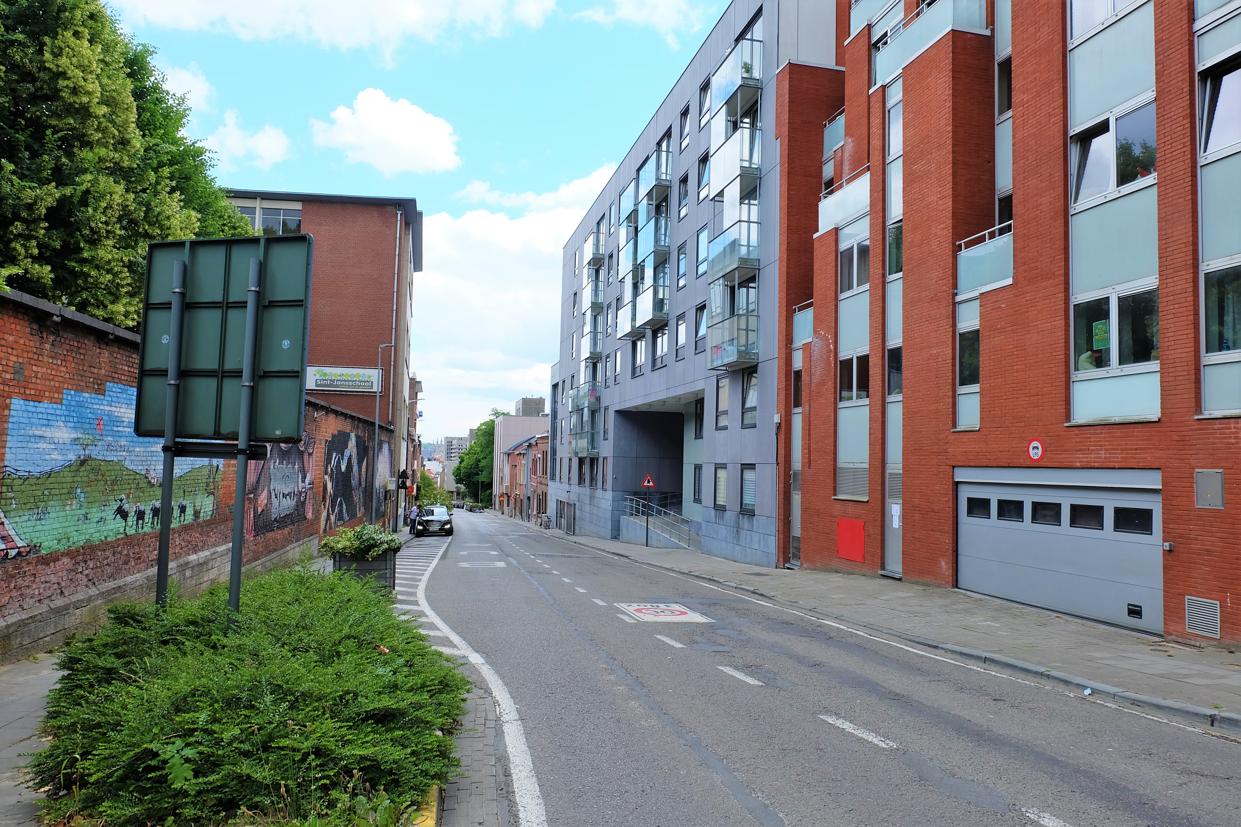
Today, Leuven’s Brusselsepoort (Brussels Gate) is a sleepy junction that links the intra-muros Brusselsestraat to the extra-muros Brusselsesteenweg. Located on the hilly western side of Leuven, the Brusselsepoort once held a beautiful name of ‘Wijngaardpoort’ (Vineyard Gate) in the Middle Ages, as it commanded a splendid view over Leuven’s sun-soaked slopes filled with rows and rows of grape vines. Because the gate was on the direct route to the city of Vilvoorde, it was also called the ‘Vilvoordsepoort’.
Origin
1355-60: Leuven bulks up its defence walls
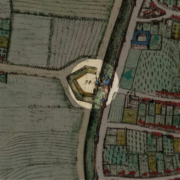
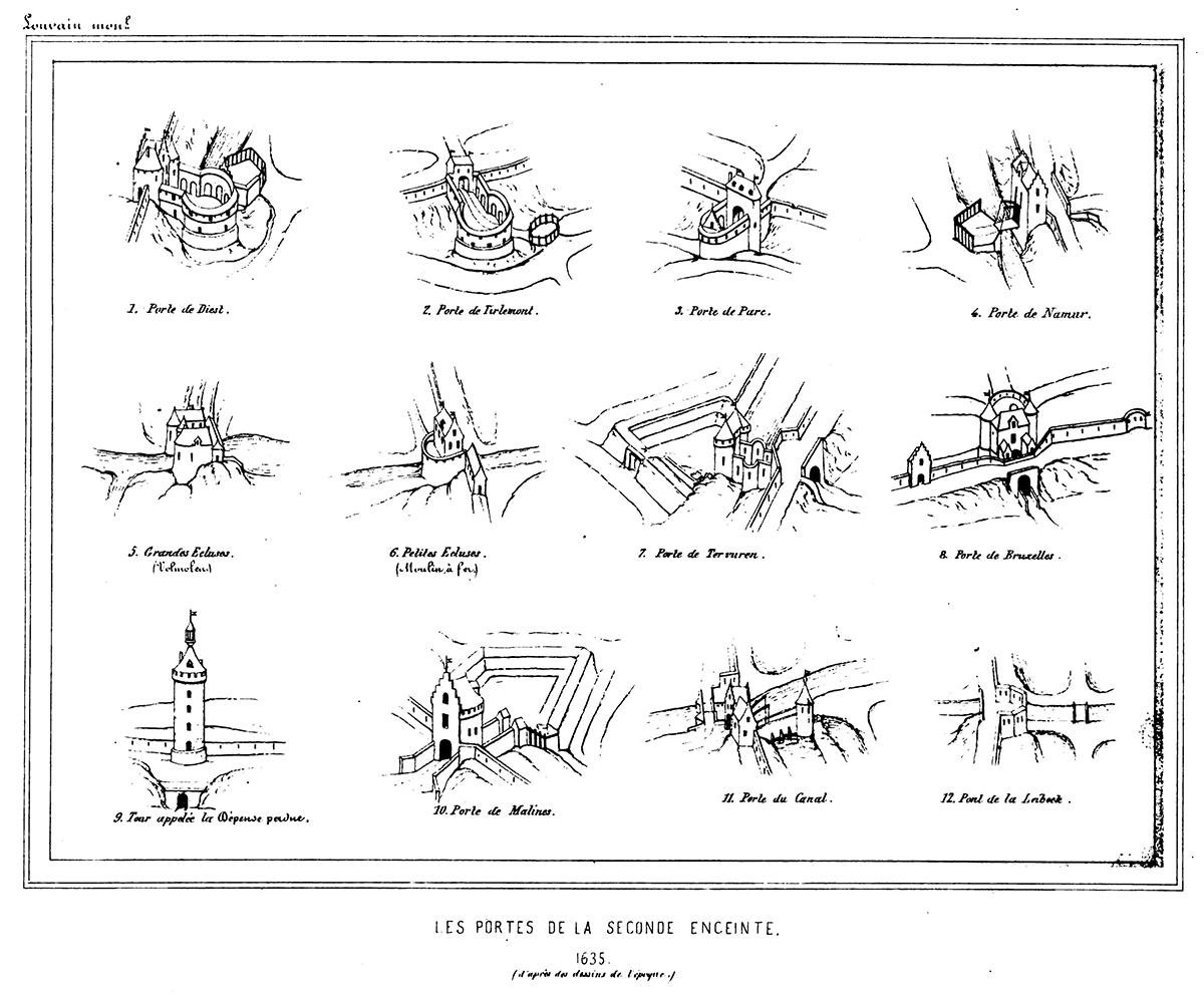
By the middle of the 14th century, Leuven began to lose its political and economic status as the capital of Brabant. Both Brussels and Antwerp began to grow richer and more powerful. Poverty began to spread throughout the city, with less and less income from its weaving trade (see Lakenhalle) and wine production (see Wijnberg). After the Brabant Succession War in 1355, Leuven dug deep into its pockets to build the 7km-long outer (second) city walls, which were completed in 1360. With its eight new modern city gates, Leuven could essentially shut itself off from invaders (starting from the north in clockwise, with modern names in brackets):
Aarschotse poort (Vaartpoort)
Dorpstrate Buiten-Poort (Diestsepoort)
Hoelstrate Buiten-Poort (Tiensepoort)
Parkpoort
Heverse Poort (Naamsepoort)
Groefpoort (Tervuursepoort)
Wyngaerdenpoort (Brusselsepoort)
Buiten-Borch poort (Mechelsepoort)
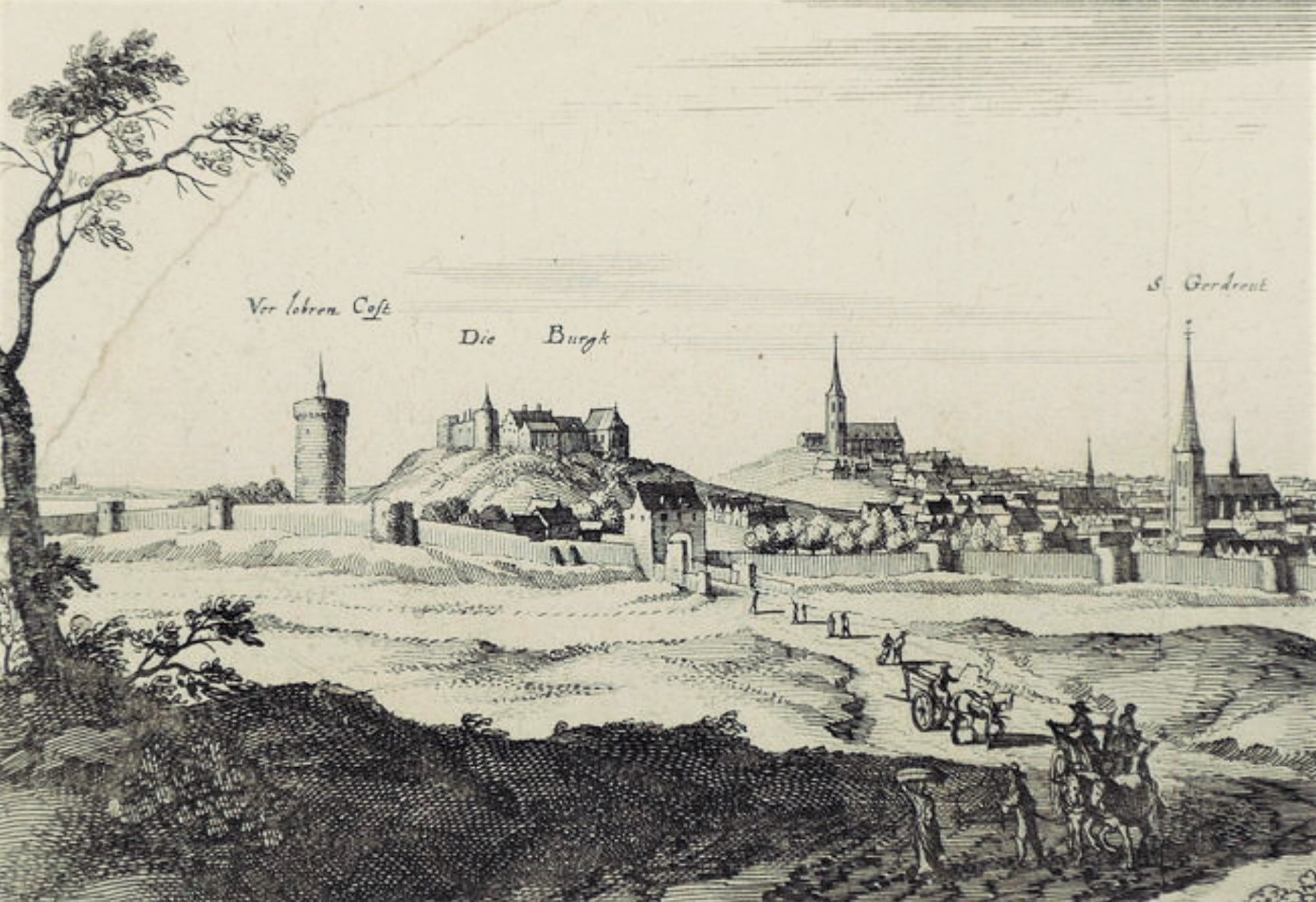
The walls also came with 48 watch towers. The later-built and very imposing Verloren Kosttoren (Tower of Lost Cost) would be incorporated into this outer wall system as its 49th and tallest watch tower.
The new outer city walls now protect and include parishes like Sint-Kwintens and Sint-Jacobs which were previously outside the first city walls against attacks launched by the Count of Flanders, Lodewijk van Male. The new walls would also have increased the city area to nearly seven times. The outer city walls were completely surrounded by a moat measuring 3-4m deep and 10-15m wide, depending on the terrain. Where the moat was not dry, it was filled with water. This occurred twice: in the south where the Dijle and the Voer flowed into the city, and in the north where the Dijle and the Vunt flowed out of the city.
The destruction of Leuven’s city walls
In 1781, Habsburg Emperor Jozef II decreed the dismantling of all city defenses, except Antwerp. Cities were only allowed to keep the embankments and canals to avoid the fines. Somehow, Leuven managed to only demolish the defense structures built in 1672 and 1674. The rest of the city fortifications were preserved. But with the French occupation that followed, the outer city walls were completely dismantled, while the city gates were partially or fully demolished. All this was replaced by parks and promenades (any of the roads along the ring ending with the word ‘-vest’ indicates this development).
Between 1950 and 1980, many of the parks and promenades gave way to roads, and with the expansion of the ring around Leuven in 1970, whatever remained of the outer city walls fully disappeared.
What's so special about this place?
The City Gate dedicated to Wine and the Holy Virgin
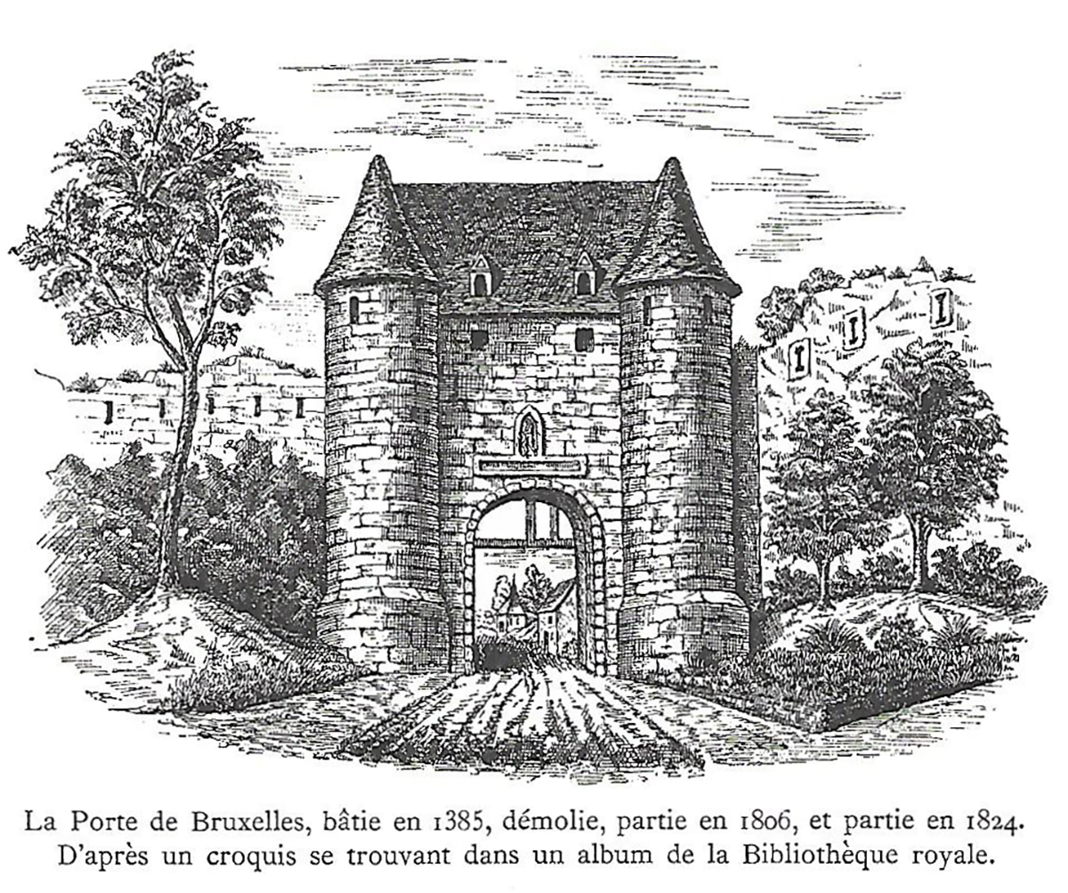
First built in 1358, the Wijngaardpoort (Vineyard Gate) was named so because of it was literally built in the middle of vineyards, both in and outside the new outer defense walls. The gate was right beside the Duke’s vineyard and the wine press (‘wijnpers‘) owned by the Abdij van Sint-Geertrui. This first gate was repaired once in 1385 and then in 1404.
Then in 1521, the Wijngaardpoort was completely replaced by a much larger and more imposing building, under the supervision of Jan Loomans and Peter Walraven then master mason of the city.
The gate has two round towers, flanking each side of an arcade, through which one had to go through to enter the city. When one faces the entrance of this arcade, coming from outside the city, there was a niche above the huge doors, with a statue of the Virgin Mary. In 1735, upon the hundredth anniversary of 1635 Siege of Leuven (read entry on the Tervuursepoort), the city placed a plaque under the niche with these words:
MARIA WILT LOVEN BEWAREN
HELIIK ALS OVER HONDERT JAEREN
This association with the Virgin Mary was not a coincidence, as the Abbey of the Our Lady of the Vineyard (Abdij Onze-Lieve-Vrouw ten Wijngaert) was just a stone’s throw away.
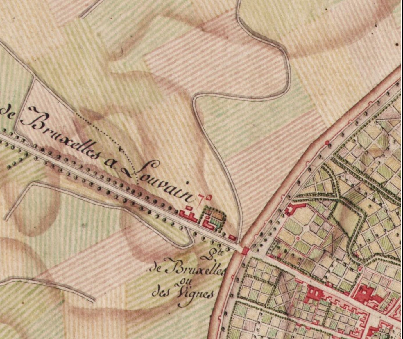
The New Route to Brussels
In the course of the 18th century, a new route to Brussels was laid. Instead of traveling via the then Brusselsepoort (now the Tervuursepoort), one could travel via the Wijngaardpoort/Vilvoordsepoort. The latter was thus renamed the (new) Brusselsepoort, together with the change of the name of the intra-muros streets that led to it all combining into one – ‘Brusselsestraat‘:
- ‘Steenstraat‘: from the Grote Markt to the inner city gate of Biest
- ‘Bieststraat‘: from the inner city gate of Biest, pass the Sint-Jacobskerk to the ‘Blauwen Hoek‘
- ‘Wijngaardstraat‘: from the ‘Blauwen Hoek‘ to the original Wijngaardpoort
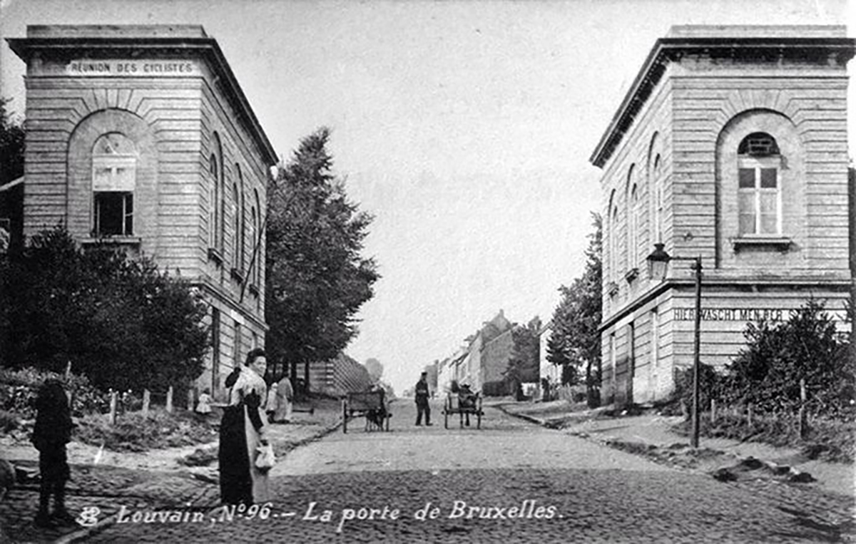
Yet not even a hundred years after the commemoration of the Virgin Mary as the protector of Leuven, the Brusselsepoort was quickly demolished right after the French arrived. In 1806 and 1824, the city gate was no more, replaced in its place in 1825, two utterly boring square pavilions.
These still exist today.
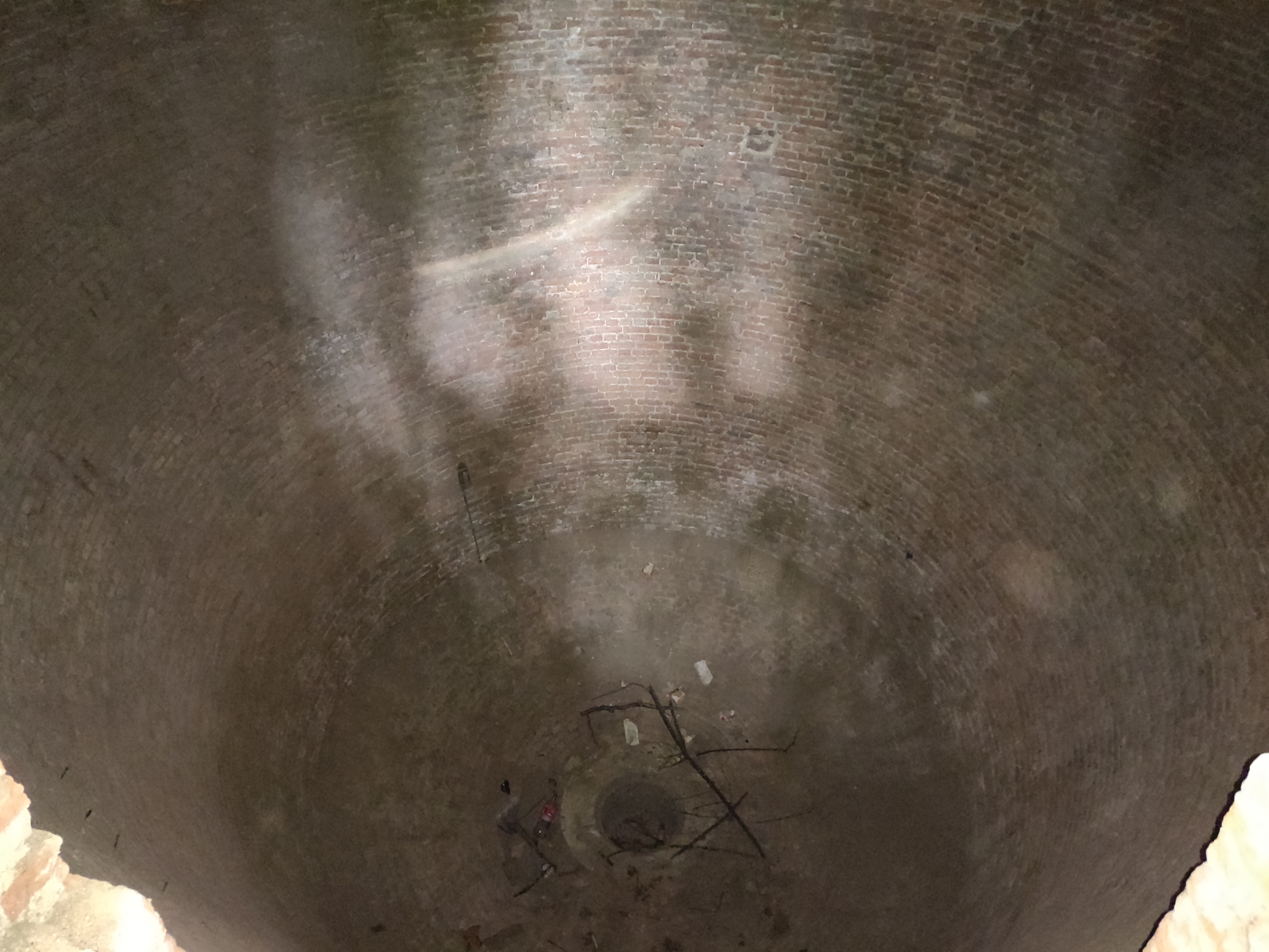
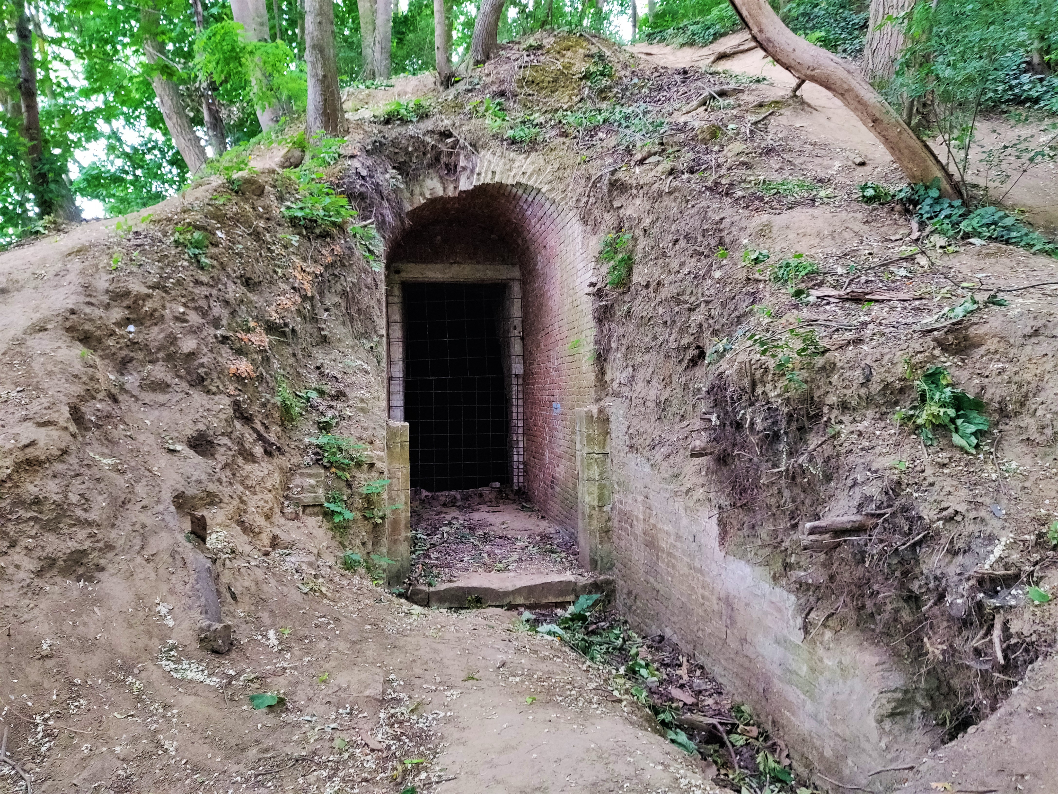
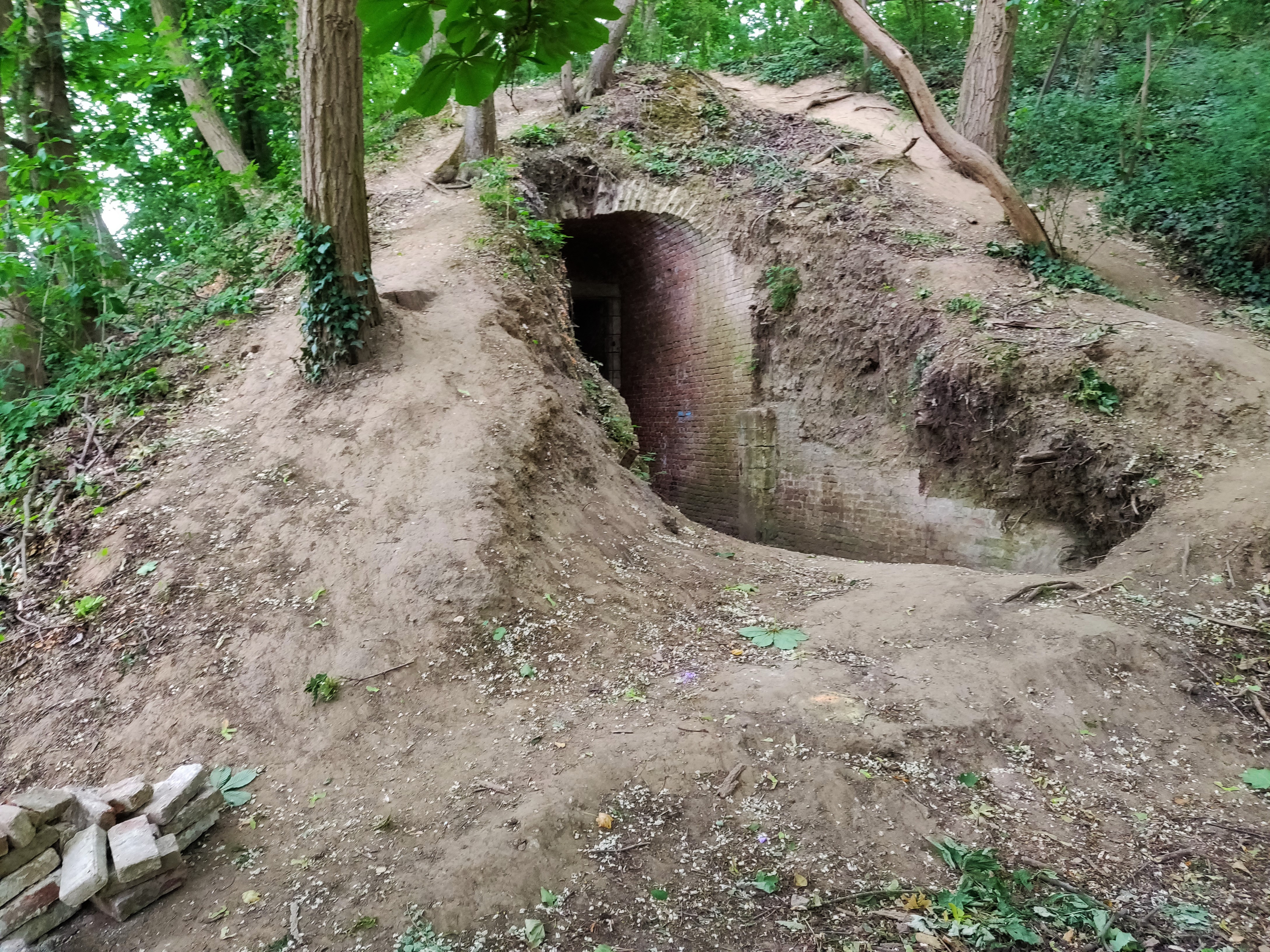
The Ice Cellar
In the same period when the pavilions were erected, the city dug an ice cellar for the benefit of its citizens in the hot summer months.
The ice cellar fell out of use with the invention of the refrigerator, and had since been forgotten. But with revived interest in Leuven’s heritage, the ice cellar is being renovated in 2021 and will soon be reopened to the public. But it will not be the next party spot, as the city has decided that the ice cellar should remain a bat cave, even when humans will soon be able to visit.
The Need for Uncontaminated Fresh Water
After the French occupation at the end of the 18th century, the unification of the North and South Netherlands did lead to a huge public sanitary improvement for the citizens of Leuven.
Since the Middle Ages, citizens relied on ground water from wells as their basic source of water. But with increased urban population, the lack of proper sanitary infrastructure led to disastrous results: the 19th century cholera outbreak led to 1600 victims in Leuven, out of which 757 died.
At that time, uncontaminated drinking water was scarce, because people had to use communal toilets, and sometimes a whole street shared one single toilet.
The city signed on a deal with the Rotterdam Water Company that pumped clean, bacteria-free drinking water from deep in the ground in the valley of Molenbeek in Heverlee (see entry on Naamsepoort), and led that water into the city.
A water reservoir was also built outside the Brusselsepoort and clean drinking water was stored there.
Today, if you go around the city and see huge cast iron water fountains. These were erected in end 19th century by Mayor Vander Kelen, once the water infrastructure was completed.
Today, the heritage site of the water reservoir is out of bounds and maintained by the Landscap Dijeland as another bat cave.
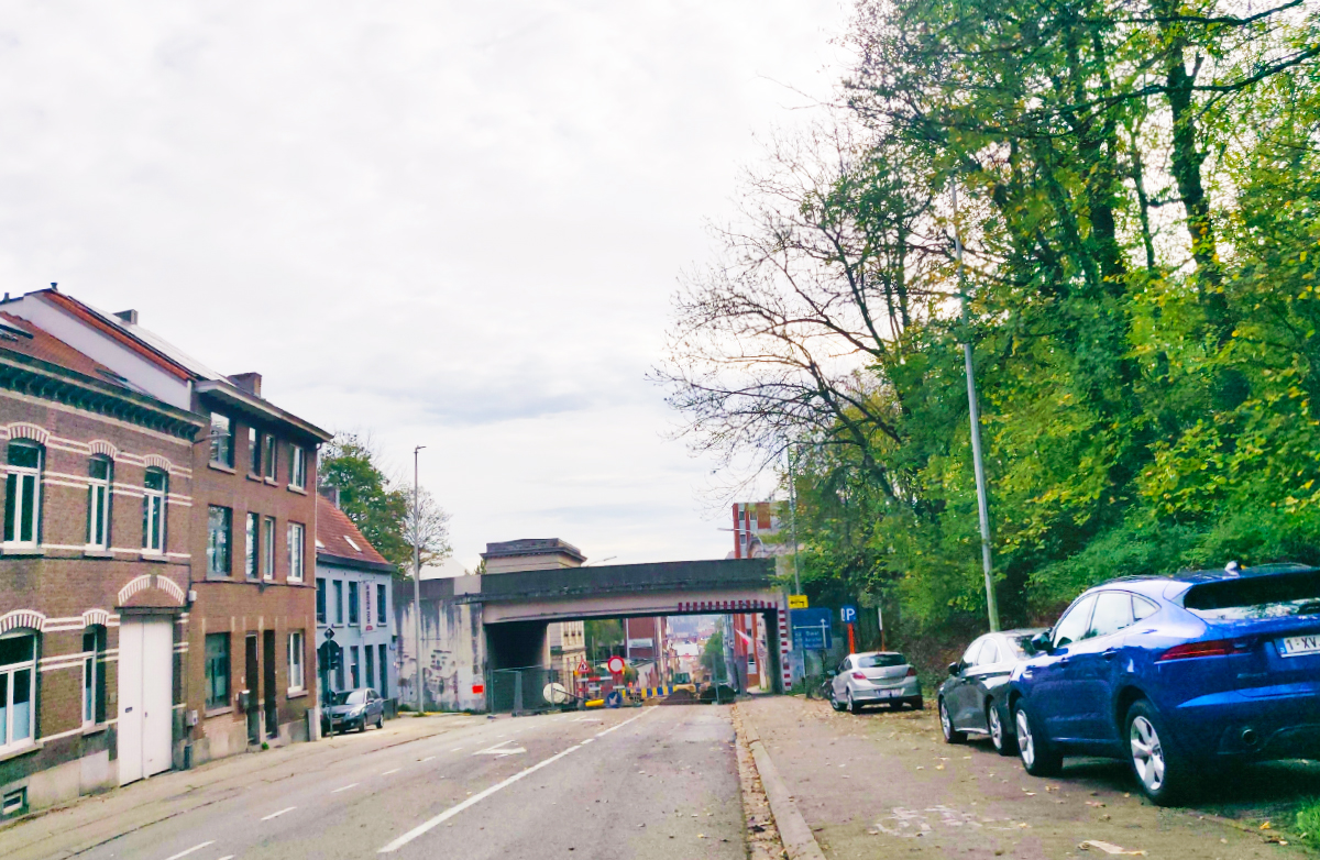
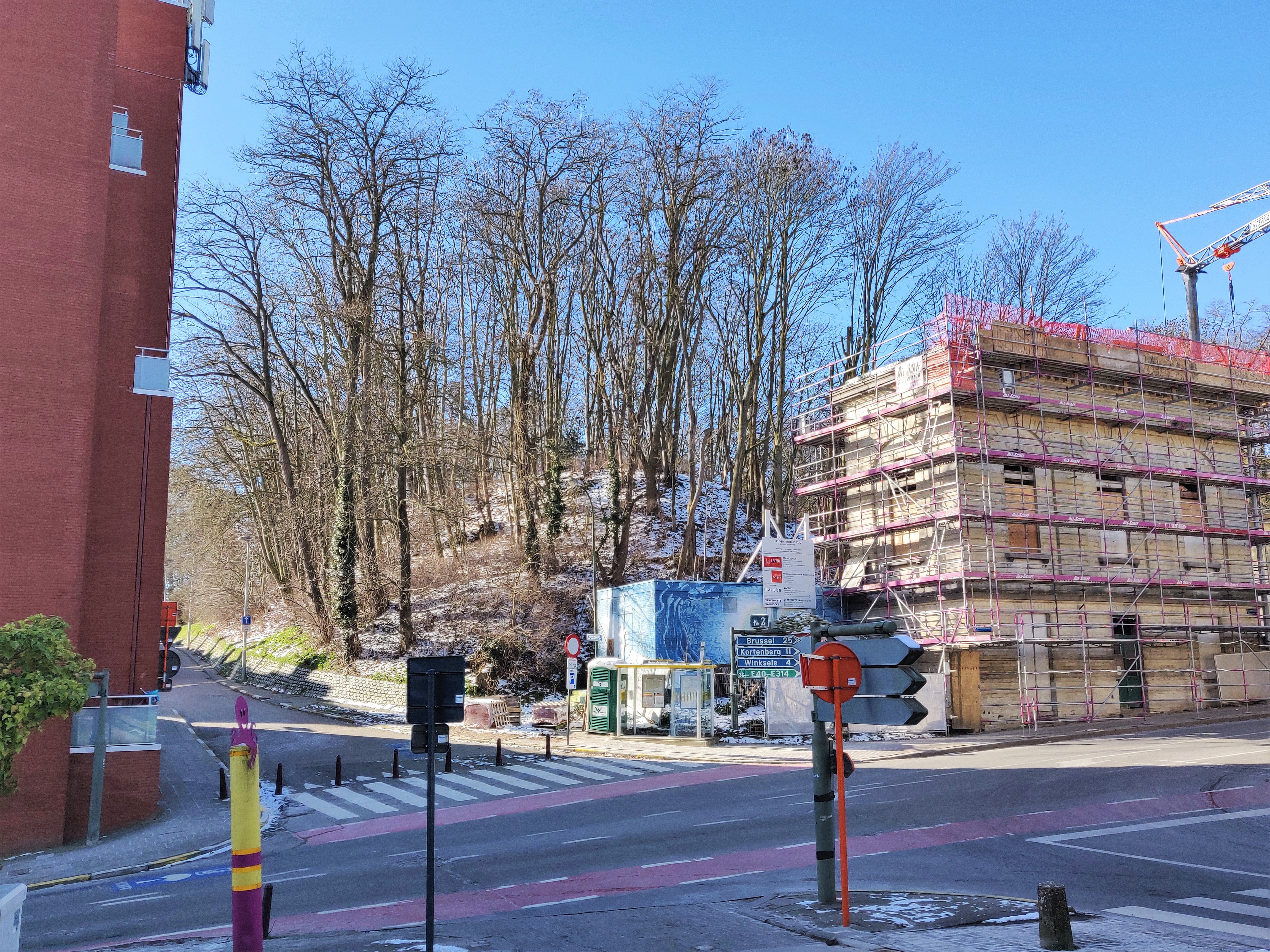
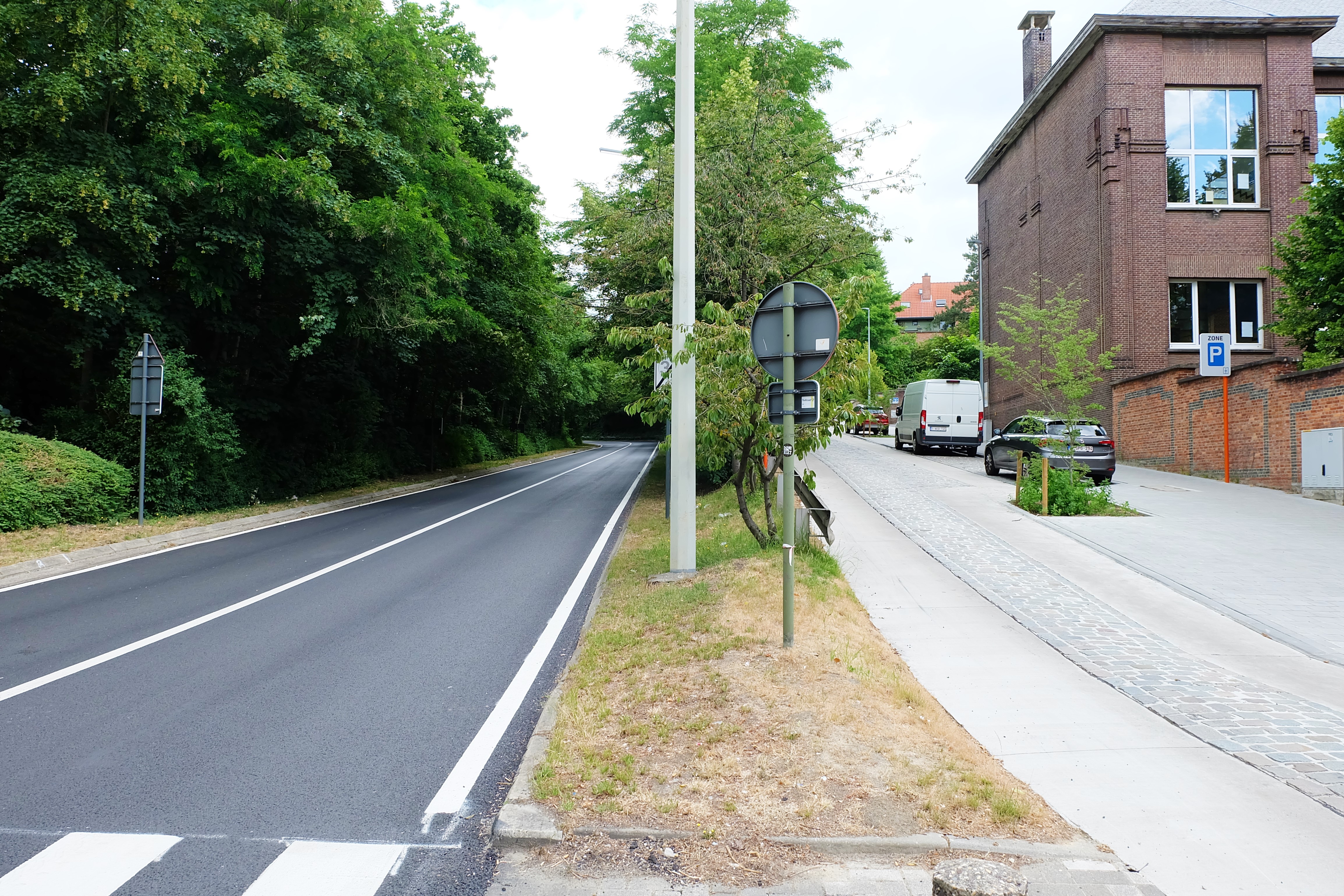
Current situation
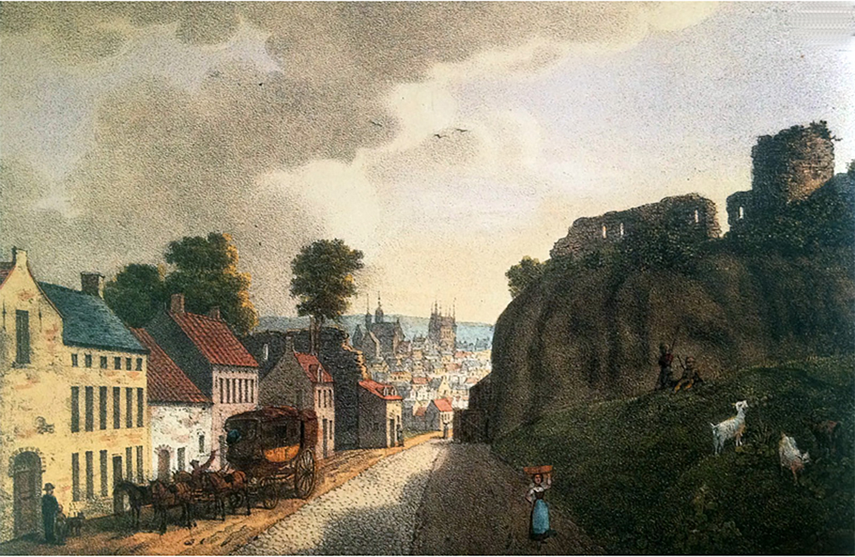
The once imposing Brusselsepoort with its link to the cult of Virgin Mary is no more, replaced by the only remaining 19th century toll houses that used to guard and replace all other 14th century outer defense gates of Leuven.
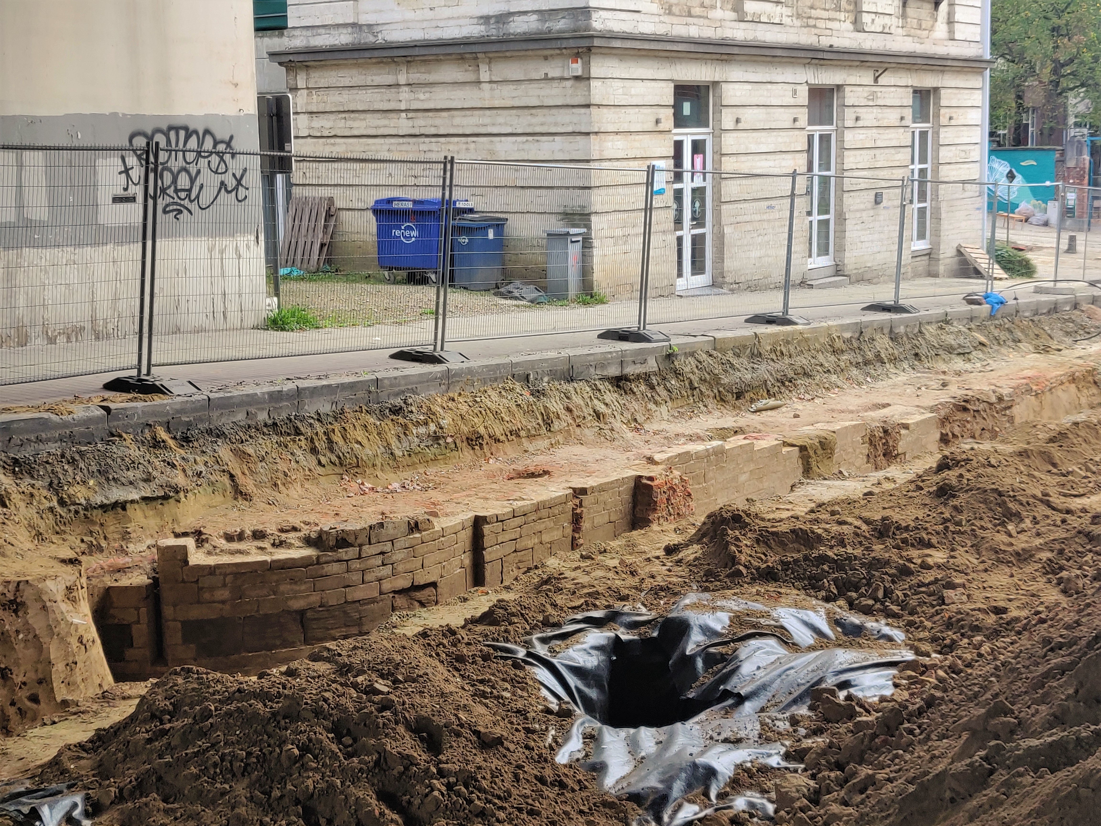
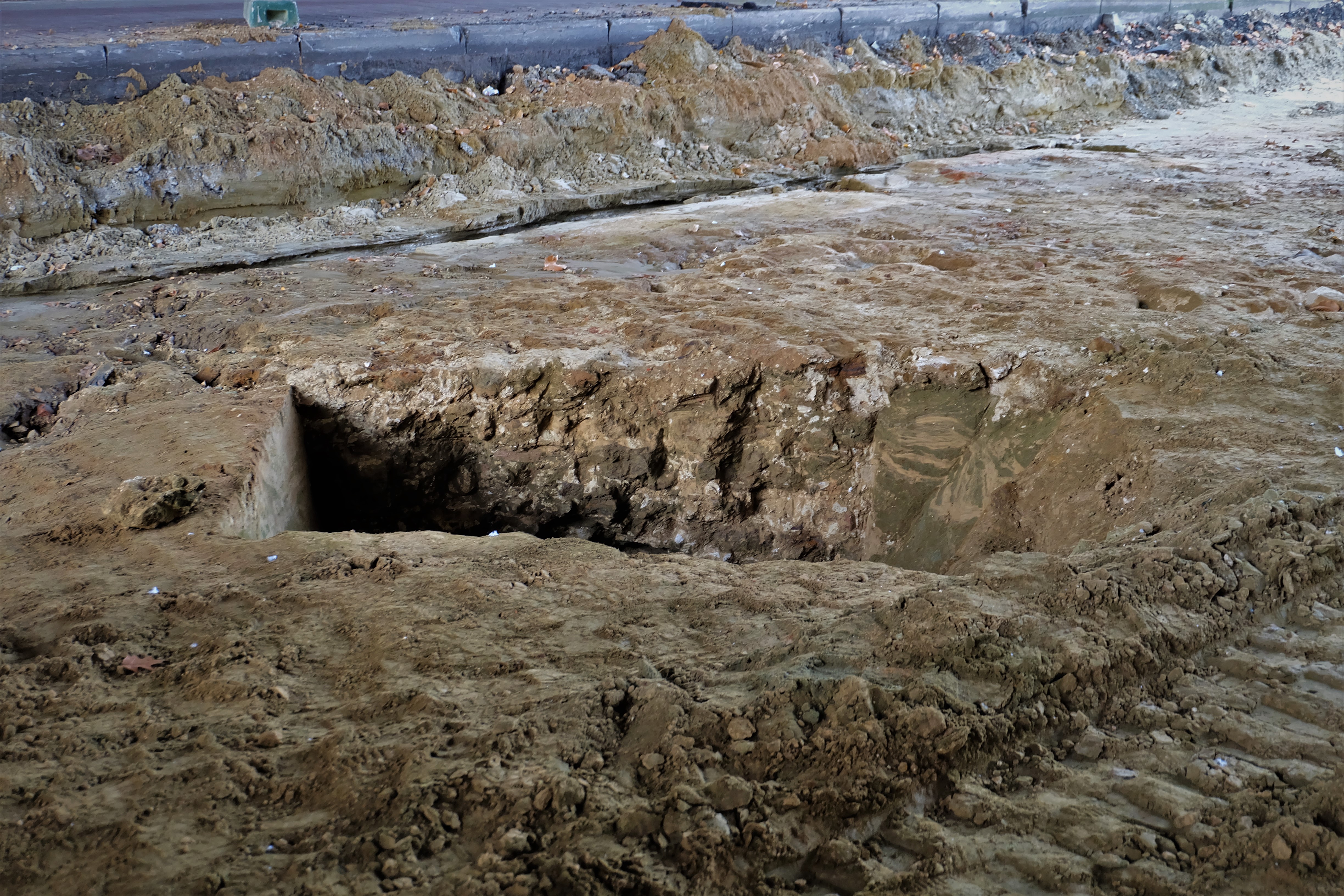
Archaeological Dig of 2022
During the renovation of the Brusselsestraat in 2022, the city’s archaeologists had the chance to unearth the foundations of the Brusselsepoort, in order to ensure the new sewage pipelines that would run through under the street will not affect any of the historical remnants of the old city gate.
On 29 October 2022, the archaeologists conducted a public tour of the site, in which the following has been revealed:
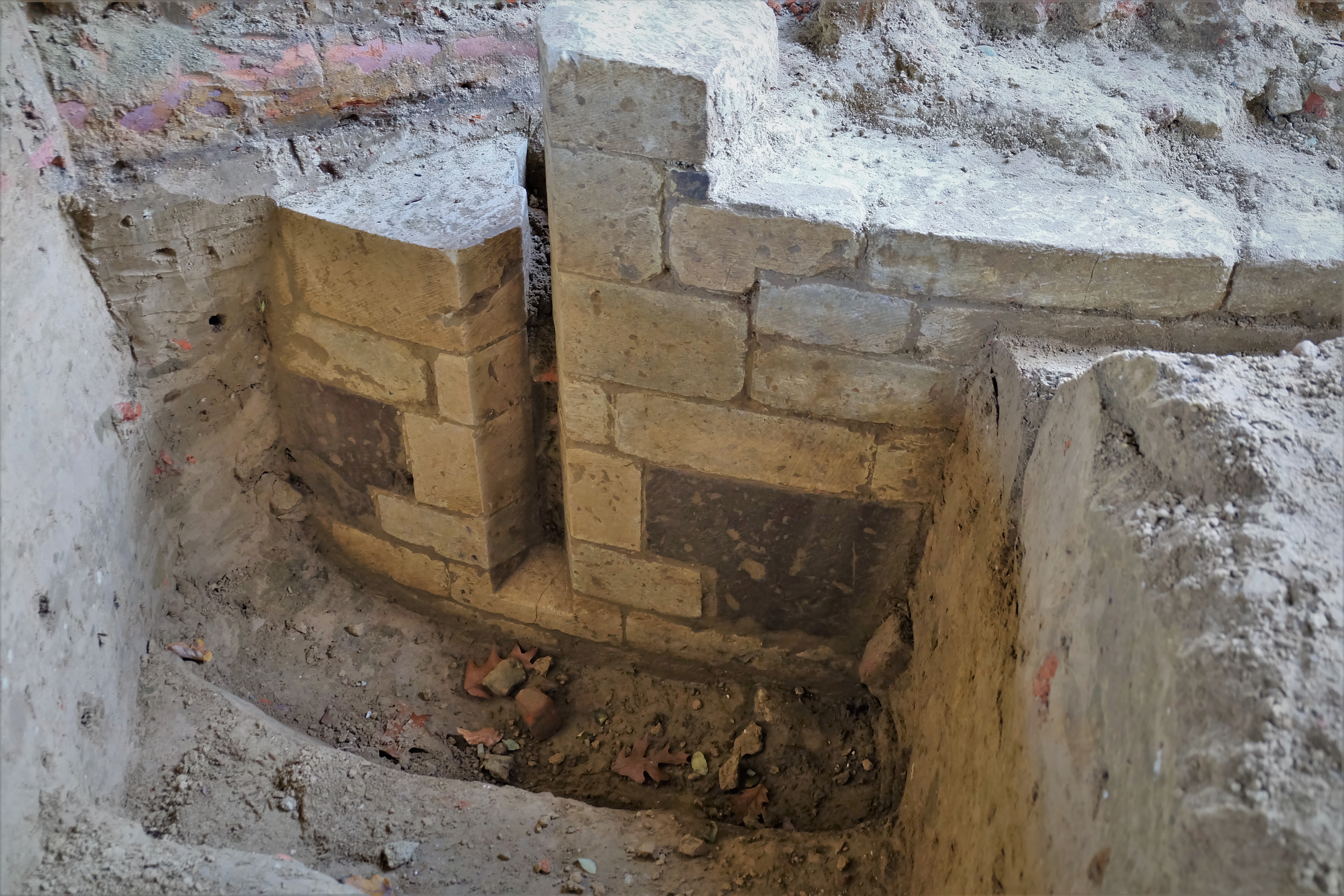
- The city gate’s entrance had a narrow corridor (around 2 metres) contrary to its monumental depiction in 17th century drawings. The discrepancy could be on the one hand due to artistic interpretation by the artist, and on the other hand, that the corridor had always been narrow in order to prevent quick influx of invaders should the gate fall.
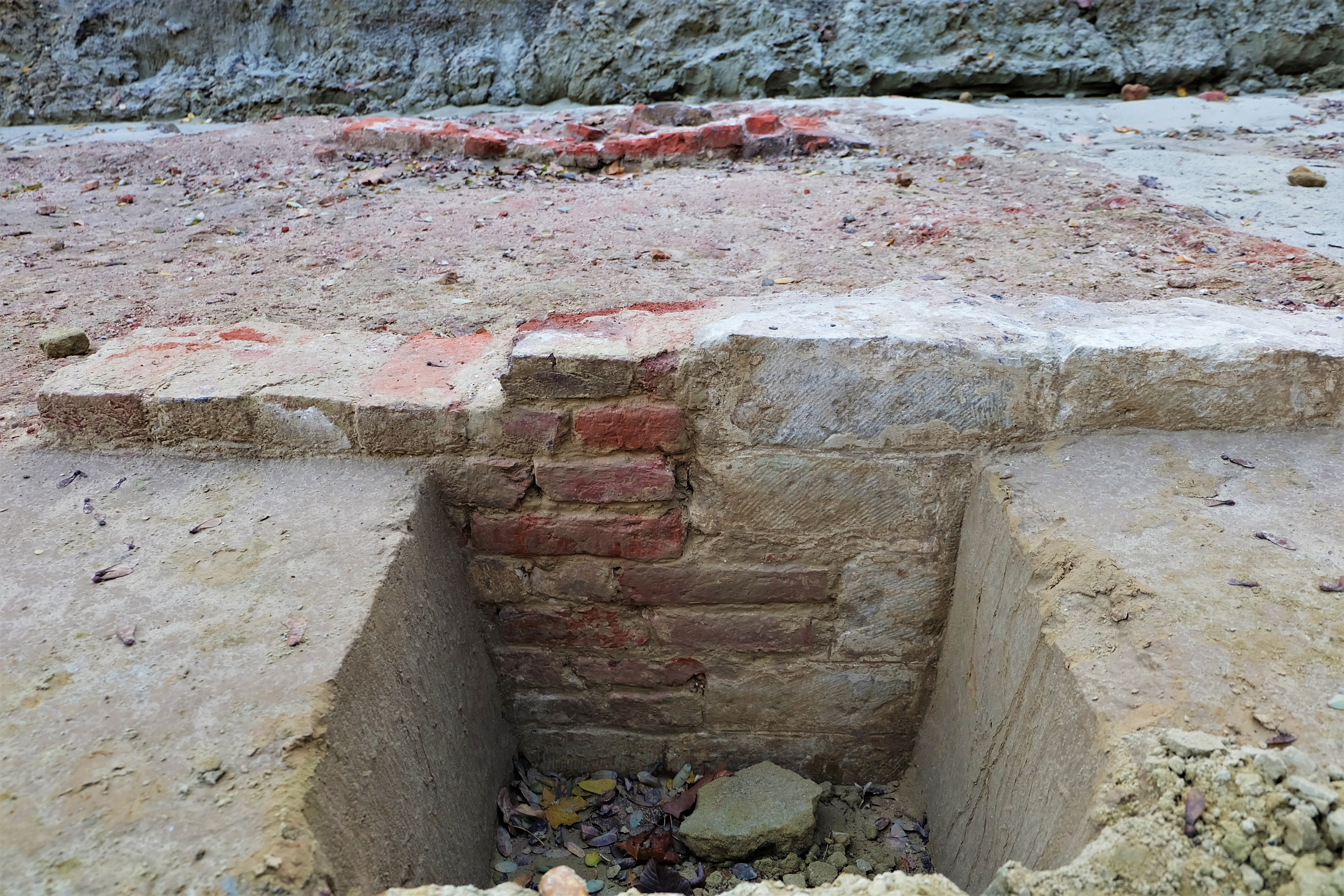
- The arrowslit found in the foundations with extremely cleancut sides shows how well-preserved this 14th century gate has been under the ground. That fact that arrowslits are found this low, tells us that the city gate itself was lower than the current level.
- The field-side constructions unearthed during this excavation exhibit a lower quality in craftsmanship and material. This points to the later extension of the fortification.
Sources:
https://nl.wikipedia.org/wiki/Geschiedenis_van_Leuven
https://nl.wikipedia.org/wiki/Ringmuren_van_Leuven
“Louvain dans le passé et dans le présent’, Edward van Even, 1895 (Image)
Many thanks to: Marc Mellaerts, Stadspoorten van Leuven (Pinterest)
HOW IT LOOKS LIKE TODAY
Click on the zoom icon to view the full size.


