ABOUT
The ‘Mechelsepoort’ (Mechelen Gate) is one of the eight city gates inherited from Leuven’s 14th-century outer city fortifications. It is located in the north of the city, at the end of the Mechelsestraat.
Origin
1355-60: Leuven bulks up its defence walls
By the middle of the 14th century, Leuven began to lose its political and economic status as the capital of Brabant. Both Brussels and Antwerp began to grow richer and more powerful. Poverty began to spread throughout the city, with less and less income from its weaving trade (see Lakenhalle) and wine production (see Wijnberg). After the Brabant Succession War in 1355, Leuven dug deep into its pockets to build the 7km-long outer (second) city walls, which were completed in 1360. With its eight new modern city gates, Leuven could essentially shut itself off from invaders (starting from the north in clockwise, with modern names in brackets):
Aarschotse poort (Vaartpoort)
Dorpstrate Buiten-Poort (Diestsepoort)
Hoelstrate Buiten-Poort (Tiensepoort)
Parkpoort
Heverse Poort (Naamsepoort)
Groefpoort (Tervuursepoort)
Wyngaerdenpoort (Brusselsepoort)
Buiten-Borch poort (Mechelsepoort)
The walls also came with 48 watch towers. The later-built and very imposing Verloren Kosttoren (Tower of Lost Cost) would be incorporated into this outer wall system as its 49th and tallest watch tower.
The new outer city walls now protect and include parishes like Sint-Kwintens and Sint-Jacobs which were previously outside the first city walls against attacks launched by the Count of Flanders, Lodewijk van Male. The new walls would also have increased the city area to nearly seven times. The outer city walls were completely surrounded by a moat measuring 3-4m deep and 10-15m wide, depending on the terrain. Where the moat was not dry, it was filled with water. This occurred twice: in the south where the Dijle and the Voer flowed into the city, and in the north where the Dijle and the Vunt flowed out of the city.
The destruction of Leuven’s city walls
In 1781, Habsburg Emperor Jozef II decreed the dismantling of all city defenses, except Antwerp. Cities were only allowed to keep the embankments and canals to avoid the fines. Somehow, Leuven managed to only demolish the defense structures built in 1672 and 1674. The rest of the city fortifications were preserved. But with the French occupation that followed, the outer city walls were completely dismantled, while the city gates were partially or fully demolished. All this was replaced by parks and promenades (any of the roads along the ring ending with the word ‘-vest’ indicates this development).
Between 1950 and 1980, many of the parks and promenades gave way to roads, and with the expansion of the ring around Leuven in 1970, whatever remained of the outer city walls fully disappeared.
What's so special about this place?
Wilselsepoort, Buiten-Borch-Poorte, Porta Montana
Built in 1358, the Mechelsepoort was designed by Henric Samme and Jan Horen. As it was located close to the Castle on the Keizersberg, the Mechelsepoort was originally called the ‘Buiten-Borch-Poorte‘, meaning the ‘Gate outside the Castle‘, or simply ‘Borch-Porte‘ (Castle Gate). The road that led to the gate used to be called the ‘Borghstrate‘ (Castle Street) and the hill on which it is located was the ‘Boelenberg‘ (probably a bastardisation of ‘Borchtberg‘, Castle Mount).
People used to also call it the ‘Poorte daar men te Wiltesele wert gaet‘ (The Gate that leads to Wilsele) or just ‘Wilselse poort‘. The more educated called it the ‘Porta Montana‘ in Latin, referring to the Boelenberg on which it was located.
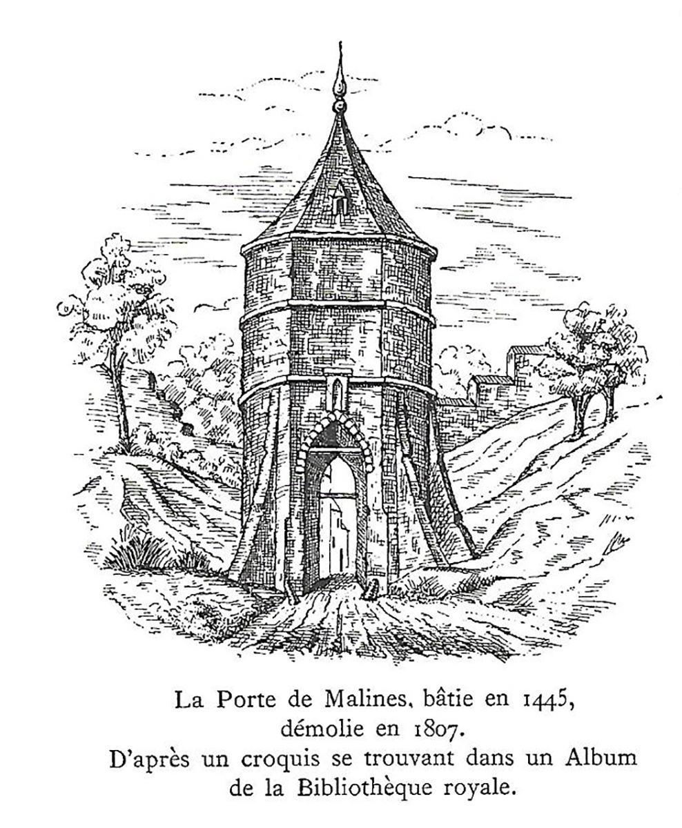
Unfortunately, the Mechelsepoort was demolished in 1807.
How did the Mechelsepoort look like?
It is not known how the Mechelsepoort looked like when it was first built. But in 1445, it was renovated/rebuilt under the supervision of Matheus de Layens (see Stadhuis city hall and the Tafelrond).
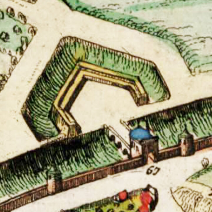
When completed a year later, the Mechelsepoort had the appearance of a tower, that was rectangular intra-muros and round extra-muros.
On the extra-muros facade, above the gate, was a niche with a stone golden lion, holding the coat of arms of Leuven. This sculpture was said to have been carefully supervised by Matheu de Layens himself and gilded by Arnould van Voorspoele.
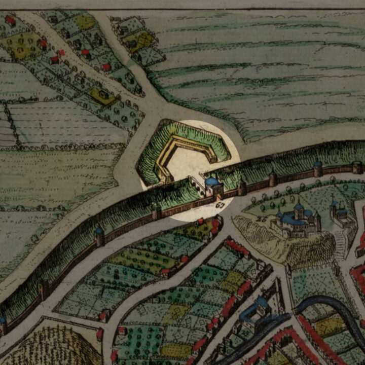
Linked to the Mechelsepoort by a bridge over the moat, was a triangular ravelin, itself surrounded by a moat filled with water.
All the above details can be observed on the 1649 Atlas van Loon map itself.
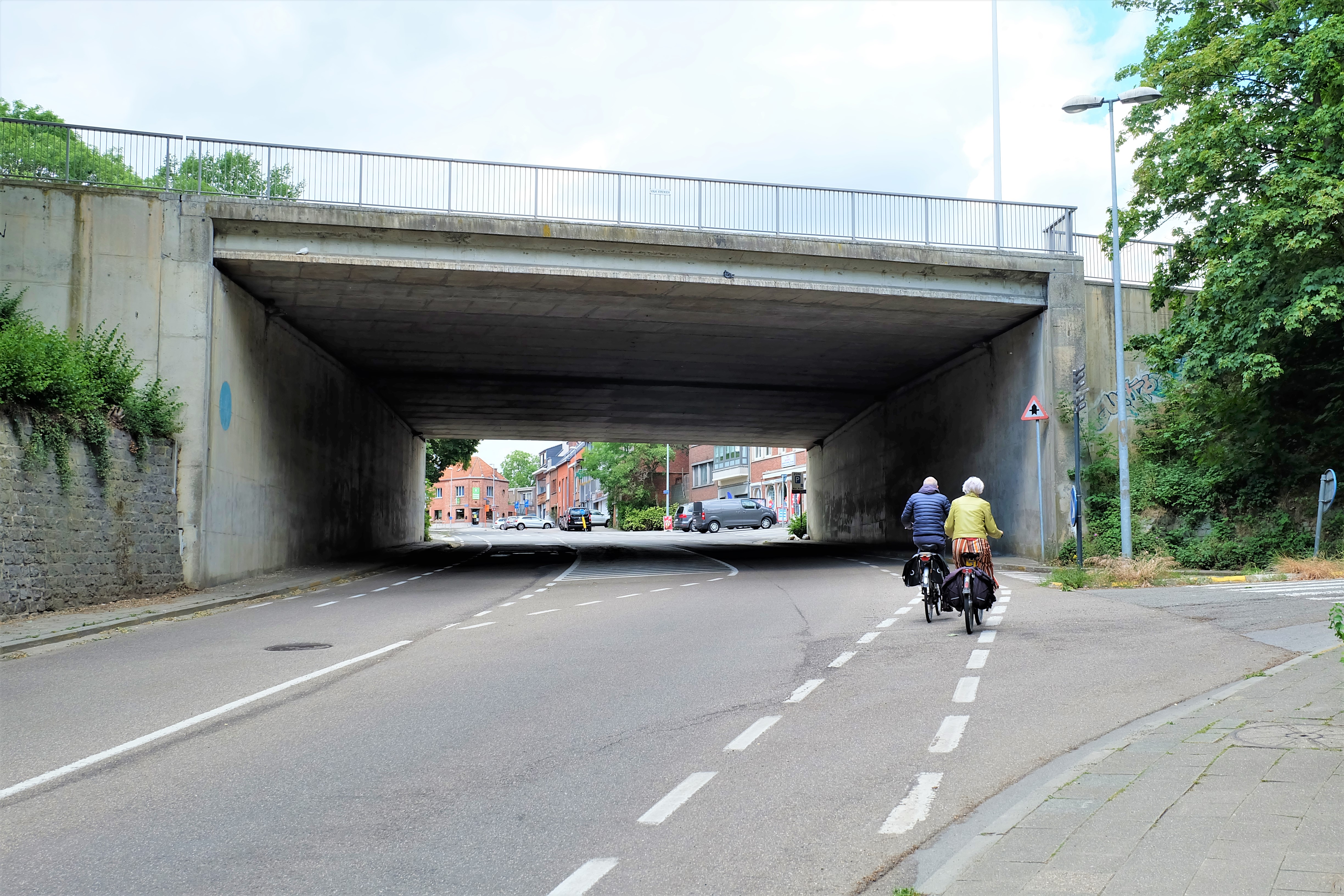
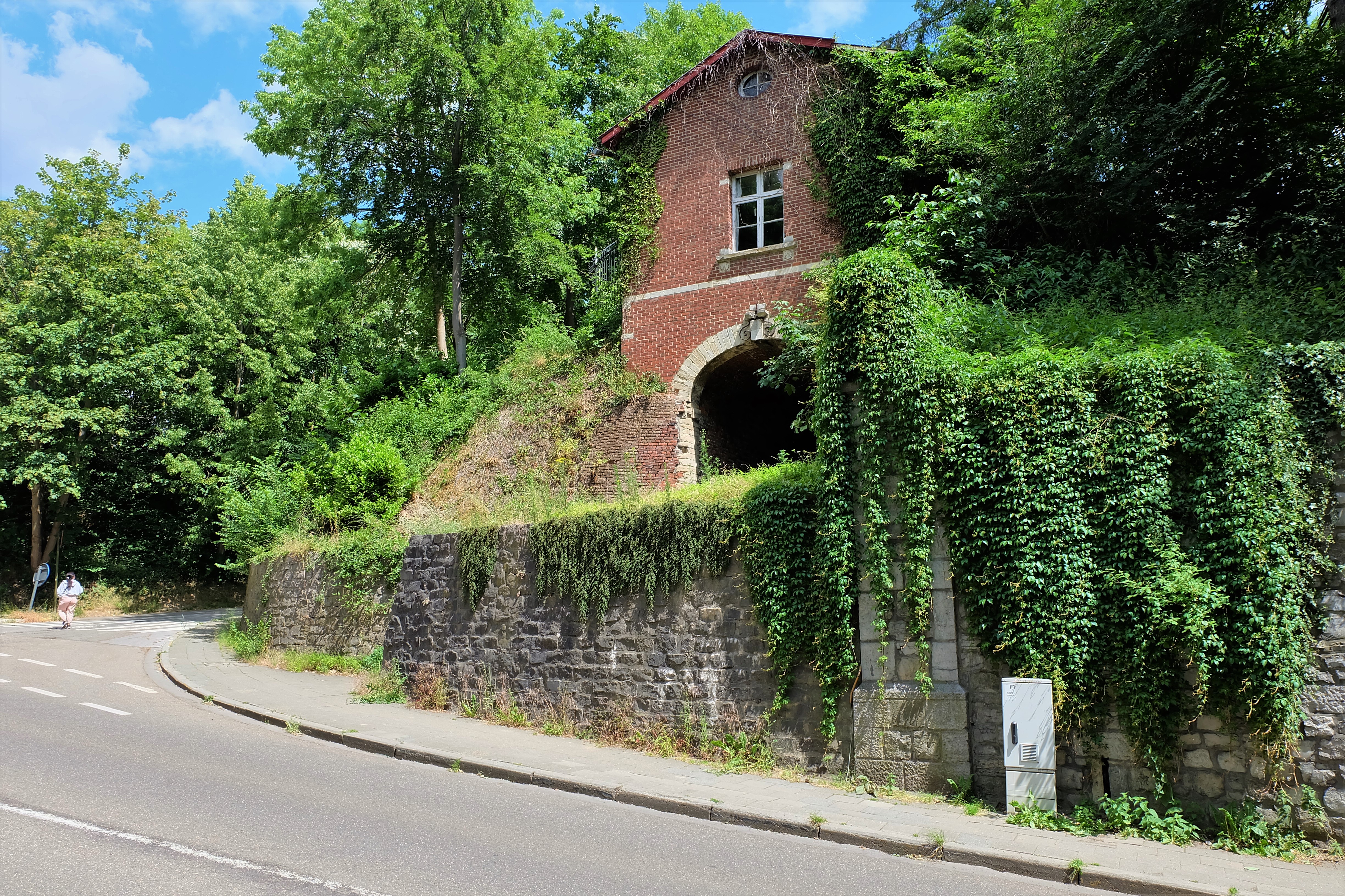
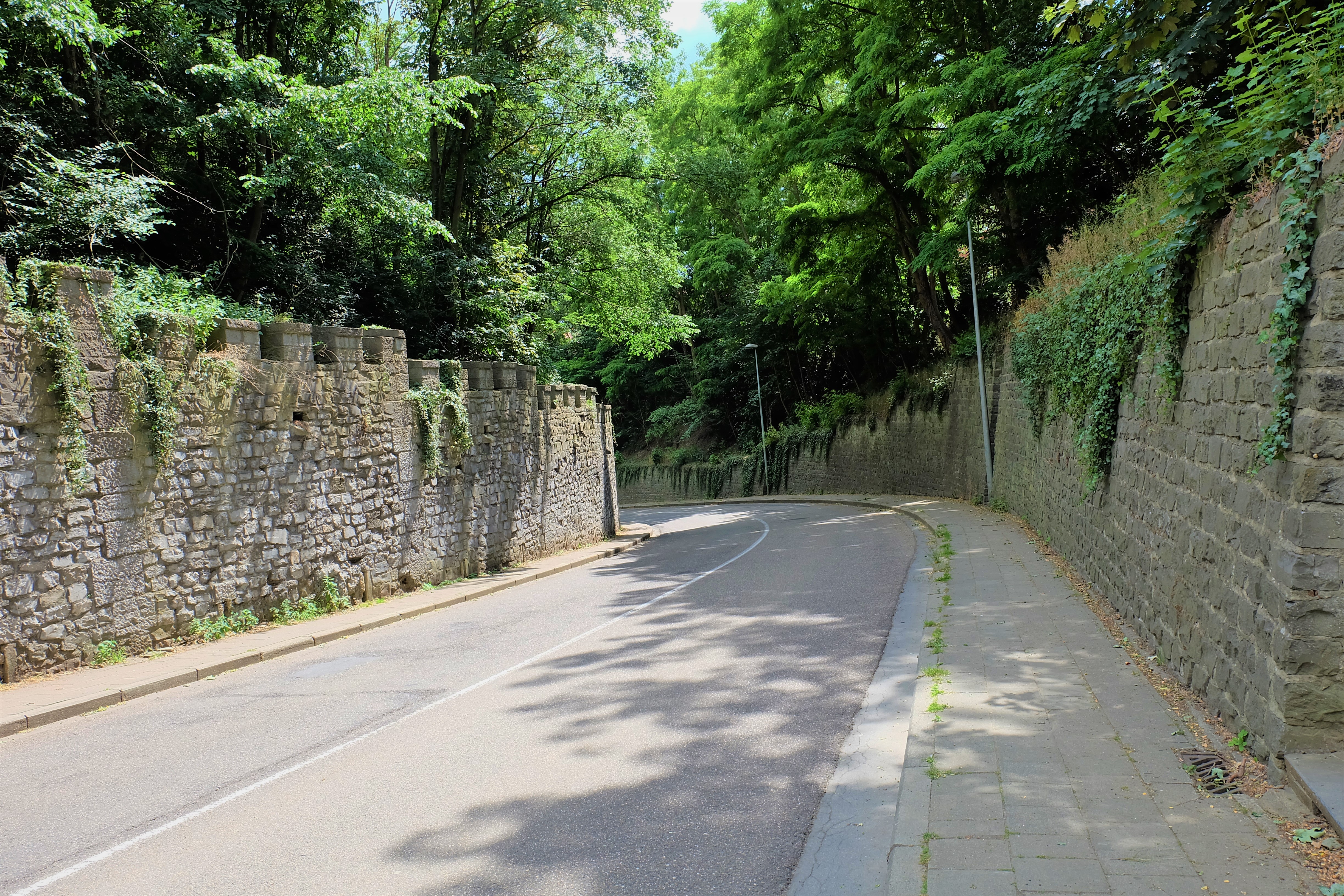
Current situation
Today, the Mechelsepoort remains a gateway to get in and out of the city. The intra-muros road is called ‘Mechelsestraat‘, and the extra-muros road is the ‘Mechelsesteenweg‘. The road leads straight to the city of Mechelen.
Sources:
https://nl.wikipedia.org/wiki/Geschiedenis_van_Leuven
https://nl.wikipedia.org/wiki/Ringmuren_van_Leuven
“Louvain dans le passé et dans le présent’, Edward van Even, 1895 (Image)
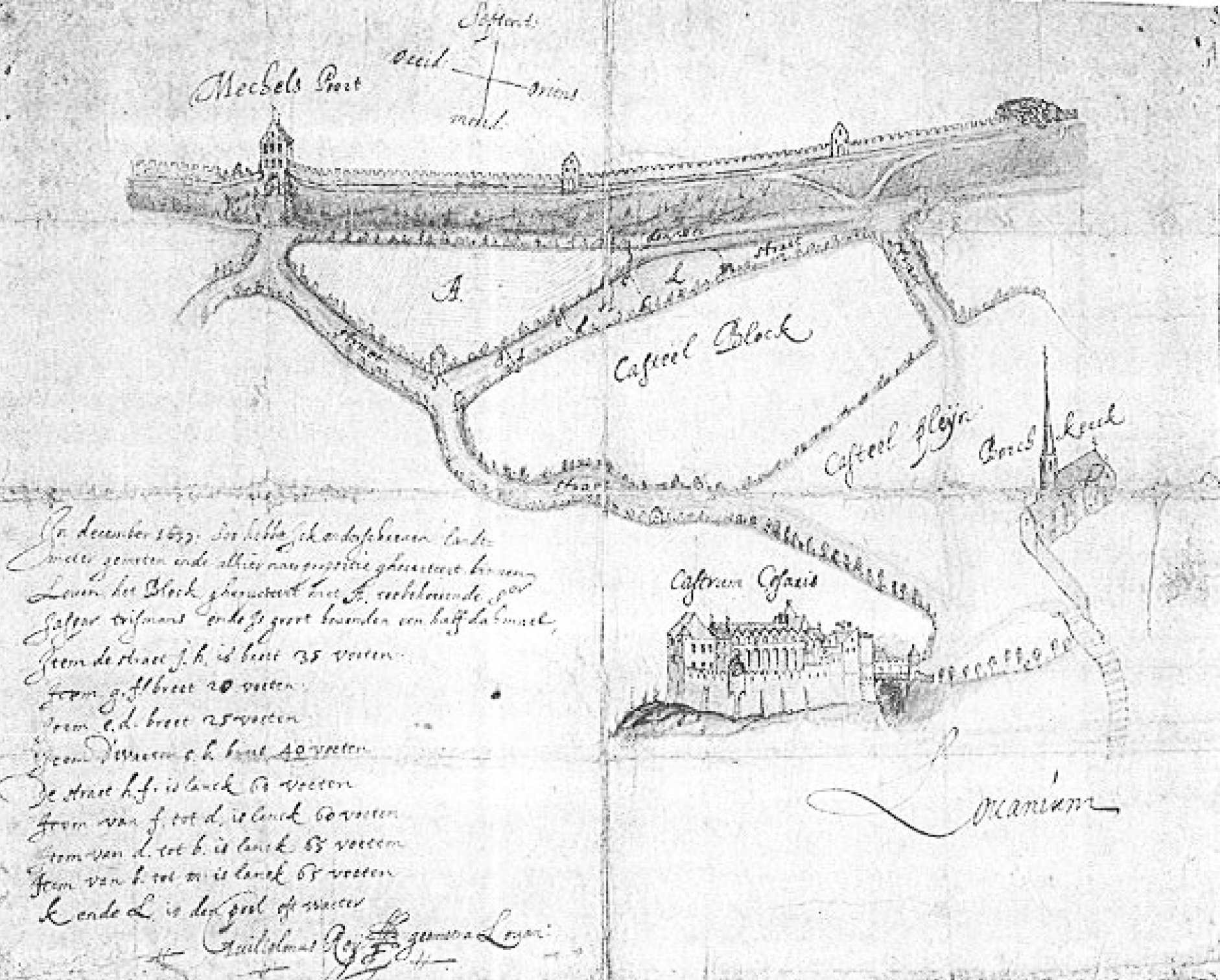
Drawing: “Castrum Caesaris”, Guilielmus Roÿ, 1637. (Image)
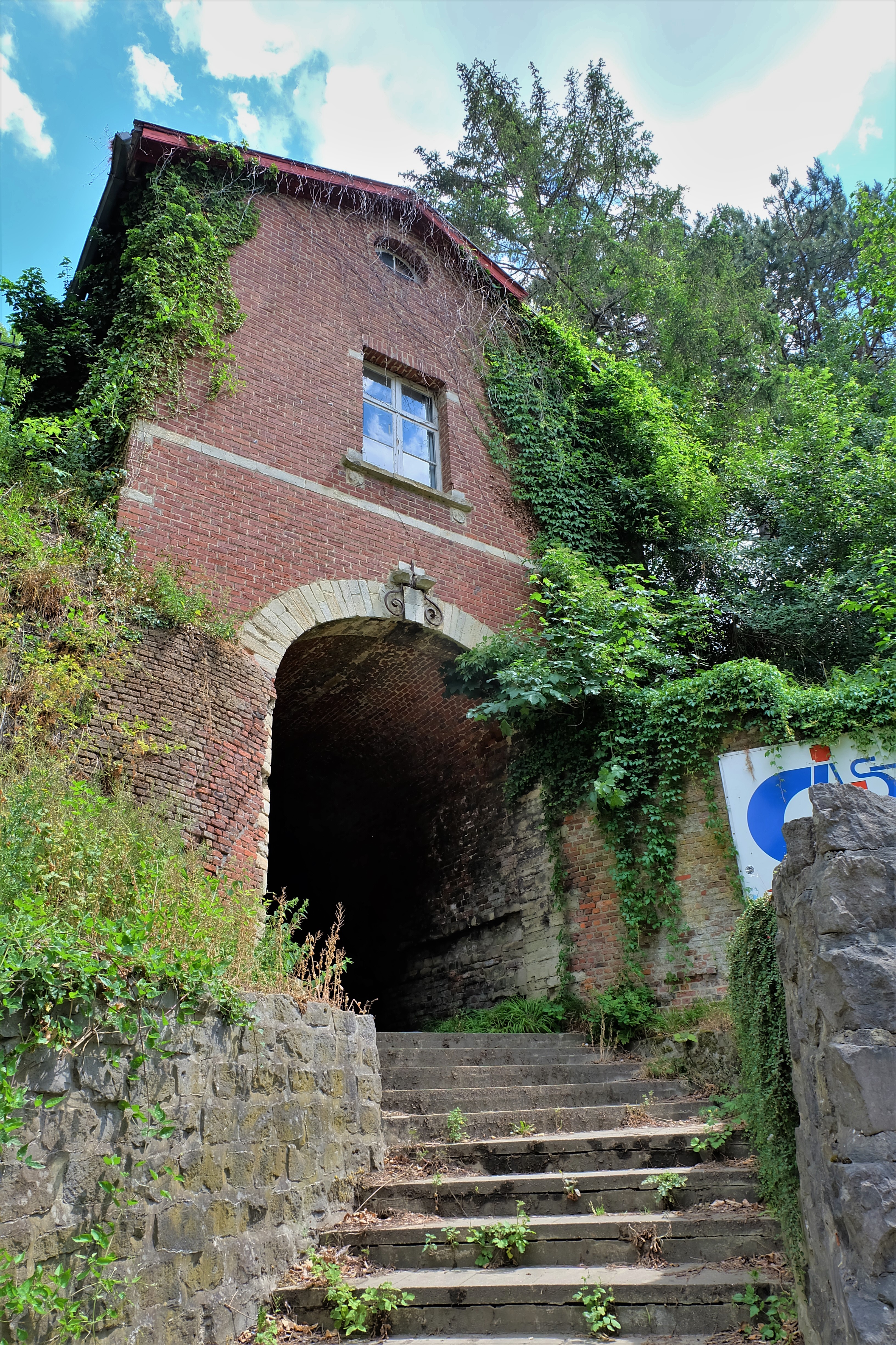
HOW IT LOOKS LIKE TODAY
Click on the zoom icon to view the full size.


