ABOUT
The ‘Aarschotsepoort’ (Aarschot Gate) is one of the eight city gates inherited from Leuven’s 14th-century outer city fortifications. While the name remains, the actual position is vaguely indicated today as the inter-junction between the elevated ringway and the road along the Leuven-Dijle Canal known as De Vaart.
Origin
1355-60: Leuven bulks up its defence walls
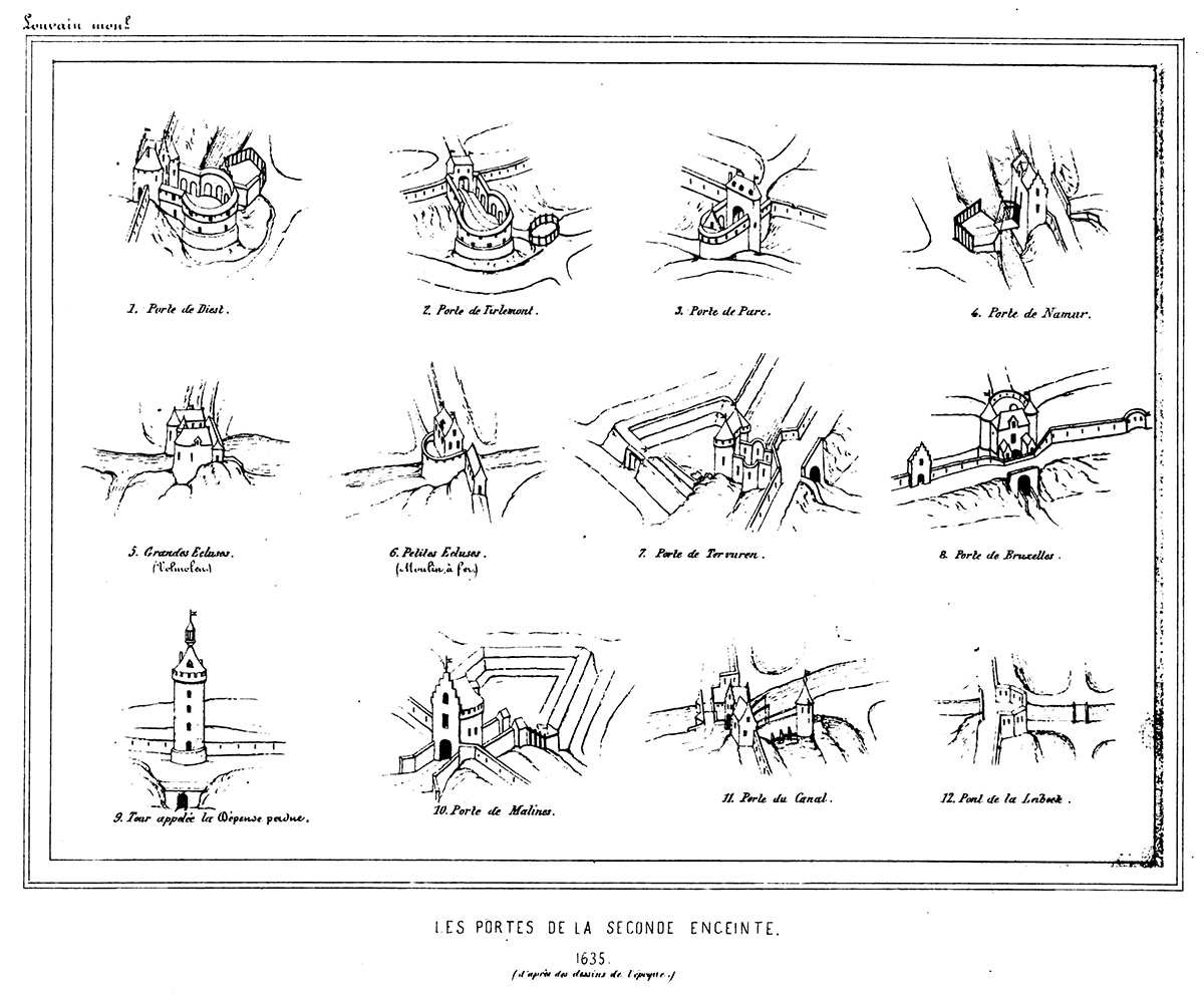
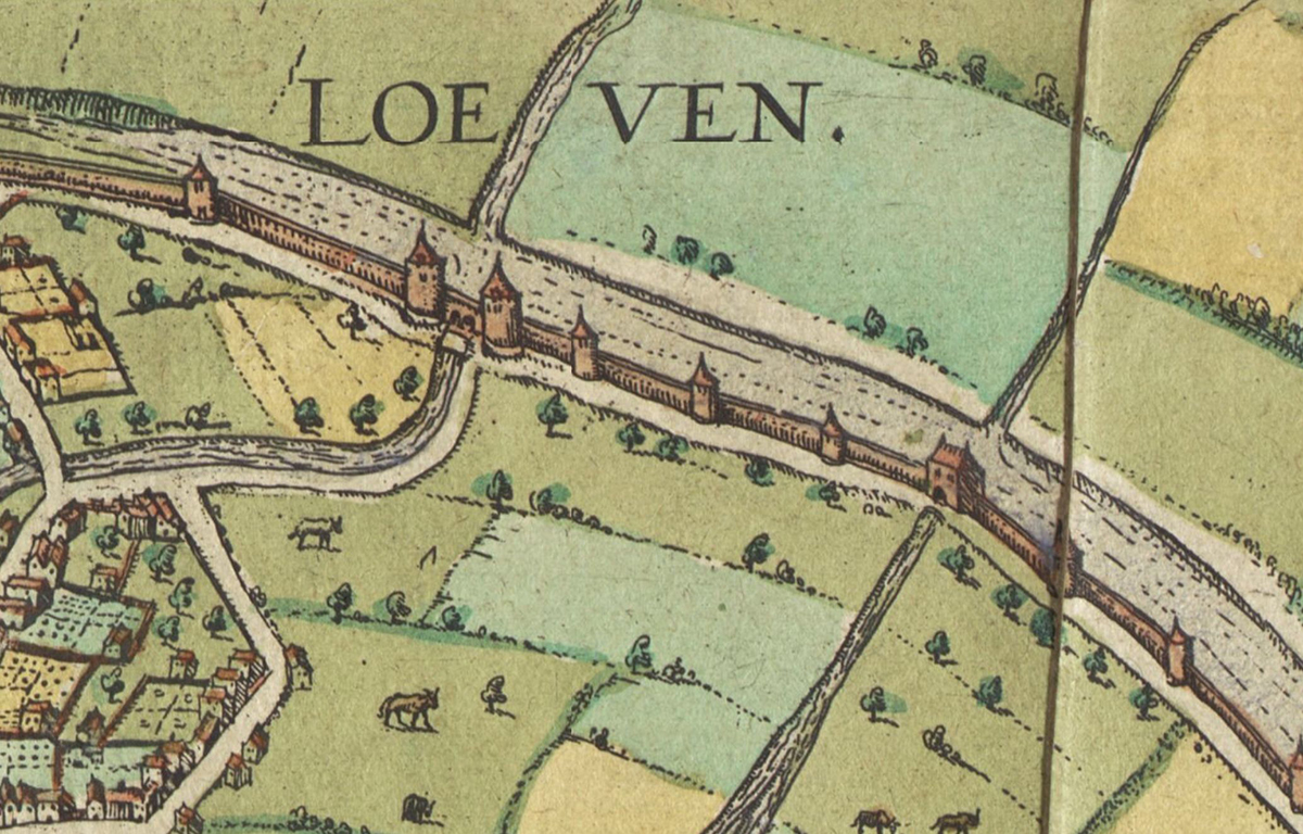
By the middle of the 14th century, Leuven began to lose its political and economic status as the capital of Brabant. Both Brussels and Antwerp began to grow richer and more powerful. Poverty began to spread throughout the city, with less and less income from its weaving trade (see Lakenhalle) and wine production (see Wijnberg). After the Brabant Succession War in 1355, Leuven dug deep into its pockets to build the 7km-long outer (second) city walls, which were completed in 1360. With its eight new modern city gates, Leuven could essentially shut itself off from invaders (starting from the north in clockwise, with modern names in brackets):
Aarschotse poort (Vaartpoort)
Dorpstrate Buiten-Poort (Diestsepoort)
Hoelstrate Buiten-Poort (Tiensepoort)
Parkpoort
Heverse Poort (Naamsepoort)
Groefpoort (Tervuursepoort)
Wyngaerdenpoort (Brusselsepoort)
Buiten-Borch poort (Mechelsepoort)
The walls also came with 48 watch towers. The later-built and very imposing Verloren Kosttoren (Tower of Lost Cost) would be incorporated into this outer wall system as its 49th and tallest watch tower.
The new outer city walls now protect and include parishes like Sint-Kwintens and Sint-Jacobs which were previously outside the first city walls against attacks launched by the Count of Flanders, Lodewijk van Male. The new walls would also have increased the city area to nearly seven times. The outer city walls were completely surrounded by a moat measuring 3-4m deep and 10-15m wide, depending on the terrain. Where the moat was not dry, it was filled with water. This occurred twice: in the south where the Dijle and the Voer flowed into the city, and in the north where the Dijle and the Vunt flowed out of the city.
The destruction of Leuven’s city walls
In 1781, Habsburg Emperor Jozef II decreed the dismantling of all city defenses, except Antwerp. Cities were only allowed to keep the embankments and canals to avoid the fines. Somehow, Leuven managed to only demolish the defense structures built in 1672 and 1674. The rest of the city fortifications were preserved. But with the French occupation that followed, the outer city walls were completely dismantled, while the city gates were partially or fully demolished. All this was replaced by parks and promenades (any of the roads along the ring ending with the word ‘-vest’ indicates this development).
Between 1950 and 1980, many of the parks and promenades gave way to roads, and with the expansion of the ring around Leuven in 1970, whatever remained of the outer city walls fully disappeared.
What's so special about this place?
Utlake-Poorte, Sint Jobs-Poorte, Water-Poorte, Vaert-Poorte
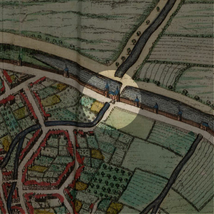
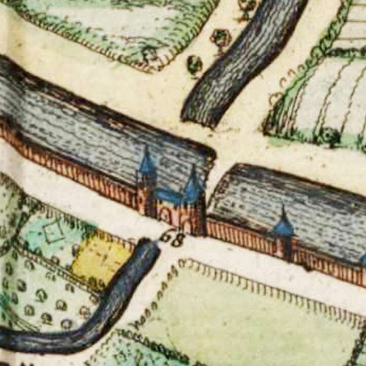
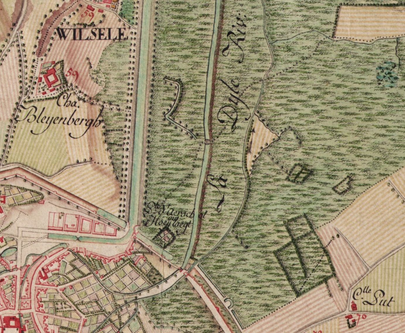
Built in 1361, the Aarschotsepoort was initally called the ‘Utlake-Poorte‘, referring to the ‘Utlake‘ – a small lake located just outside the gate. This is because when the Dijle flowed northwards, it first formed a lake here which was integrated into the moat of the outer fortification.
From the 16th century onwards, it was called the ‘Sint-Jobpoort‘ (St Job’s Gate). This is because it was through this gate, that pilgrims had to pass through this gate when traveling to the nearby church in Wezemaal to worship a miraculous image of St Job. The pilgrimage was so popular, that an image of St Job was cast and placed in a niche above the entry gate. You can read all about the cult of Sint-Job in Leuven in this post about the Sint-Jobkapel (Saint Job’s Chapel) located in the Vaartstraat.
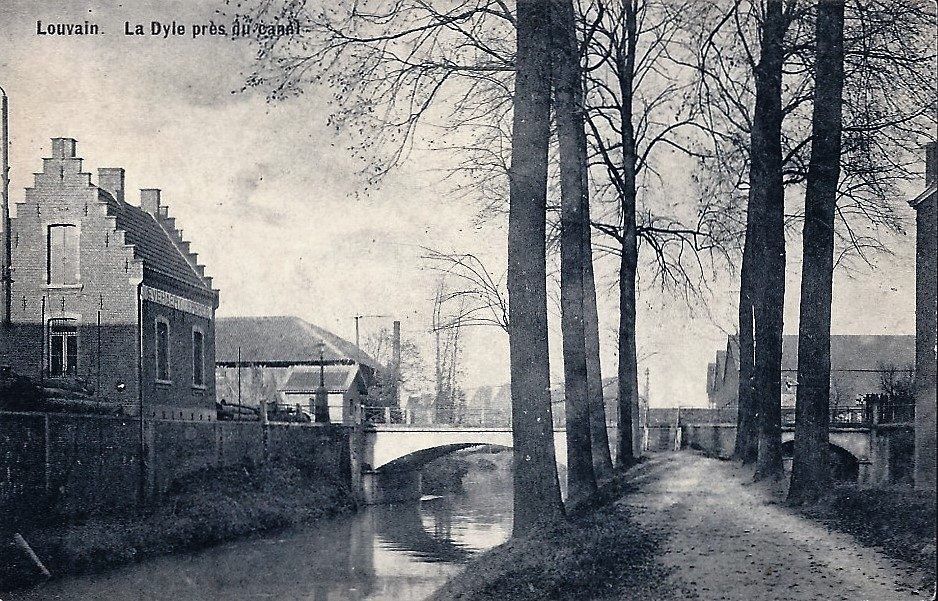
After the Leuven-Dijle Canal was laid in the mid-18th century, the Aarschotsepoort also became known as the ‘Vaert-Poorte‘, meaning Canal Gate, or ‘Porte du Canal‘ in French.
How did the Aarschotsepoort look like?
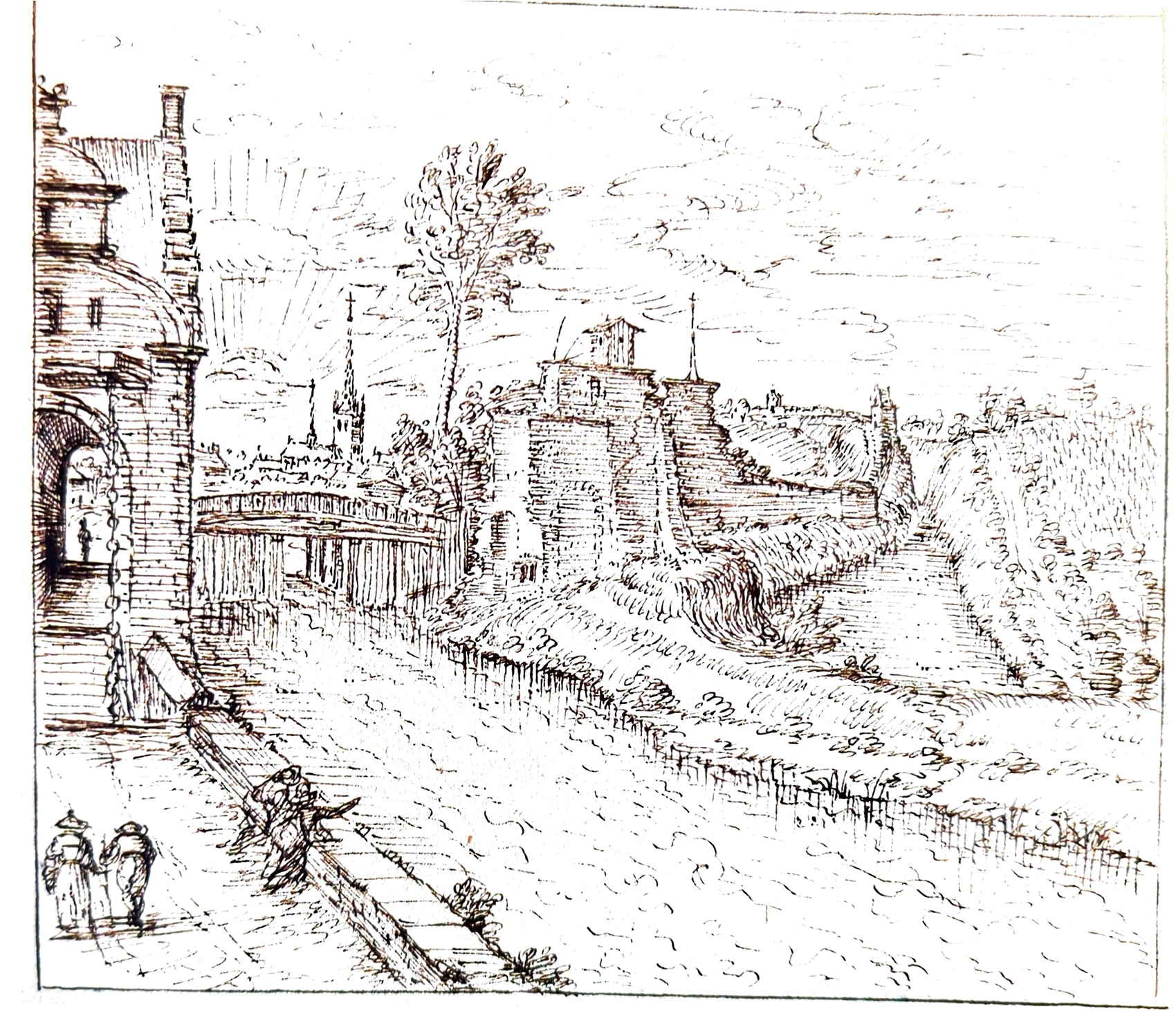
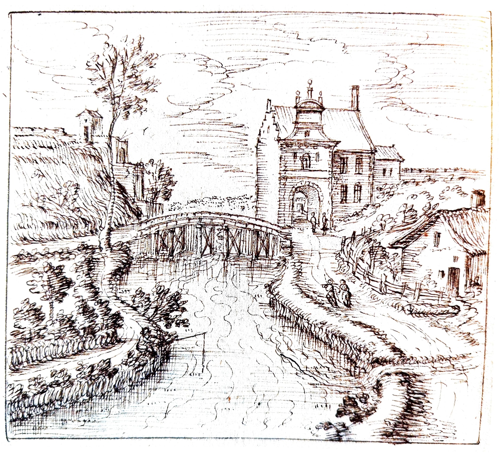
We do not know much about the appearance of the first Aarschotsepoort, except that in 1364, a small building was added to it containing a staircase that led to the ramparts connecting to the Diestsepoort towards the East. A decision was taken in 1515 to demolish and build a new Aarschotsepoort. Work commenced on 20 July 1517, led by architect and sculptor Mathys Keldermans.
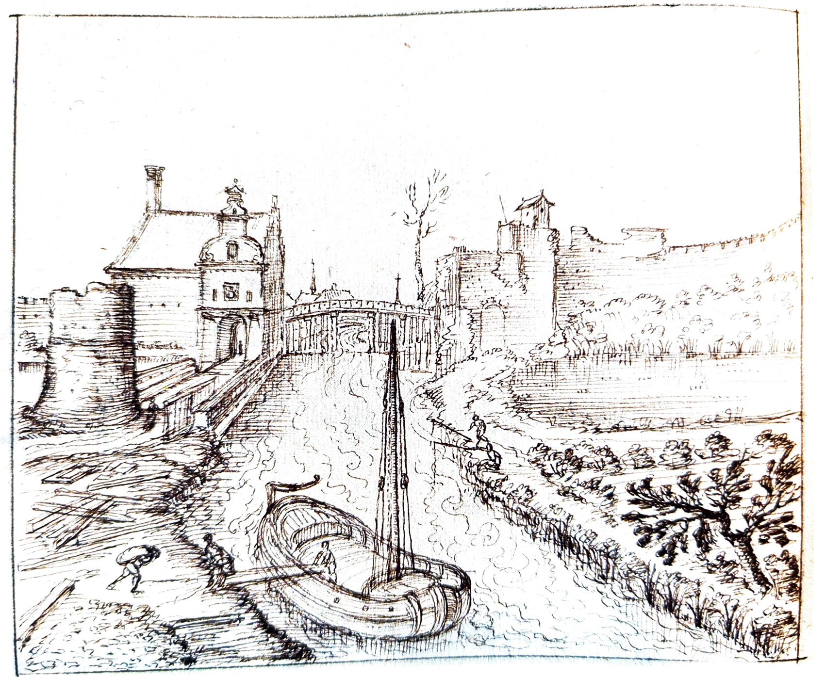
The new building was completed in 1519, and it was crowned with a stone lion measuring two and a half feet. A golden wind vane and ten gilded globes decorated the summit of this edifice. There was a bridge in front of the Aarschotsepoort to cross the moat and another across the River Dijle itself (see Het Spuigat below).
The River Dijle flowed under the Aarschotsepoort out of the city into the Utlake, before it continued northwards.
The Leuven-Dijle Canal (1750)
The Kanaal Leuven-Dijle (Leuven-Dijle Canal) was dug to enlarge the inland waterways between Leuven, Mechelen and Antwerp. The River Dijle that flows, with its many arms through Leuven, was and still is the river that brought life to the city. It was an important water trade route that made Leuven a major trading post since 1327.
The establishment of the canal, that runs parallel to the Dijle, aimed to increase the capacity and volume of the water transport, and bring it into the 18th century industrialising Belgium.
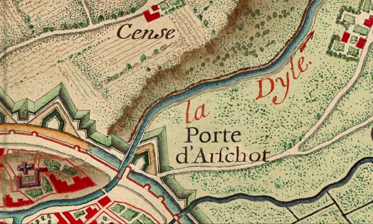
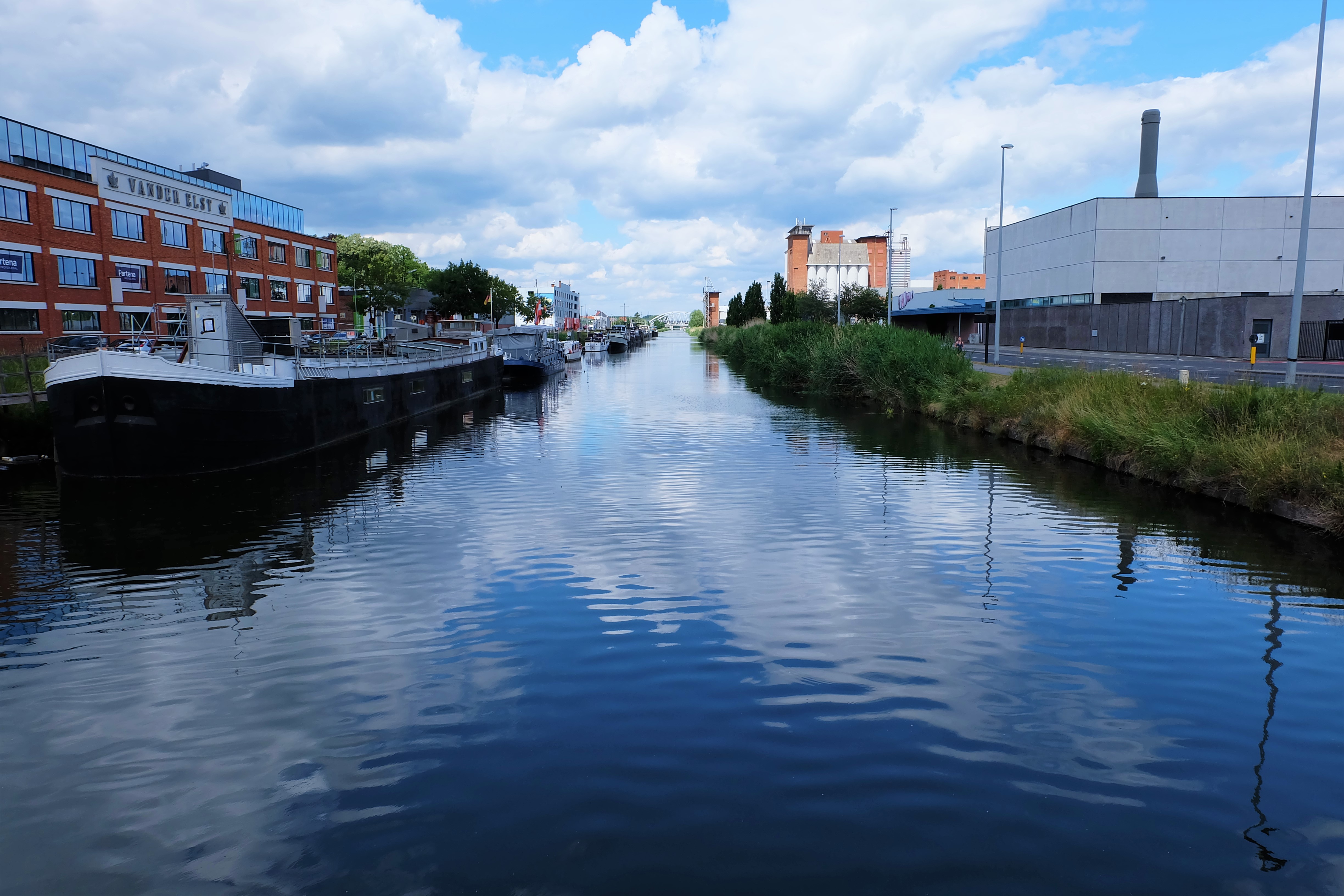
Because of the Leuven-Dijle Canal, the Dijle had to be rediverted to run east of its normal course before and after exiting Leuven – running alongside its daughter river called the ‘Vunt‘ or the ‘Leibeek‘ (see below). The moat that used to be a lake was now filled up and a harbour known today as Vaartkom (see Het Spuigat below) was constructed to link to the canal, west of the Aarschotsepoort within the city walls, to facilitate the loading and unloading of goods.
While the Aarschotsepoort itself was demolished in 1776, the canal has hardly changed. The whole canal infrastructure is protected since 1997 as Belgium’s industrial heritage.
Het Spuigat and Het Nieuw Werk
Many people know that when the River Dijle enters Leuven, it goes through the ‘Grote Spui‘ (The Big Watergate), which still exists. The River Voer, being a smaller river, enters via the ‘Kleine Spui‘), which also still exists.
The Dutch word ‘spui‘ is cognate of the English word ‘spew‘, which is closer to the original meaning of the source word which refered to ‘water coming out of the mouth‘ (of a person or otherwise).
But not many people know that when the Dijle leaves the city, it also used to pass through two other watergates, which do not exist anymore:
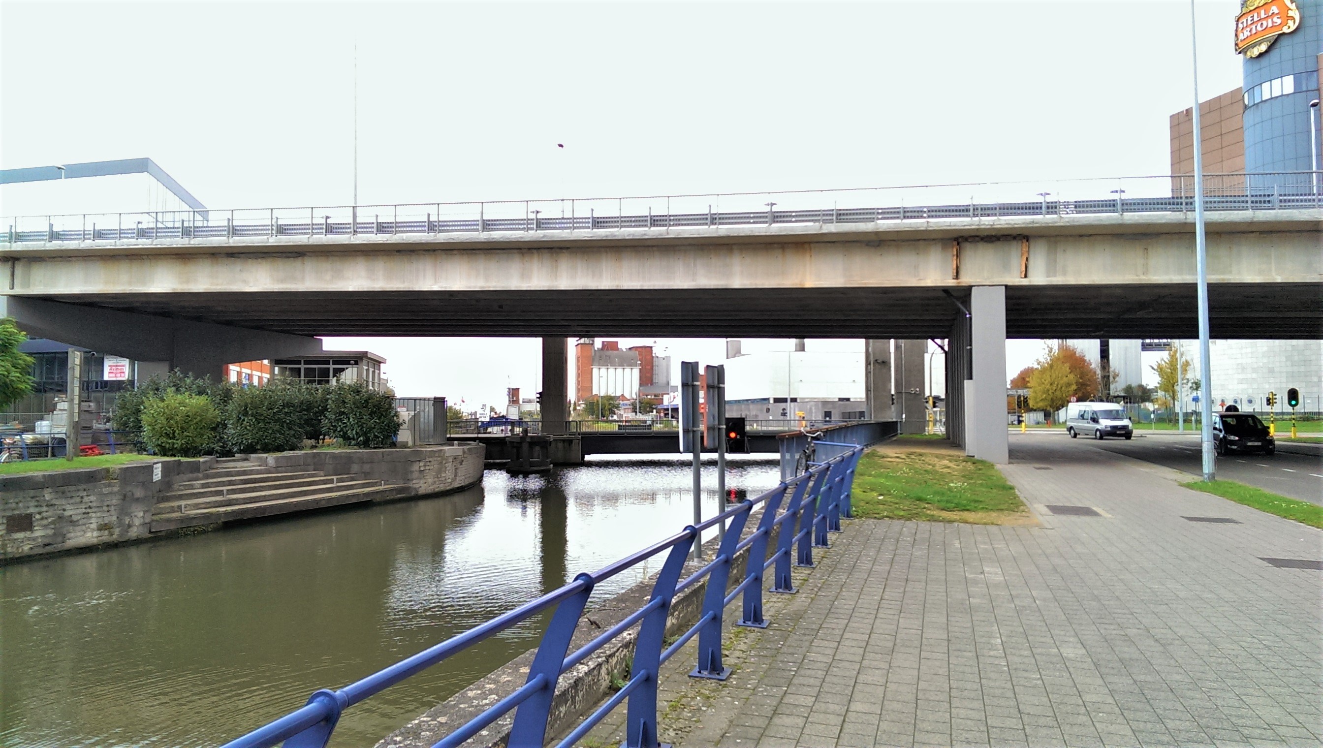
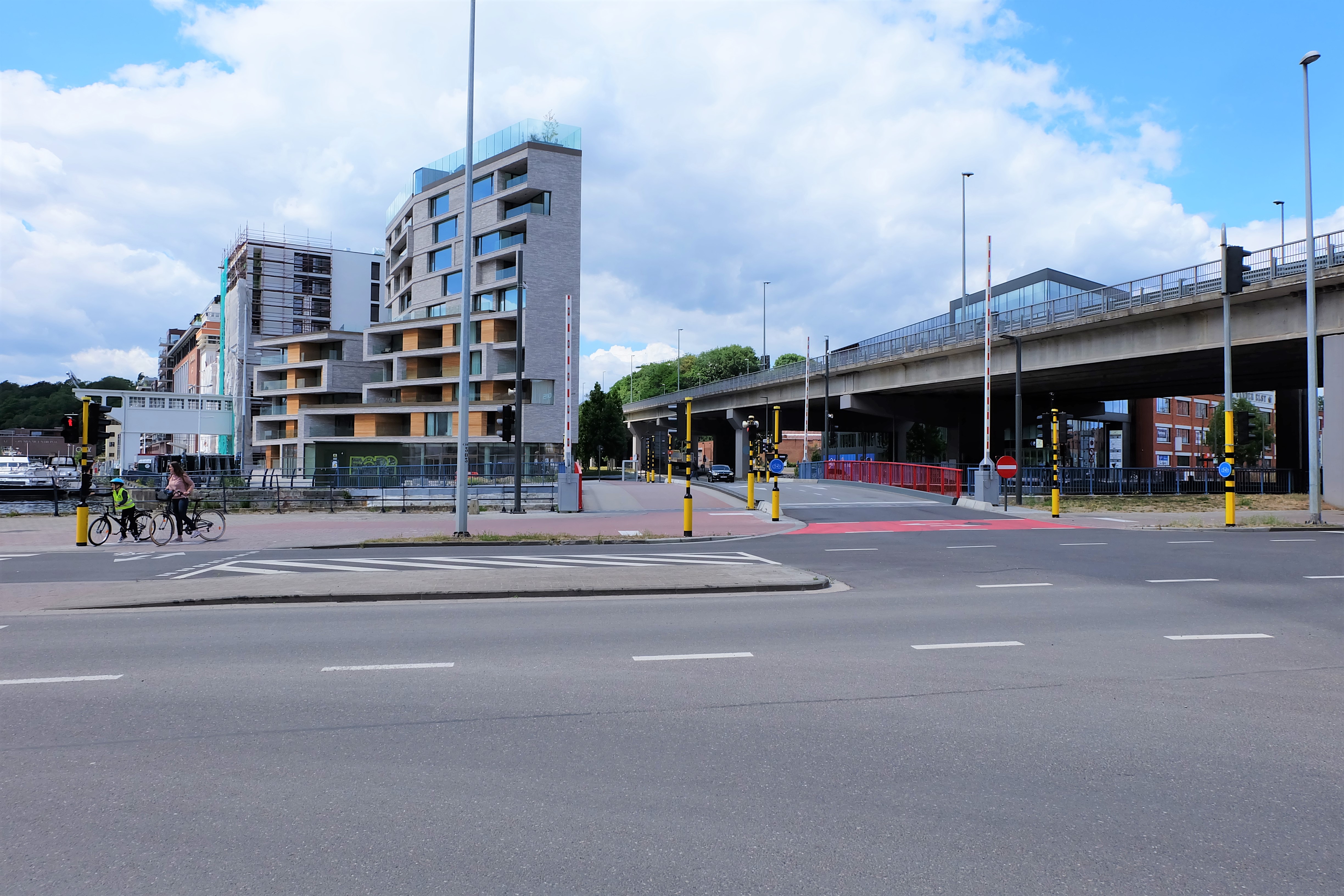
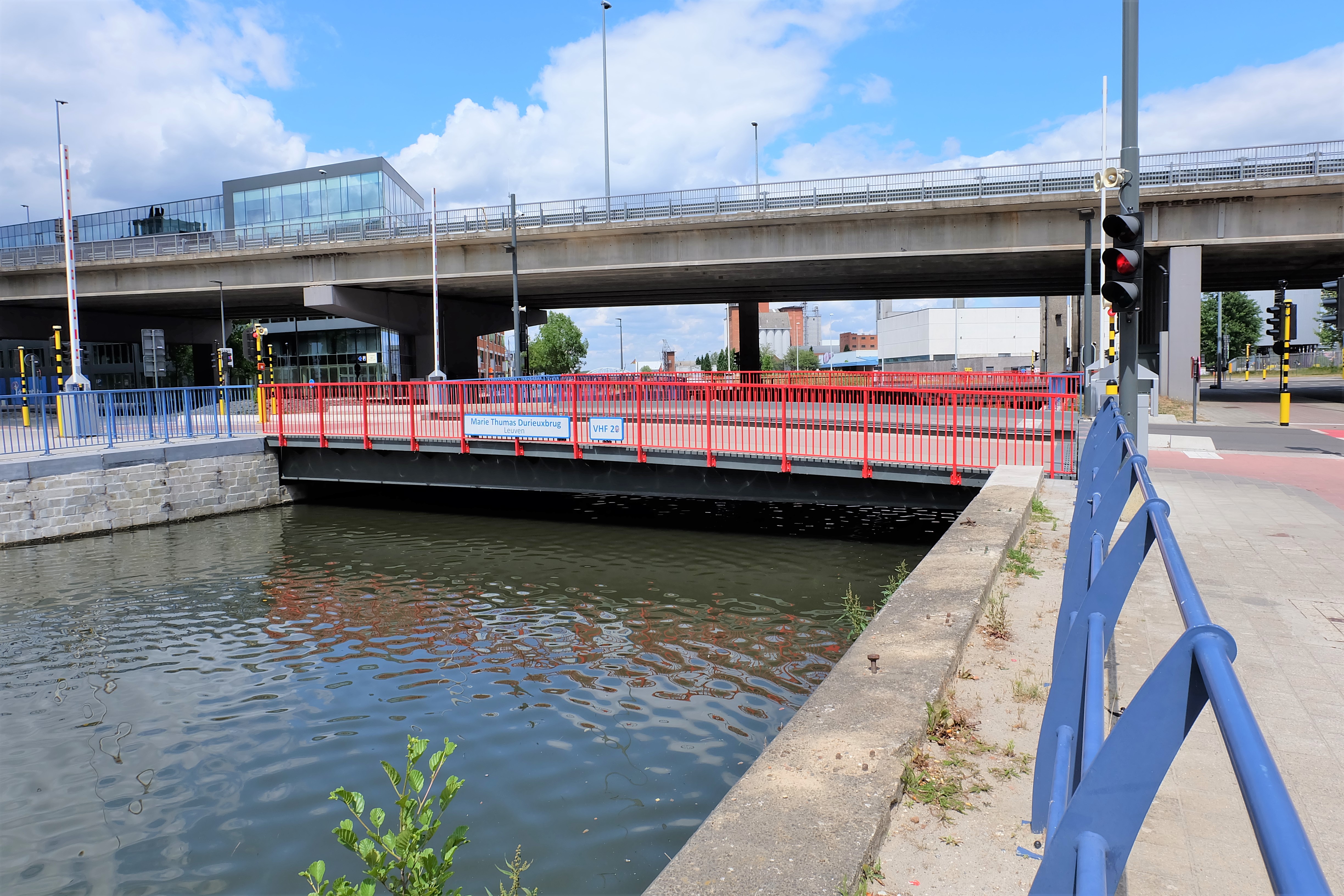
Het Spuigat – where the basin of the canal is which also functions as Leuven’s harbour, nowadays used for yachts, was where the River Dijle passed through a spacious arcade, that used to be called ‘Het Spuigat‘ (Literally ‘The Spew Hole’). There used to be a drawbridge across Het Spuigat in the 16th century, right by the Aarschotsepoort. Nowadays, this bridge has been replaced by two bridges: the ‘Wandelaarsbrug which is an iron drawbridge, while the ‘Marie Thumas Durieuxbrug‘ is a recent addition in 2019.
Het Nieuw Werk – this is part of the outer city fortification east of the Aarschotsepoort. After the completion of the Canal, Het Spuigat became the Canal habour but the water is cut off from the rest of the river while the Dijle just outside the city became the Canal. So the Dijle itself had to be diverted taking another route parallel to the Canal. Meanwhile, there is already another river exiting Leuven, which is a new River Leibeek formed from the Dijle inside Leuven, called the ‘Vunt‘ nowadays. On the 1649 map, you can see the Leibeek/Vunt going through a fortified arcade before it travels out of the city. This was called Het Nieuw Werk (The New Fortification). Nowadays, both the diverted Dijle and the Vunt go underground into the property of beer producer Stella Artois. Rumour has it that the beer uses the water from both rivers, which is why it became the world’s best-selling beer!
Current situation
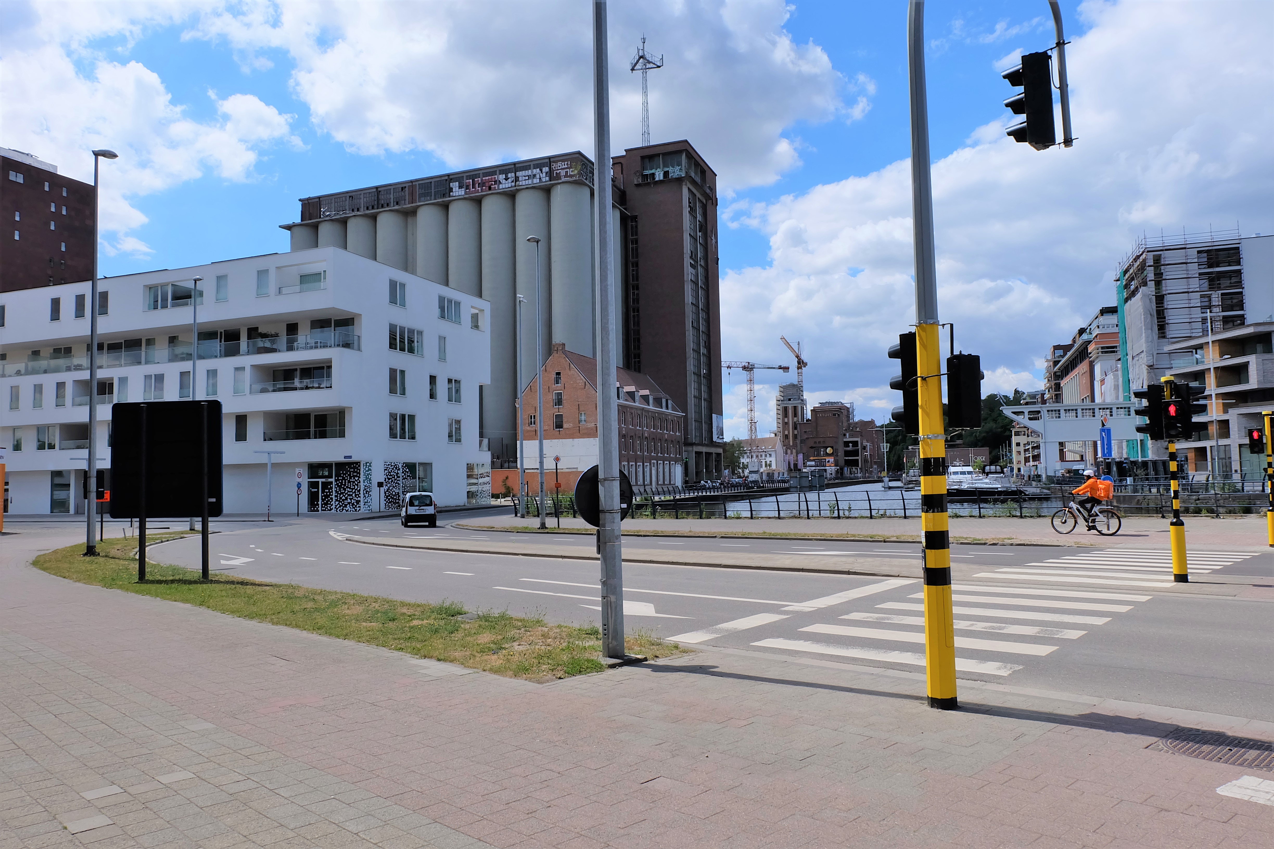
The Aarschotsepoort has completely disappeared from Leuven’s cityscape, and even its location is vague. But the previously industrial and poor area before and along the canal is now being developed into a posh district of Leuven.
Sources:
https://nl.wikipedia.org/wiki/Geschiedenis_van_Leuven
https://nl.wikipedia.org/wiki/Ringmuren_van_Leuven
“Louvain dans le passé et dans le présent’, Edward van Even, 1895 (Image)
Many thanks to: Marc Mellaerts, Stadspoorten van Leuven (Pinterest)
https://nl.wikipedia.org/wiki/Kanaal_Leuven-Dijle
https://nl.wikipedia.org/wiki/Vunt
“Civitates orbis terrarum van Georg Braun en Frans Hogenberg”, 1583, KBR (Image)
“Ferraris kaart – Kabinetskaart der Oostenrijkse Nederlanden en het Prinsbisdom Luik”, 1771 – 1778, KBR (Image)
‘Oude zijtak van Dijle wordt weer opengelegd’, De Standaard, 26 September 2020
‘De Leuvense Prentenatlas’, Cockx and Huybens, 2003 (images)
HOW IT LOOKS LIKE TODAY
Click on the zoom icon to view the full size.


