Oud Leuven: #57 Berg van Barmhartigheid

Oud Leuven: #57 Berg van Barmhartigheid

  • Name in 1649:

    Mons Pietatis

  • Other names:

    d'Oude Munte, Lombaerde, Tafel van Leeninghe, Berg van Barmhartigheid

  • Current name:

    -

  • SHARE:

ABOUT

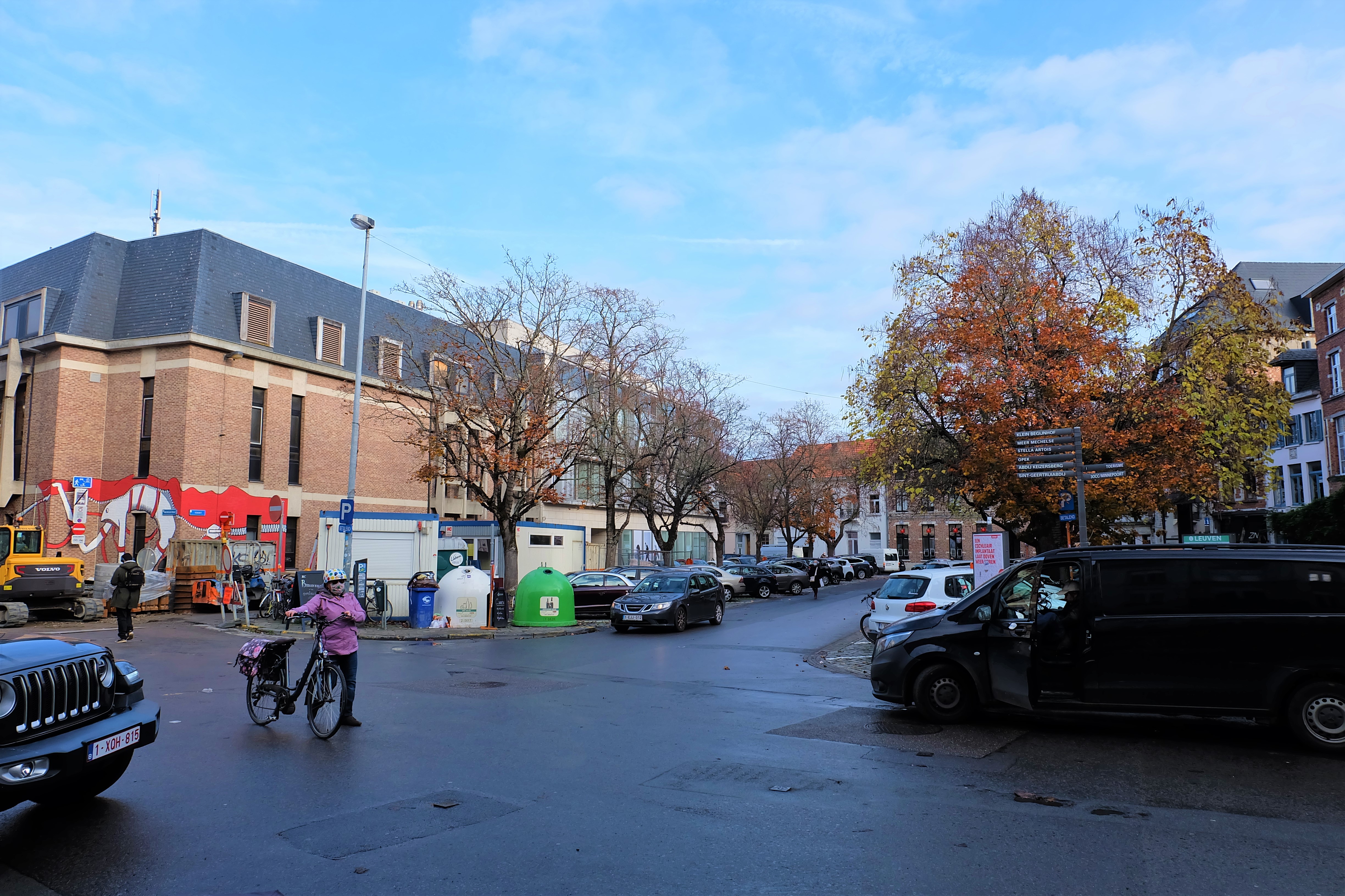
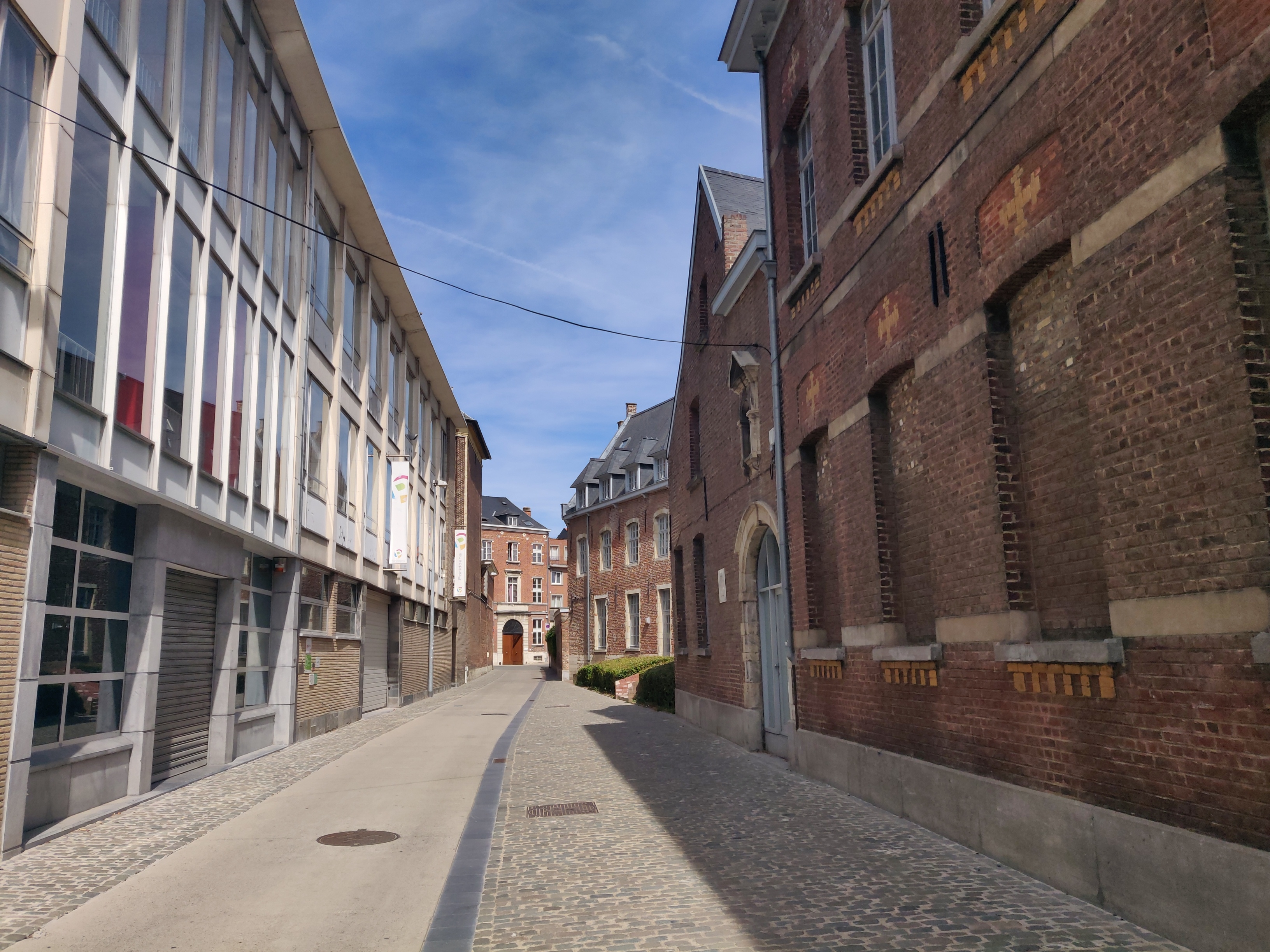
The Mons Pietatis (Mount of Piety) was located in the corner between the Vaartstraat and the Lombaardenstraat in Leuven. In medieval Europe, the Mons Pietatis was the only form of loan available to citizens. On the map, the cartographer mistakenly placed the number 57 in the garden of the house opposite.

Origin

What is a “Mons Pietatis”?

The concept of Mons Pietatis developed in 15th century Italy, as a form of charity and a religious movement against money-lending. Operated by the church, every town and city had a “mons pietatis” to lend money to citizens with low interest, with a deposit of something of value, such as jewelry, silvery, artwork or even books.

Known in Dutch as the “Berg van Barmhartigheid“, this form of loan was banned by the law of 1848. The only existing Mons Pietatis left in Belgium is the one in Brussels.

Between the Mountain and the Lombards

The street by which we know today as “Lombaardenstraat” was known as early as 1564 as the “Lombaerde straetken“. Its other name was “Bergstraat“, which was also used from the Middle Ages up until as recently as 1998.

Why the reference to Italy’s Lombards? The building in the corner with Vaartstraat (known before 1750 as the “Coestrate” – Cow Street) was a house that was called ‘d’Oude Munte‘. When Leuven’s Mons Pietatis called “Lombaerde” moved into this building, locals started calling this street the ‘Lombaardenstraat‘. So in fact, it has nothing to do with the Lombards at all.

There is also another reason for the street’s alternative name, ‘Bergstraat‘:
Since the Dutch translation of Mons Pietatis is “Berg van Barmhartigheid“. This is why Lombaardenstraat was also called the “Bergstraat” although there was clearly no mountains in sight.

What's so special about this place?

In a city decree dated 27 October 1594, the Lombaardenstraat was mentioned as a ‘little street‘ but apparently without a formal name:

“… waarin het bedrag van een toelage bepaald werd tot behulp van der cauchyden int straetken tusschen d’Oude Munte ende thuys van Everbede te maken.”

According to city plans, the Lombaardenstraat alias Bergstraat was underdeveloped until around 1810-1820. After this,  a brewery called ‘Breda’ was built in the houses behind the Mons Pietatis. This brewery was later cleared in the recent decades to make way for the supermarket Colruyt and the streetside building adjoining the Mons Pietatis site all became student housing.

Current situation

Numbers 66-70 (used to be 62-66) Vaartstraat occupy the site of Leuven’s former Mons Pietatis. The buildings were built in 1845. It is nowadays a law firm.


Sources:

https://inventaris.onroerenderfgoed.be/themas/15091
https://inventaris.onroerenderfgoed.be/themas/1043
https://nl.wikipedia.org/wiki/Berg_van_barmhartigheid

HOW IT LOOKS LIKE TODAY

Click on the zoom icon to view the full size.

  • SHARE:

Oud Leuven: Aulnecollege The Aulnecollege existed from 1629 to 1796. It was situated on a prominent, sloping corner lot in the heart of Leuven where the Sint-Quintensstraat (today's Naamsestraat) met the Goeden Hoelewech (today's Karmelietenberg). The college eventually expanded down the hill to reach the Legestraat (today's Schapenstraat). The location is occupied today by the American College. Oud Leuven: #9 Miniemenklooster There was clearly a mistake in the naming of this spot. #9 Vrauwenbroeders Boogarden (the Carmelites Beghards) was not located on this spot, but further west on the current-day Vital Decosterstraat. In 1649, this spot was the Sint-Genovevagasthuis. Oud Leuven: #58 Maria-Theresia- en Veteranencollege The former 'Meiershuis' (Mayor's House) was located on the site of the current Maria-Theresia- en Veteranencollege on the Sint-Michielsstraat. Oud Leuven: #62 Vismarkt The oldest recorded marketplace of Leuven, the Vismarkt (Fish Market) is now an above-ground carpark that is framed by the Craenendonck, the Mechelsestraat, the Karel van Lotharingenstraat, the Visserstraat and the Augustijnenstraat. Its history as probably the first nuclear settlement of Leuven still lies hidden beneath the surface, as is an ancient arm of the... Oud Leuven: #56 Waag Leuven, like many trading centres across the Benelux, used to have a public weighing house, or a 'weighhouse' called 'waag'. This allows the city administration to control the weighing of goods, to ensure a fair levying of taxes on goods. Leuven's Waag was located on the Zeelstraat, at the exit to the Oude Markt. Oud Leuven: Biestpoort The Biestpoort (Biest Gate) was located on today's Brusselsestraat, before where the River Dijle flows. While facing outwards, on its right towards the Minnepoort is the Handbooghof, the best preserved section of Leuven's first city wall with watch towers dating from the 12th century, on its left towards the Minderbroederspoort is the new development site... Oud Leuven: #60 Oude Markt Located between the Naamsestraat and the Parijsstraat, Leuven's "Oude Markt" (Old Market) has been the heart of the city's economic activities since the 12th century. The large rectangular square that measures 174 metres long by 35 metres wide, holds the title of "the longest bar in the world". Oud Leuven: #19 Sint-Pietersziekenhuis Perhaps the oldest hospital in Belgium, the Sint-Pietersziekenhuis is (soon to be "was" at the time of writing) located on both East and West banks of the Dijle river on the Brusselsestraat. On the East bank, are the remains of the hospital chapel and its side buildings. On the West bank ate two contemporary tall... Oud Leuven: Broekstraatpoort The Broekstraatpoort (Brook Street Gate) was located in the Janseniusstraat before the bridge and not far from the Irish College. Oud Leuven: #11 Jezuïetenklooster The "Iesuiten cloost. en collegie" (Jesuit Monastery) mentioned in the map, is no more. The exact location of this monastery is the current-day Sint-Michielskerk (St Michael's Church) located in the Naamsestraat. This former Jesuit church is now one of the Seven Wonders of Leuven still existing, and one of the most monumental Baroque churches in... Oud Leuven: #14 Klooster van de Annunciaten The site of the Klooster van de Annunciaten is completely gone. The current location is at Numbers 1 to 5 of the Monseigneur Van Waeyenberghlaan. The convent existed from 1530 to 1784. Oud Leuven: #44 Sint-Joriskapel In the corner between the Kapucijnenvoer and Bankstraat, there used to be a Chapel devoted to St George. Today, it is a quant 18th-century house that is privately owned. Oud Leuven: #29 College van Mechelen The Collegium Mechliniense was mistakenly placed in the Mechelsestraat by the cartographer in the 1649 map. The College van Mechelen was actually located in the Diestsestraat, at Nummers 26-28 today. Oud Leuven: #35 Pedagogie Het Varken The "Pedagogie Het Varken" (School of the Hog) existed from 1428 to 1797. It was located on today's Hogeschoolplein. Oud Leuven: #41 Koningscollege The King's College (Koningscollege) is located along the Naamsestraat at the corner of the Charles de Bériotstraat in Leuven. Today, the Koningscollege houses the Zoological Institute (Zoölogisch Instituut) of the KU Leuven. Read about its rise as a Royal College of the Spanish King.
  • Share:

Leave a Reply