ABOUT
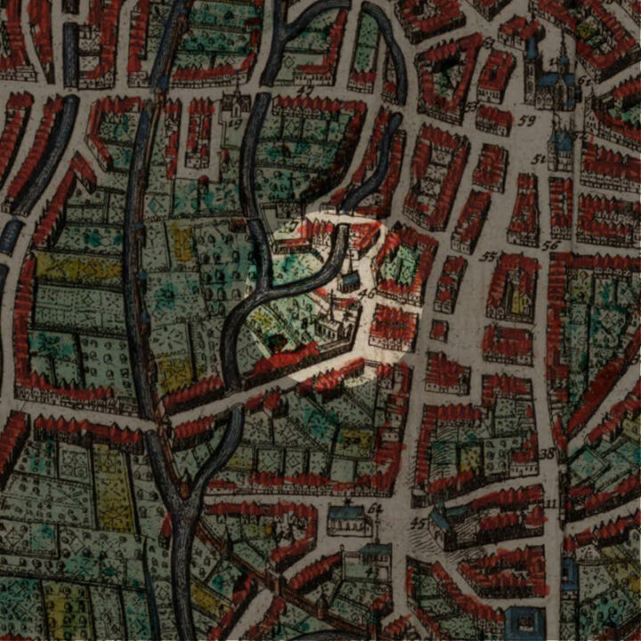
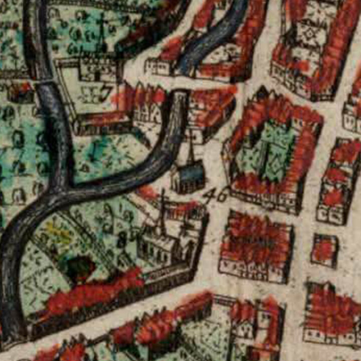
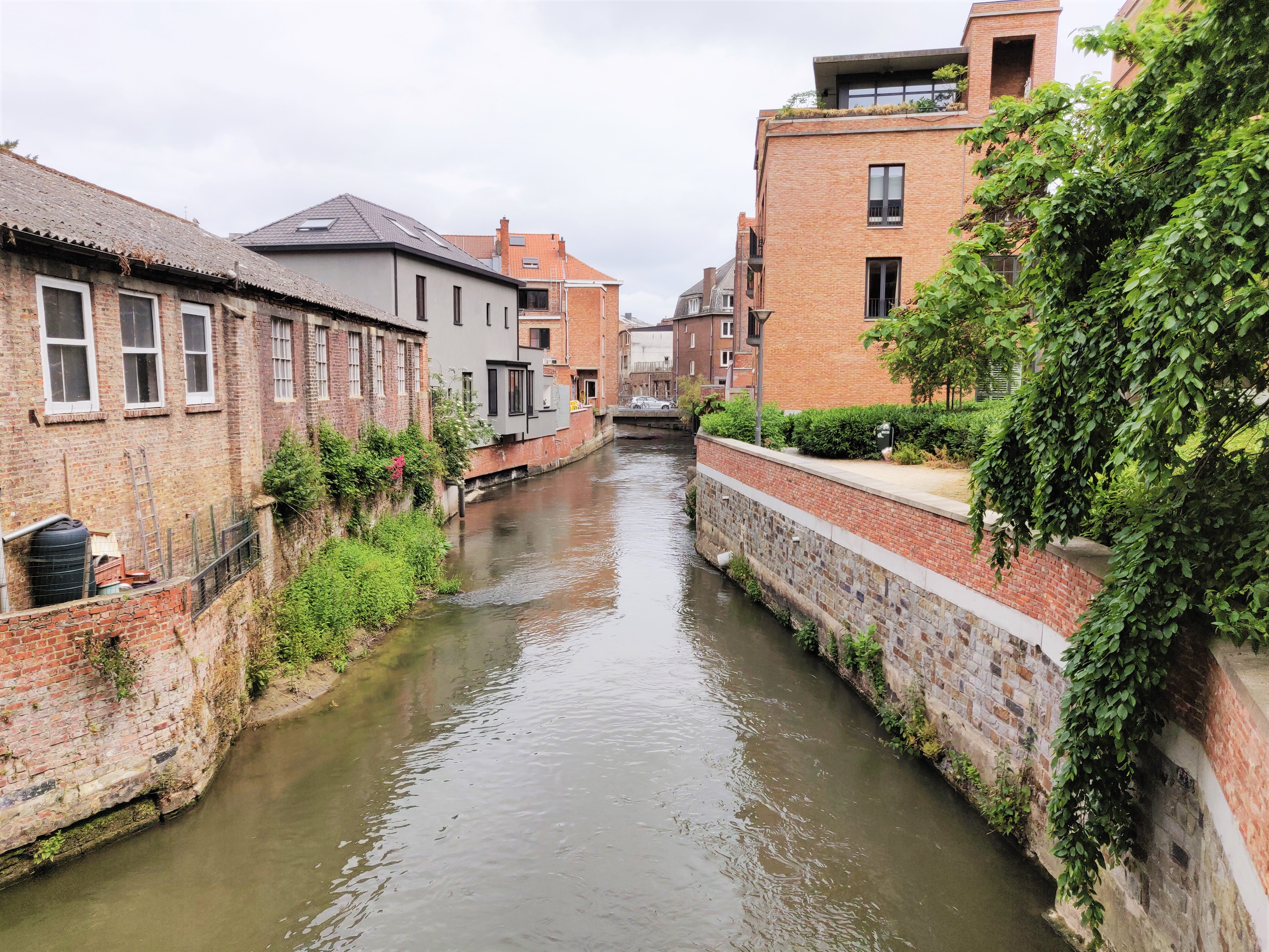
The Sint-Barbarakapel (Chapel of St Barbara) was located along the River Dijle. The site is now the housing complex called Barbarahof, around the square of Joris Helleputteplein.
Origin
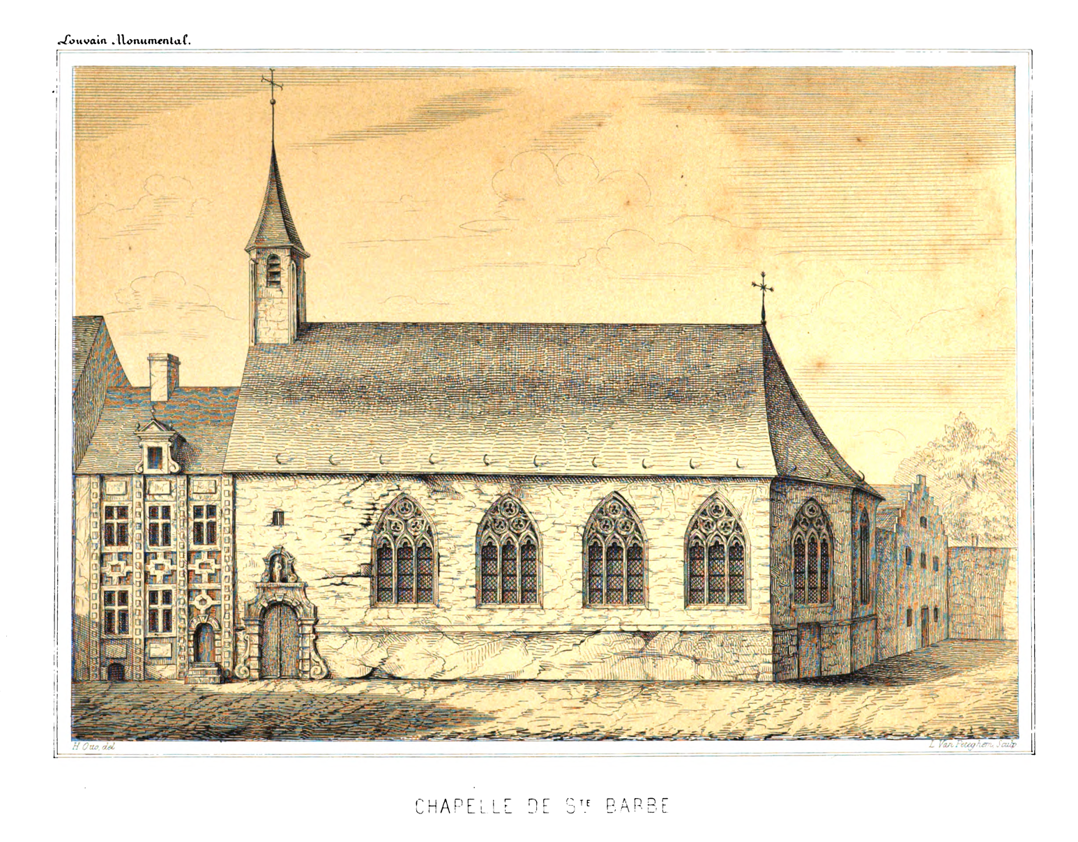
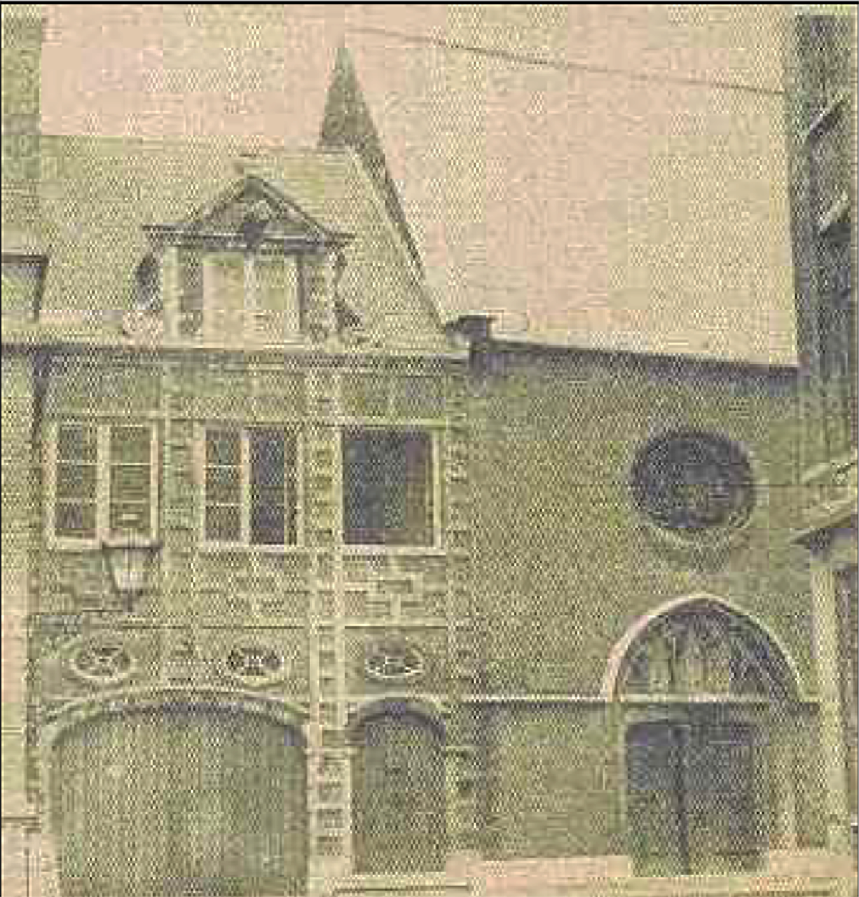
Before the year 1278, the Sint-Barbarakapel was erected at the end of the street of the same name – Sint-Barbarastraat. Originally destined as an infirmary for ten poor beguines, the chapel was a small building with a single nave with only six windows. It also contained three altars. We knew that the Sint-Barbarakapel went through two renovations: once in 1465 (donated by a certain Hubert Vander Wonde and his wife Catherine Stempere) and another in 1665 when the entrance was replaced with one in bluestone ‘in Italian style‘.
The Sint-Barbarakapel also conducted an annual procession carrying the statue of the saint, since 12 May 1484. It also became the chapel of the Guild of the Archers of St Barbara in 1488, one of the five small guilds at that time.
The Sint-Barbarakapel was doing a lot of charity, based on its origins of helping the poor. It ran an almshouse and a school.
By the time of the French Occupation in 1797, the chapel was forced to close, together with all other religious organisations. All its possessions were transferred to the public health administration.
The chapel was demolished in 1827.
The Barbarahof and the Joris Helleputteplein
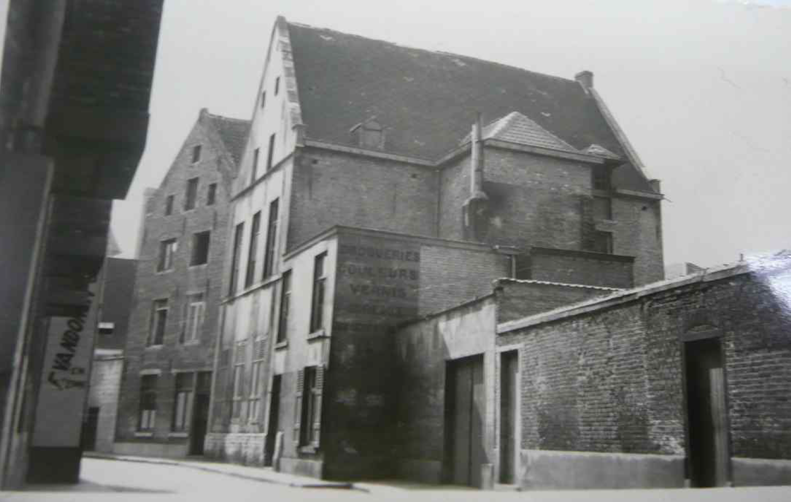
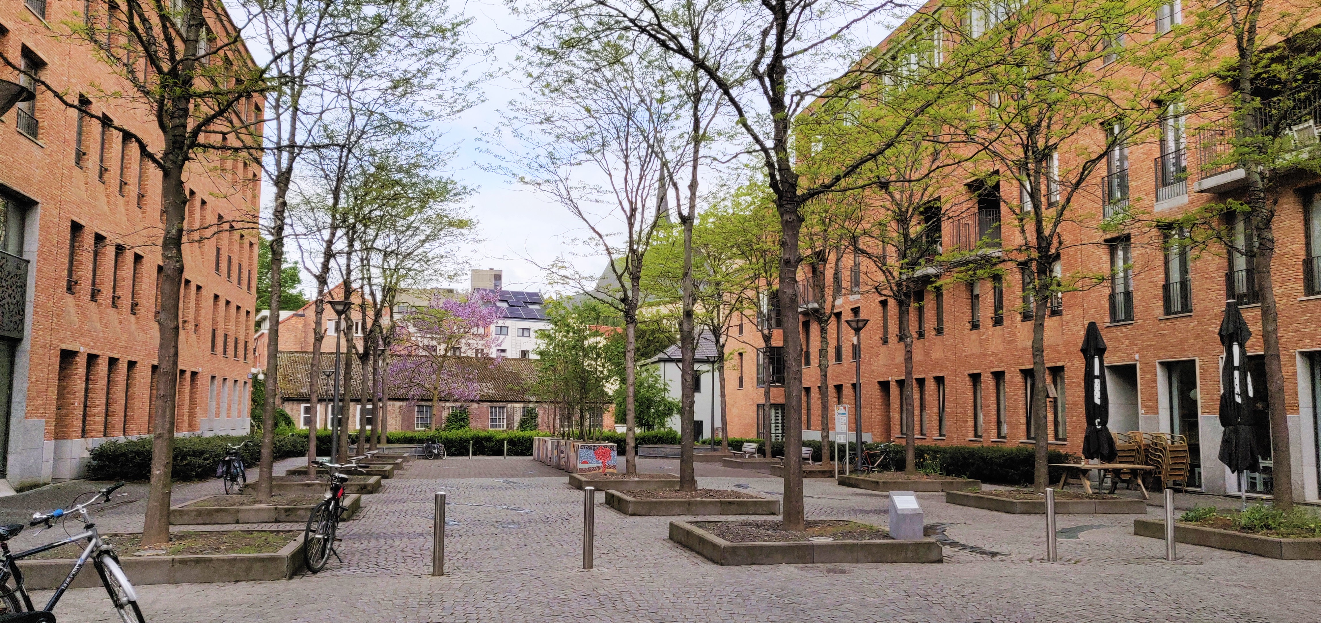
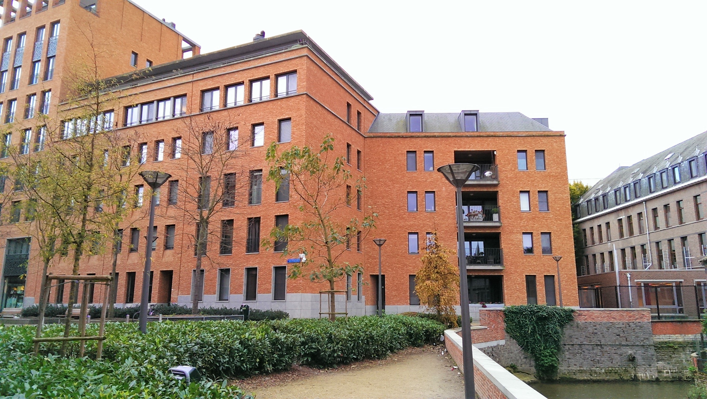
The housing project site you see today is called the Barbarahof, after the Sint-Barbarakapel. It occupies the whole site including the Sint-Barbarahuis (the almshouse managed by the chapel), the school run by the sisters from the chapel and the Geuzenkerkhof graveyard.
An archaeological dig took place in 2007 before the site was cleared for building. The square that was put in the centre of the project is named after Joris Helleputte, one of the founders of the powerful Boerenbond (Farmers’ Union) and an architect and politician. The construction was managed by private company Resiterra, which was again commissioned to work on the Hertogensite on which the Sint-Pietersziekenhuis was situated.
When such powerful political and financial interests are at play, around a lucrative modern housing investment in the centre of the city, the project is not without its controversies. This will be explained further in the text below.
What's so special about this place?
The Low, the Empty and the Short of it
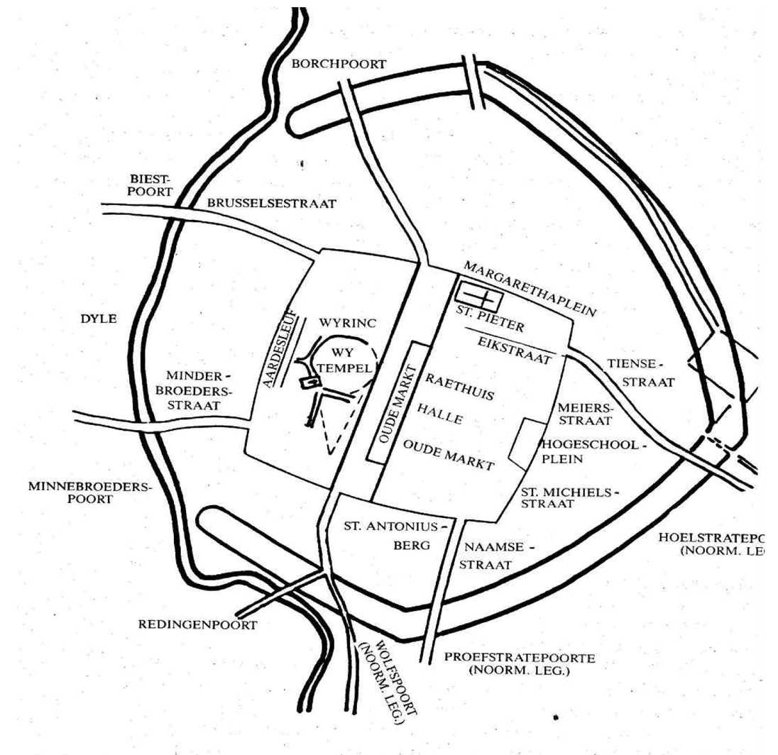
The main street from which the Barbarastraat leads from is called today Parijsstraat – Paris Street. It was already known in 1278, under the name of ‘Leger Straat‘ or ‘Lagerstraat‘.
As explained in the article on Sint-Antoniuskapel, the Pater Damiaanplein on which it is located was known in the Middle Ages as ‘Ledige Plaats‘ or ‘Empty Square’, and the street leading to it was called the same – ‘Leger Straat‘ or ‘Ledige Straat‘.
Another theory is the city was divided into upper and lower towns. Lower town centred around the ‘Lage Plaats‘ so ‘Lower Square’ and the street was called ‘Lage(r)straat‘ or Low(er) Street.
The Sint-Barbarastraat that leads from this Lagerstraat was known as ‘Kortestraet’ (Short Street) before it was named after the chapel. Briefly during the French Occupation, its name was changed to ‘Rue de Lepelletier‘.
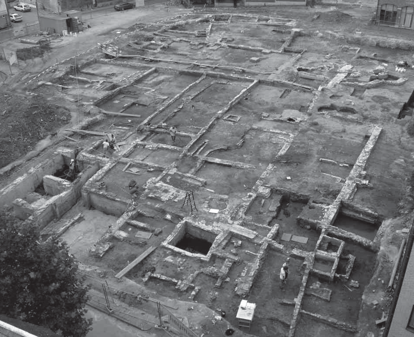
The 2007 Archaeological Report of the Barbarahof site: Roman presence
On 23 April 2007, the biggest ever archaeological dig in the centre of Leuven took place on the Barbarahof site, by 5 archaeologists and 10 employees of the company Examino. The dig took five months.
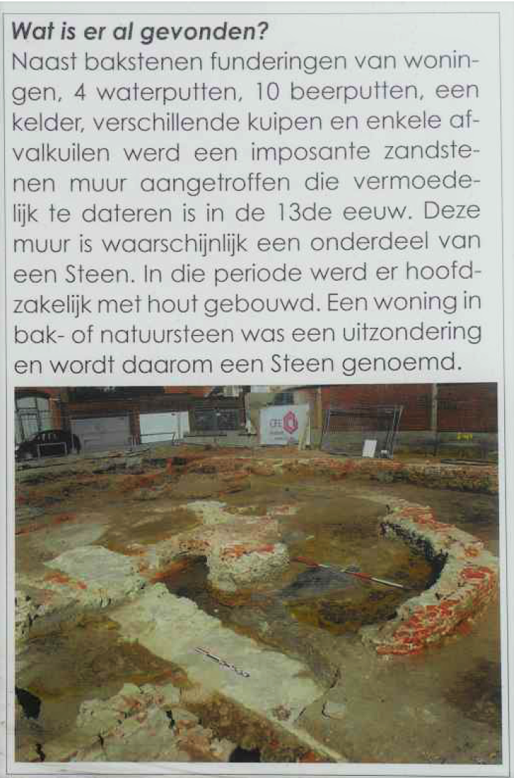
The most interesting find was various fragments of Roman pottery and two 2nd-century Roman coins.
It was an indication that there could be Roman presence in Leuven during that time.
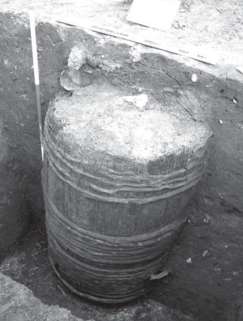
Human habitation dated ‘ONLY‘ from the 12th century onwards, with presence of loam, used to make floors and walls. Found from the 13th century, there were wooden barrels used as cess pits (see photo). The amount of leather in the wastes shows the presence of a shoe workshop.
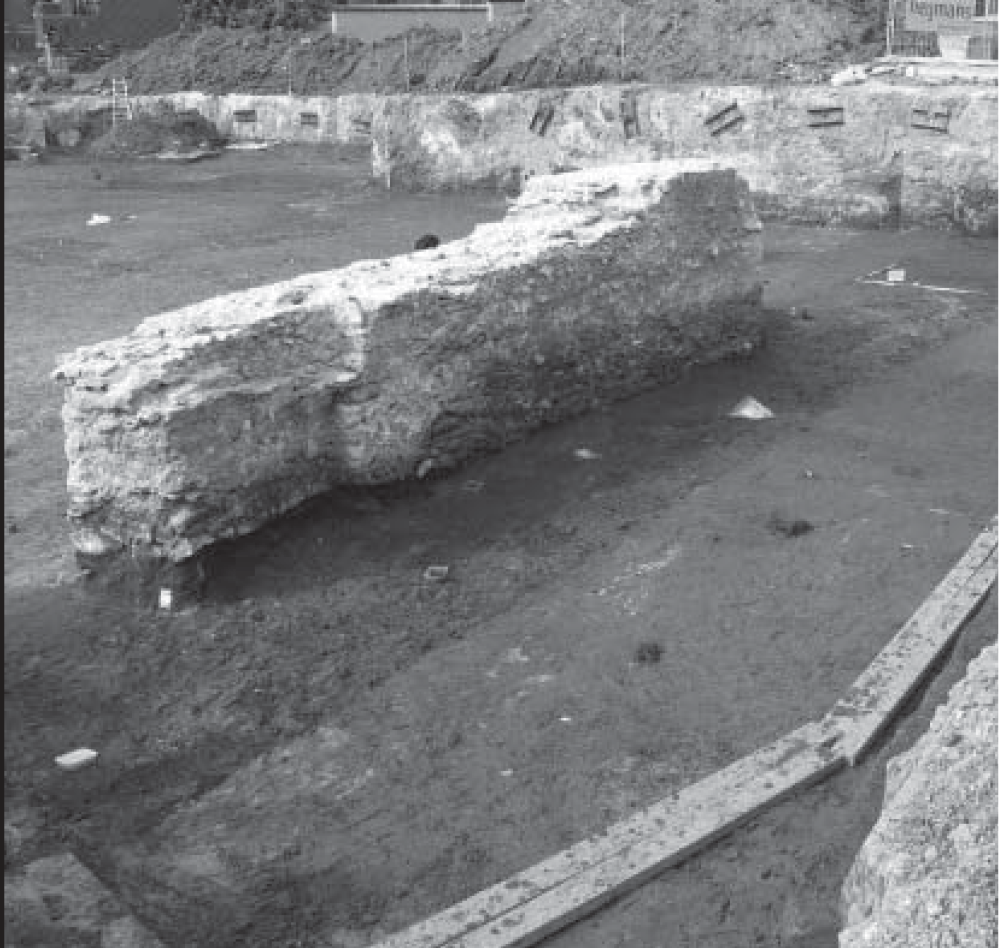
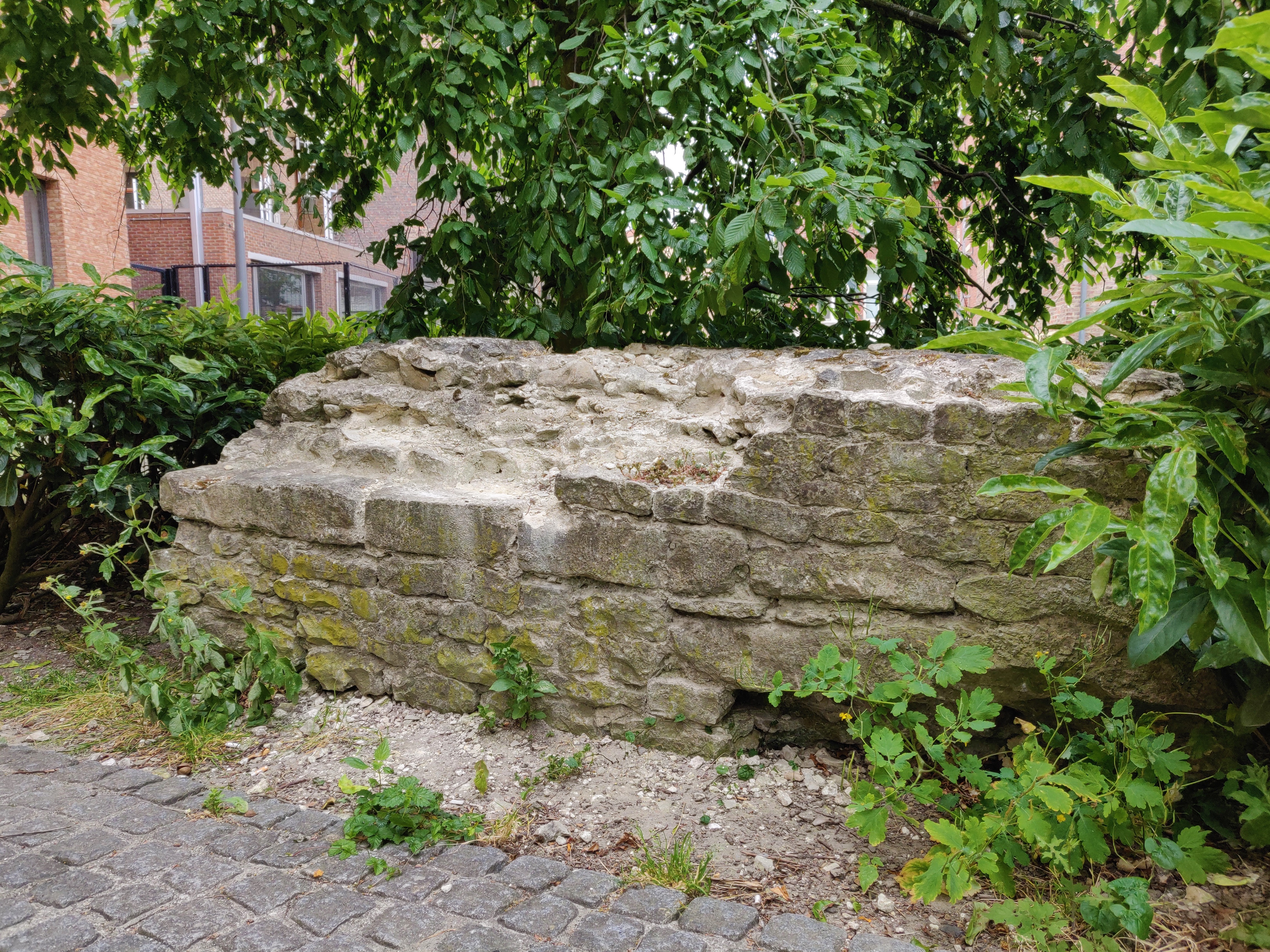
The other big find are the huge sandstone walls close to the River Dijle.
According to the report of the dig, these were most likely built in the 12th-13th century was supporting canal walls of the river.
You can still see one of the walls today on the site (see photos below).
Counter-arguments by the Leuven Historisch Genootschap: Viking Camp and Castle
The Leuven Historisch Genootschap – Leuven Historical Society – published a serious of counter arguments against the delexical report of the official archaeological dig.
First of all, the LHG accuses the workmen of Resiterra mishandling precious archaeological remains of the site. Sculptures and stones found from the remains of the Sint-Barbarakapel were discarded. The remains of the bodies found in the Geuzenkerkhof graveyard could have provided insight into the victims of the Black Death.
Most vitally, the society is of the opinion that the site was hastily covered up and built over due to a political and commercial cover-up.
Photos by the LHG show large vertical wooden beams taken out of the ground and carelessly piled up by the Resiterra workers, and then discarded without any verification.
Looking at the simulations of the Battle of Leuven (Slag bij Leuven) in 891 possible in today’s Groot Begijnhof where Vikings attacked Leuven, the site could very well have been that of a Viking camp, and the beams were the defense walls of the camp.
Another photo of the LHG reveals a circular sandstone structure. This was not mentioned in the report and the society is of the opinion that seeing that the most civilian buildings were made of wood and loam, as explained in the report, the site was more than a civilian neighbourhood.
Such a round foundation points to a fortified castle, which in turn explains the presence of the large sandstone walls.
However, none of this was explained or revealed by the city administration, the provincial government or the company.
Quoting Professor Mertens, Belgian archaeologist, there was even a part of the site that did not undergo any research before constructions took place.
The same professor also said “Indien er ergens naar de oorsprong van Leuven moet gezocht worden, het de Barbarasite is ter hoogte van de Dijleoever” (If we were to look somewhere for the origins of Leuven, the Barbara site would be it, as it is at the level of the Dijle’s bank).
With the discovery of Roman coins and the imposing sandstone structures, the Barbarahof may have well been the spot from which Leuven has sprung.
Current situation
There is nothing left from the site of Sint-Barbarakapel, except for a small section of a sandstone wall which was placed along the river bank which you can still check out.
Sources:
https://nl.wikipedia.org/wiki/Joris_Helleputteplein
Leuvens Historish Genootschaap Nieuwsbrief – juni 2009
Leuvens Historish Genootschaap Nieuwsbrief – september 2007
Archeologie 2007, Recent archeologisch onderzoek in Vlaams Brabant, Provincie Vlaams Brabant
Louvain monumental ou Description historique et artistique de tous les édifices civils et religieux de la dite ville, by Edward van Even, 1860 (image)


