ABOUT
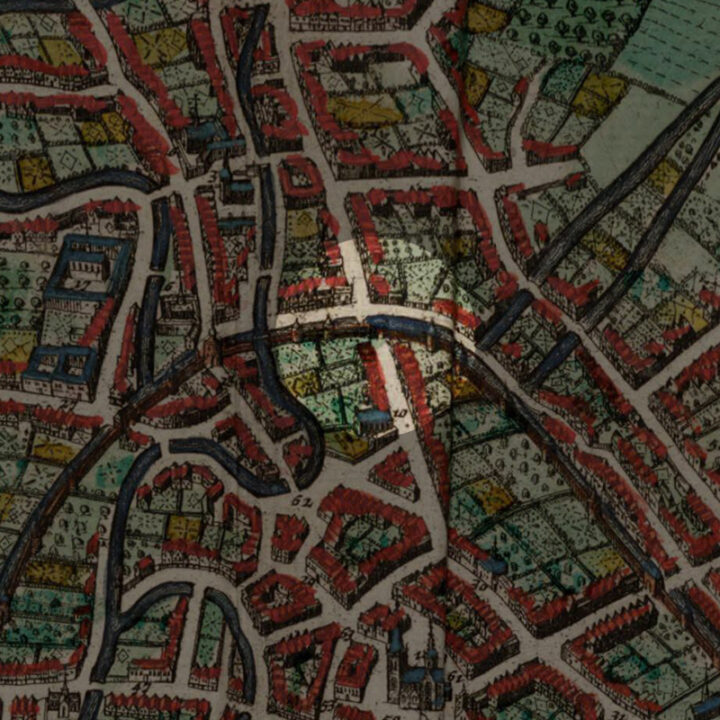
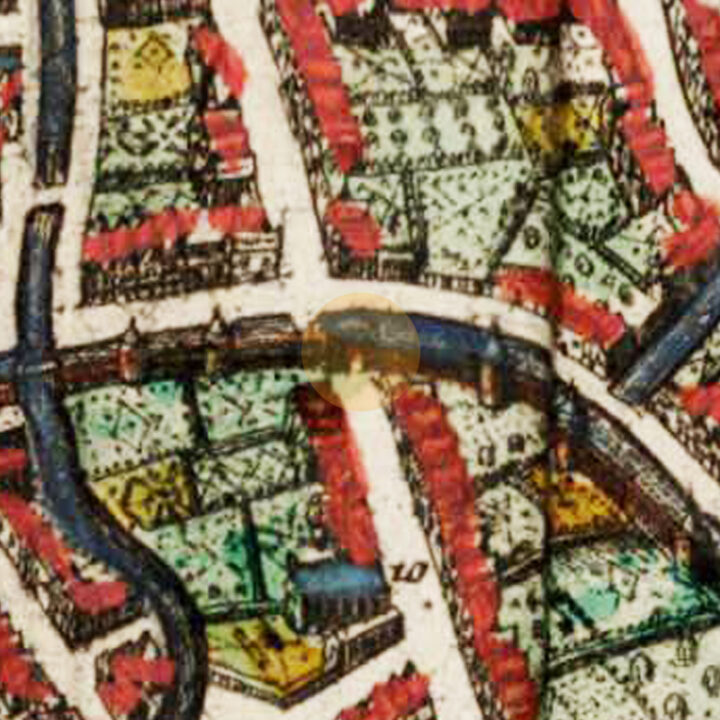
The Steenpoort was one of the city gates of the first and inner city defence wall of Leuven. The gate was located on today’s Vaartstraat, where the Karel van Lotharingenstraat and the Vital Decosterstraat meet.
Origin
The First and Inner Defence Wall of Leuven: After 1190
In the Early Middle Ages, Leuven was defended by a primitive fence that stretched from the Aardappelmarkt (modern-day Vital Decosterstraat) to the Redingenstraat, while an arm of the River Dijle formed a natural border.
By the 13th century, when the city grew to be the permanent residence of the Count of Leuven and Brussels, the need for a stronger defense bulwark became urgent. Historians have traditionally dated the construction of Leuven’s first defense walls to be between 1156 and 1165, during the reign of Count Godfried III, due to the yearly tax he imposed on citizens for defense. However, the military features of Leuven’s wall such as anchor towers, arrowslits etc cannot date before the 1200s, making this estimate too early. It is now generally accepted that Leuven’s first city wall was built by Henry I (Henrik), the first Duke of Brabant (1190-1235). He also abolished his father’s defense tax in 1233.
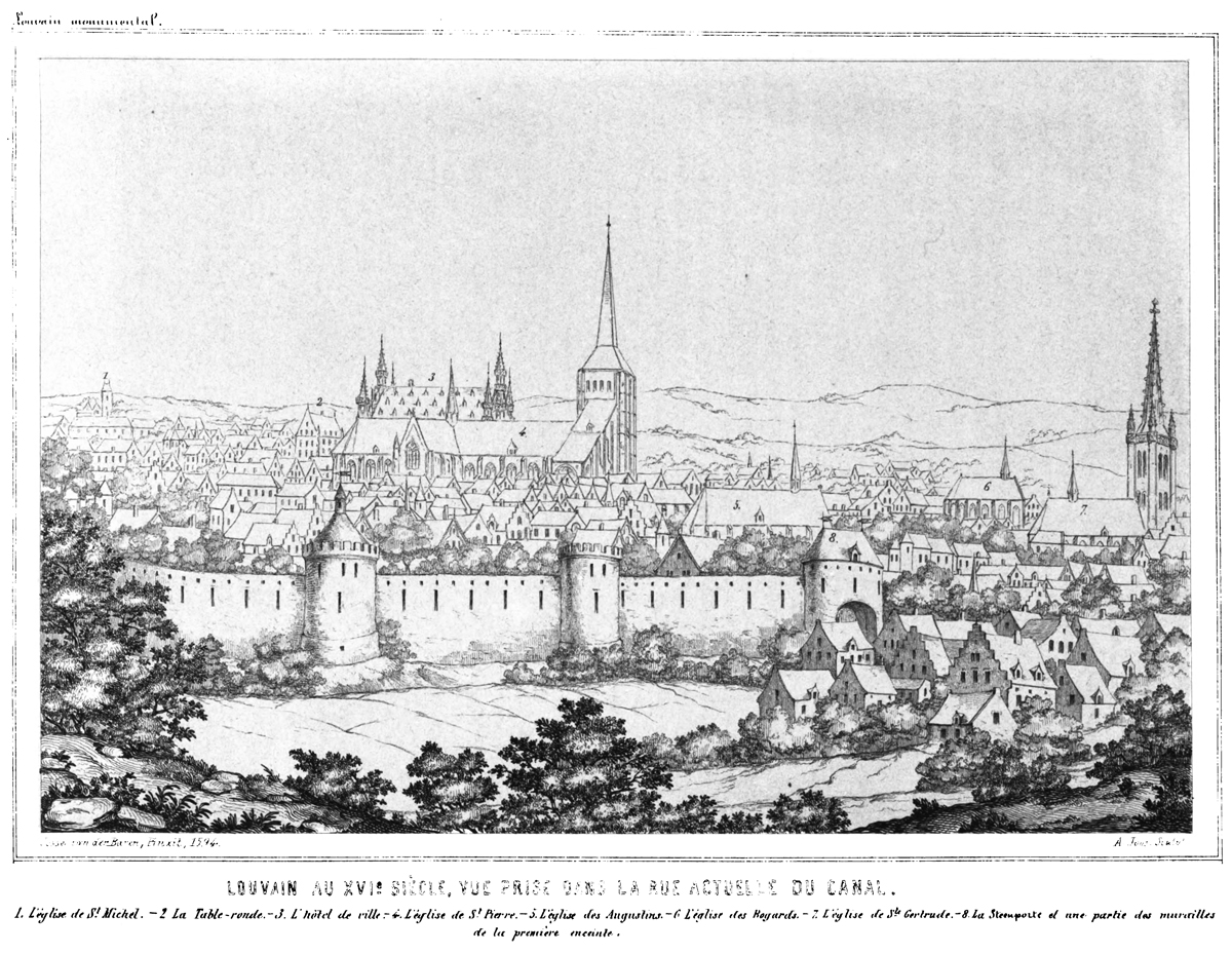
Constructed with layers of sandstone from nearby Diegem and Zaventem and ironstone, the first defense wall was roughly 2,740 metres long with 31 watch towers, 11 city gates and 2 water gates.
The wall measures 1.70m thick and rests on a series of underground arches. On the field side, the wall rises to about 5m tall. On the inside, a continuous series of arches supported a three-foot-wide walkway. The wall had arrowslits that were reduced on the outside to a narrow opening of 90cm high and 5cm wide.
However, as the city grew rapidly in size, a second (outer) more impressive defence wall was built in 1357, rendering the inner wall somewhat redundant. But the inner wall and gates were not immediately torn down. Most of it only disappeared in the 18th and 19th centuries. Even so, we see more of Leuven’s inner city wall today than the more recent outer city wall. Very well-preserved remnants of the 12th-13th century wall can still be seen in the City Park, as well as in the Refugehof, the Handbooghof, in the Redingenstraat behind the Irish College, and on the Hertogensite. The outer city wall and gates were torn down completely in the 19th and 20th centuries to become today’s ring road around the city.
Below is the list of the gates of Leuven’s first city wall starting from the north going eastwards:
- Steenpoort
- Heilige-Geestpoort
- Sint-Michielspoort
- Proefstraatpoort
- Wolvenpoort
- Redingenpoort
- Broekstraatpoort/Liemingepoort
- Justus Lipsiustoren-Janseniustoren*
- Minderbroederspoort
- Biestpoort
- Minnepoort
- Borchtpoort
- Sint-Geertruisluis*
*water gates.
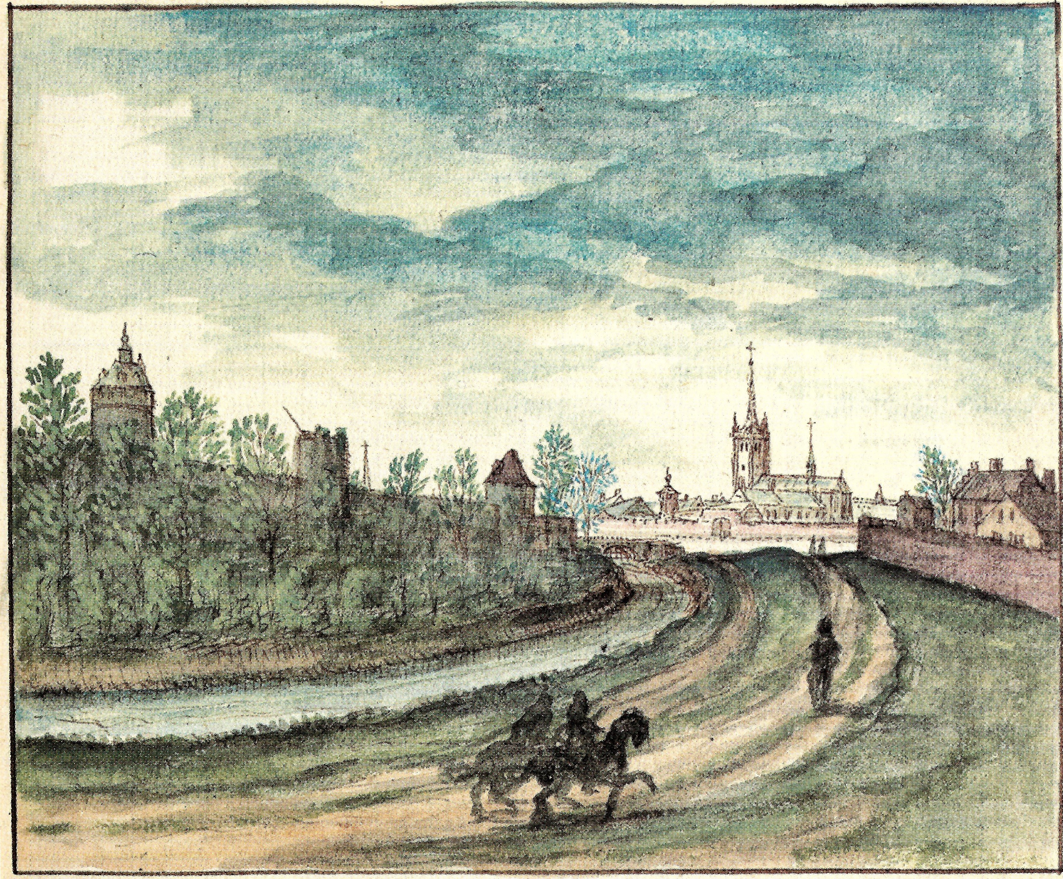
How did the Steenpoort look like?
The Steenpoort was the northernmost gate of the first and inner defence Wall of Leuven. To its west, was the Sint-Geertruisluis (Saint Gertrude’s sluice Gate) and to its east, the Heilige-Geestpoort (Holy Spirit Gate). The roads today – Karel van Lotharingenstraat and the Vital Decosterstraat – were actually its water-filled moat, connected to the River Dijle via the sluice and the harbour at the Vismarkt (Fish Market).
According to Leuven’s 19th century city archivist Edward van Even, Steenpoort – which means “Castle gate” – was not named after a patrician family ‘van de Steen’. The word “Steen” was used in the medieval sense of a “prison”, not “castle”. Hence the translation should have been “Prison Gate”.
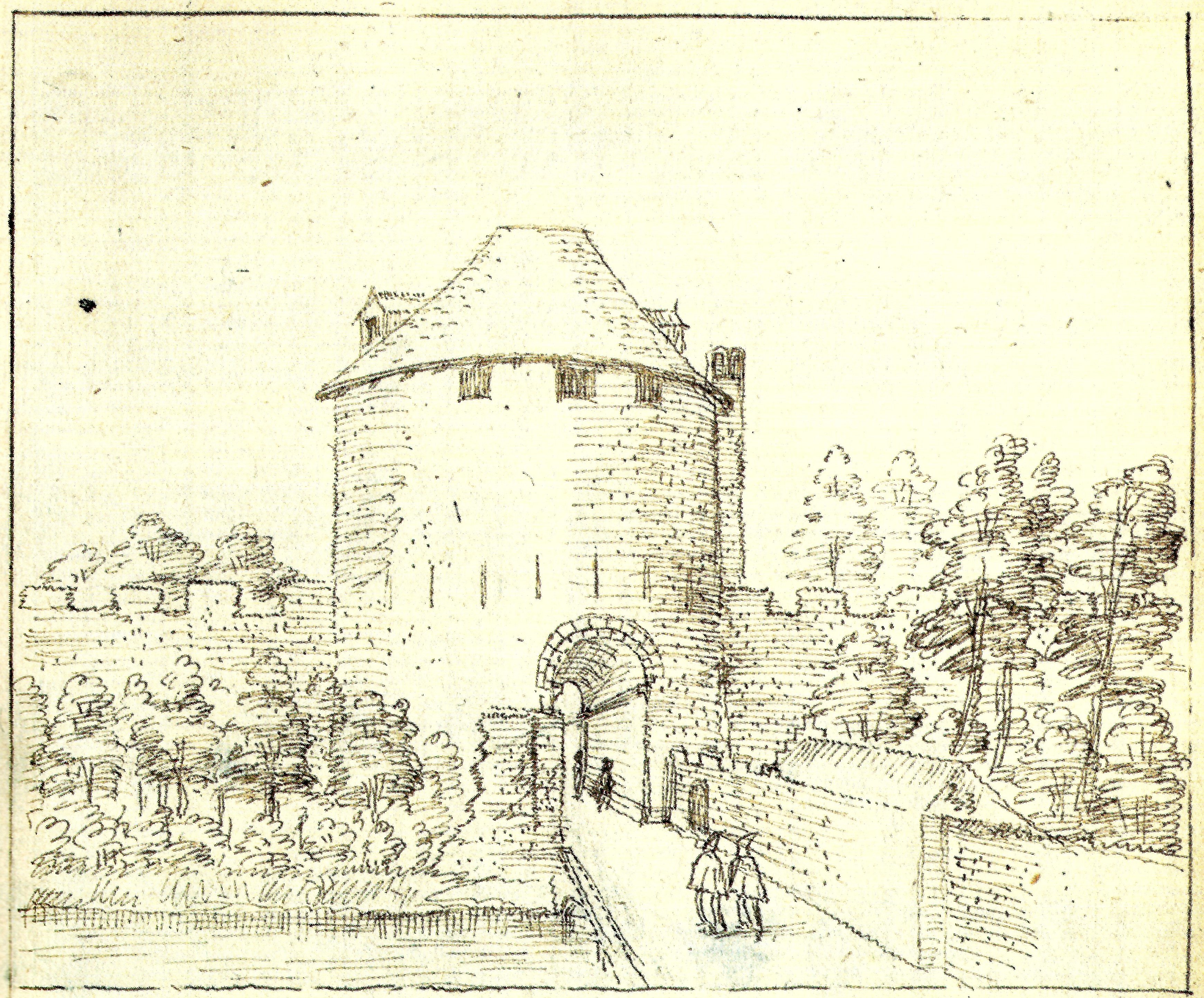
The appearance of the gate also pointed to this usage. Very similar to the university prison at the Borchtpoort, the Steenpoort had two massive semi-circular towers that rose above the gate and connected by a gallery above the passageway.
The Steenpoort was also called the “Coestrate-Porte”, refering to the older name of Vaartstraat, which means “Cow Street”.
Another name of the gate was the “Utlake-Binne-Porte“. Van Even said that this referred to the “outer lake”, which was the predecessor of the Vaartkom harbour today which was built in the 19th century when the canal was dug to lead all the way to Mechelen. This “utlake” was in fact a natural water basin where the rivers Dijle and Voer met and mingle before the larger Dijle flowed out of the outer city walls via the Spuigat (Spew Hole) by the Aarschotsepoort.
What's so special about this place?
The Prison: 1190?-1778
It is unclear when the Steenpoort started serving as a prison. But according to a record in 1371, prisoners held there were being kept warm with peat in the winter:
“Item van torven ghebernt op den kerchof ter armer lieden behoef, den vondelingen en den gevanghenen, op DEN STEEN, ome gode, van 37 sacken metten draeghehure, 21 in meerte, 61 lib.”
Certainly in the 17th century, the gate served as a criminal prison and a detention centre for strangers. It even had a torture chamber!
The state of the inner city gates and walls was dire by the 18th century. On 20 January 1778, the Steenpoort was sold to a Pieter Meulemans for 950 florins on the condition that it be torn down by the 1st of May. And he did.


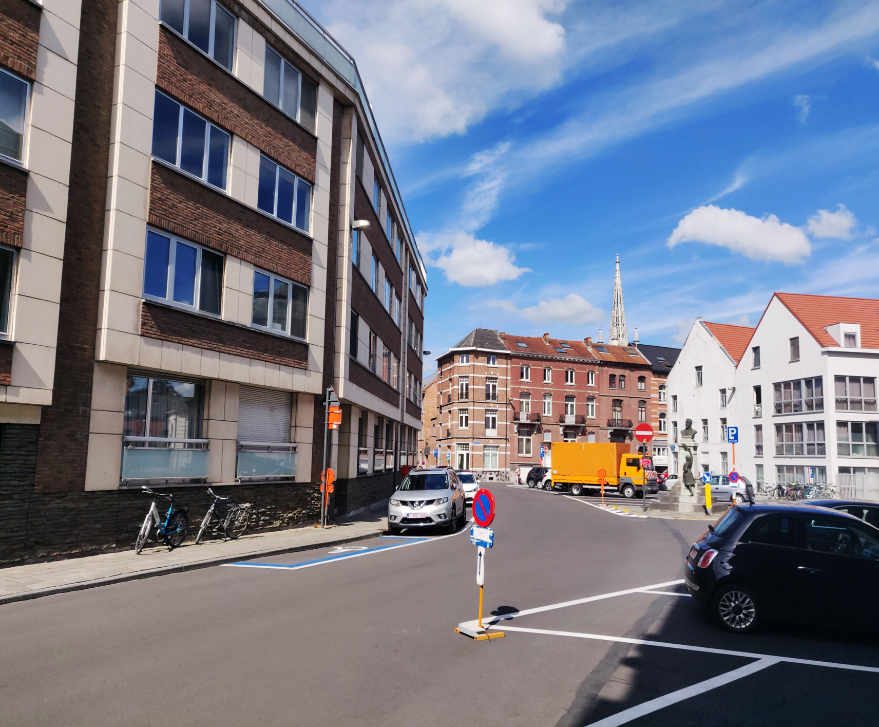
Current situation
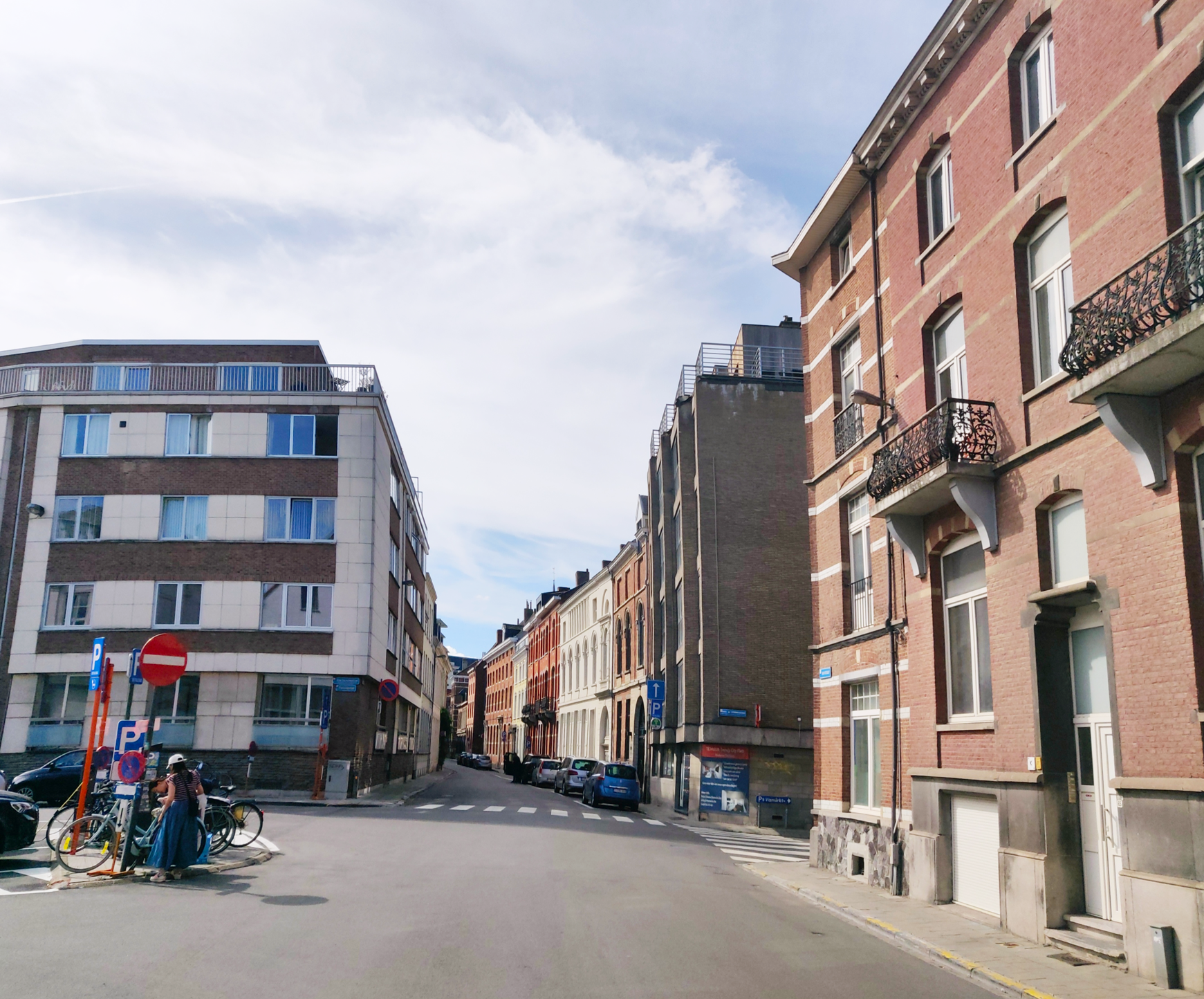
The gigantic prison that was the Steenpoort is no more. Also was the impressive city wall that ran from the former Steenpoort along the Vital Decosterstraat. You can still imagine this from looking at the drawings that survived. The curve of the street, on which you can find a carpark today, follows the moat.
Sources:
“Louvain dans le passé et dans le présent“, Edward van Even, 1895
“De Leuvense Prentenatlas: Zeventiende-eeuwse tekeningen uit de Koninklijke Bibliotheek te Brussel“, Evert Cockx, Gilbert Huybens, 2003
https://nl.wikipedia.org/wiki/Ringmuren_van_Leuven
https://www.erfgoedcelleuven.be/nl/stadsomwalling
https://inventaris.onroerenderfgoed.be/erfgoedobjecten/125406


