ABOUT
The “Obbrusselpoort”, now known as the “Hallepoort” or “Porte de Hal”, is one of the most remarkable remnants of Brussels’ medieval city defences. Located in the southern part of the city, this iconic gate has stood the test of time, transitioning from a crucial military structure to a celebrated historical monument. The Halle Gate is the last vestige of the outer city walls that once encircled Brussels.
Origin
The War of the Brabantian Succession (15 June 1356 – 4 June 1357)
When he died in 1355, Jan III Duke of Brabant and of Limburg left behind three daughters and no son. This created a succession problem for the Duchy. His second son-in-law, Louis II, Count of Flanders, alias Louis of Male, attacked the Duchy in an attempt to seize power, aided by Jan’s third son-in-law Reginald III, Duke of Guelders.
In fact, Duke Jan III had intended for his oldest daughter Joanna to succeed him, according to “ius Brabantinum” law.
In order to exert her power, Joanna and her husband performed the “Joyous Entry of 1356” in Leuven on 3 January 1356. This is known in Dutch as the “Blijde Inkomst” and the street in which they entered Leuven is still known today as the “Blijde Inkomststraat“.
The Joyous Entry of 1356 is of vital significance.
It was not just a spectacle, witnessed by citizens, nobles and officials from all Brabantian cities. It was the Magna Carta of Brabant, where she granted a charter of liberties granted to the burghers in return for their loyalty to her as their Duchess.
Nevertheless, a few months later, Flanders attacked Brabant. The Flemish occupied Brussels (18 August 1356), Mechelen (20 August 1356), Leuven and Vilvoorde (22 August 1356), Antwerpen and Grimbergen (23 August 1356), Tienen and Nijvel (24 August 1356).
It was only when Joanna’s husband, Wenceslaus I, Duke of Luxembourg, approached his half-brother, Charles IV, Holy Roman Emperor for help that the war ended. The Flemish were driven out of Brabant and Joanna was finally recognised as the Duchess of Brabant by her neighbours.
400 years of Brussels’ Outer City Wall (1357-1783)
It was likely the result of this war that Brussels started building its second (outer) city walls.
Records show that the constructions started in 1357, a year after Leuven. By 1379, the names for the new city gates started appearing in documents with different variations.
First it was the city gates that were built, and the walls linking the gates were then erected. In total, there were seven city gates:
Leuvensepoort
(Nieuwe) Koudenbergpoort (later Naamsepoort)
Obbrusselpoort (later Hallepoort)
Anderlechtsepoort
Vlaamsepoort
Lakensepoort
Keulsepoort (later Schaarbeeksepoort)
But with the decision by Habsburg Emperor Jozef II to demolish all city defense throughout his realm, Brussels’ city wall was gradually torn down since 1783.
In the place of the city gates, twin pavilions were placed at fourteen entry points. The walls gave way to broad green boulevards designed by Jean-Baptiste Vifquain, from 1818 to 1840. But because of Brussels was already being Brussels, due to the taxation differences between Brussels inhabitants and those of the satellite towns, a patent wall had to be built 2.5m high with a 3m-wide ditch (basically a small city wall) to demarcate the city boundaries.
During this time, a ring road following the pentagonal shape of the old city was built over the moat. Today, the circle metro line follows the trajectory and so does the modern inner ring road.
What's so special about this place?
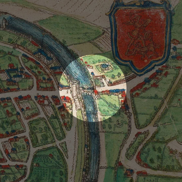
Incorrectly marked as “Oude Brußel poort” (Old Brussels Gate) on the map, the actual name of the city gate was “Obbrusselpoort“, referring to the hilly area just outside the gate known in the Middle Ages as “Obbrussel“. “Obbrussel” is short for “Op Brussel” in modern Dutch, which means “Upper Brussels“.
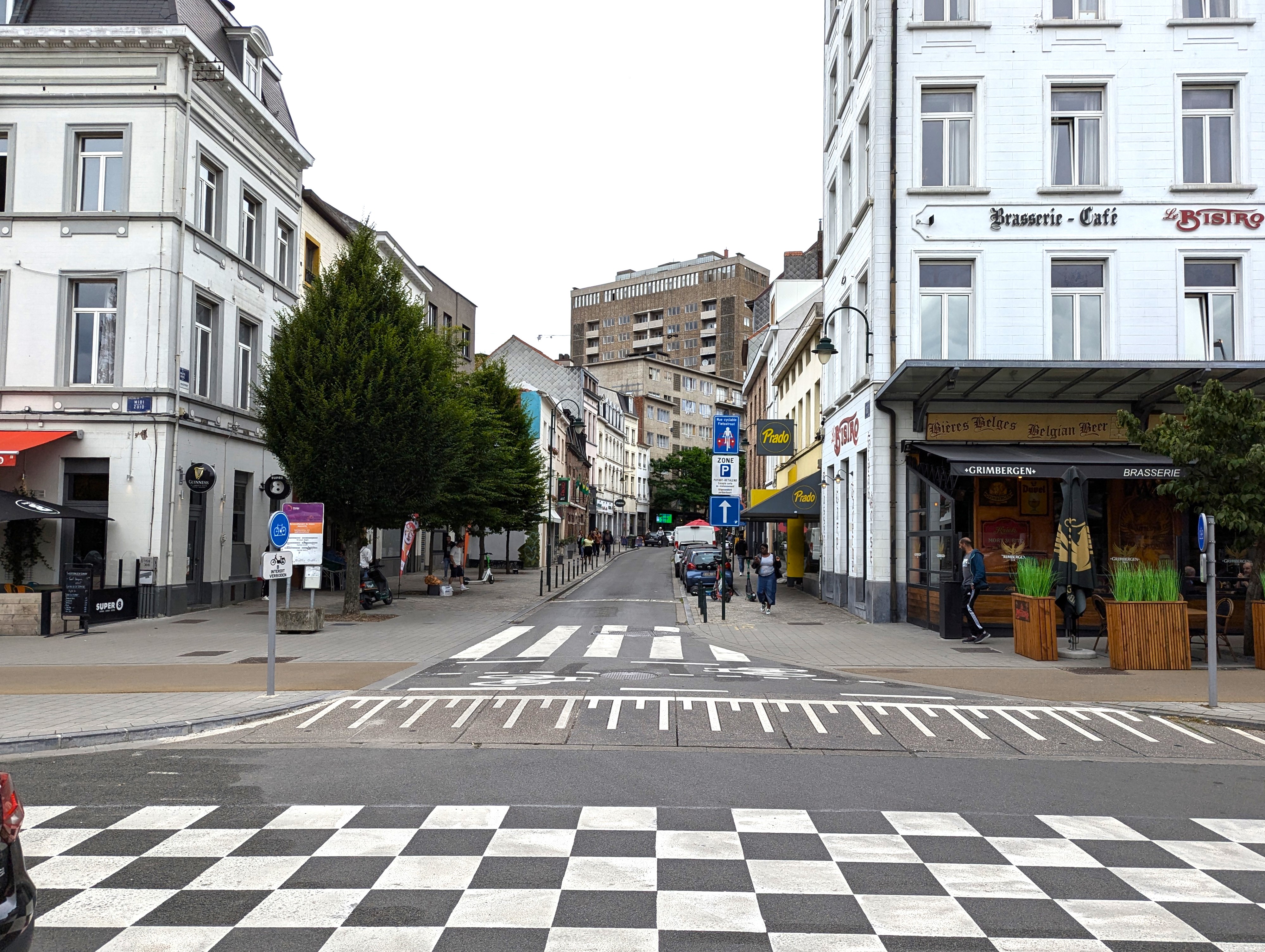
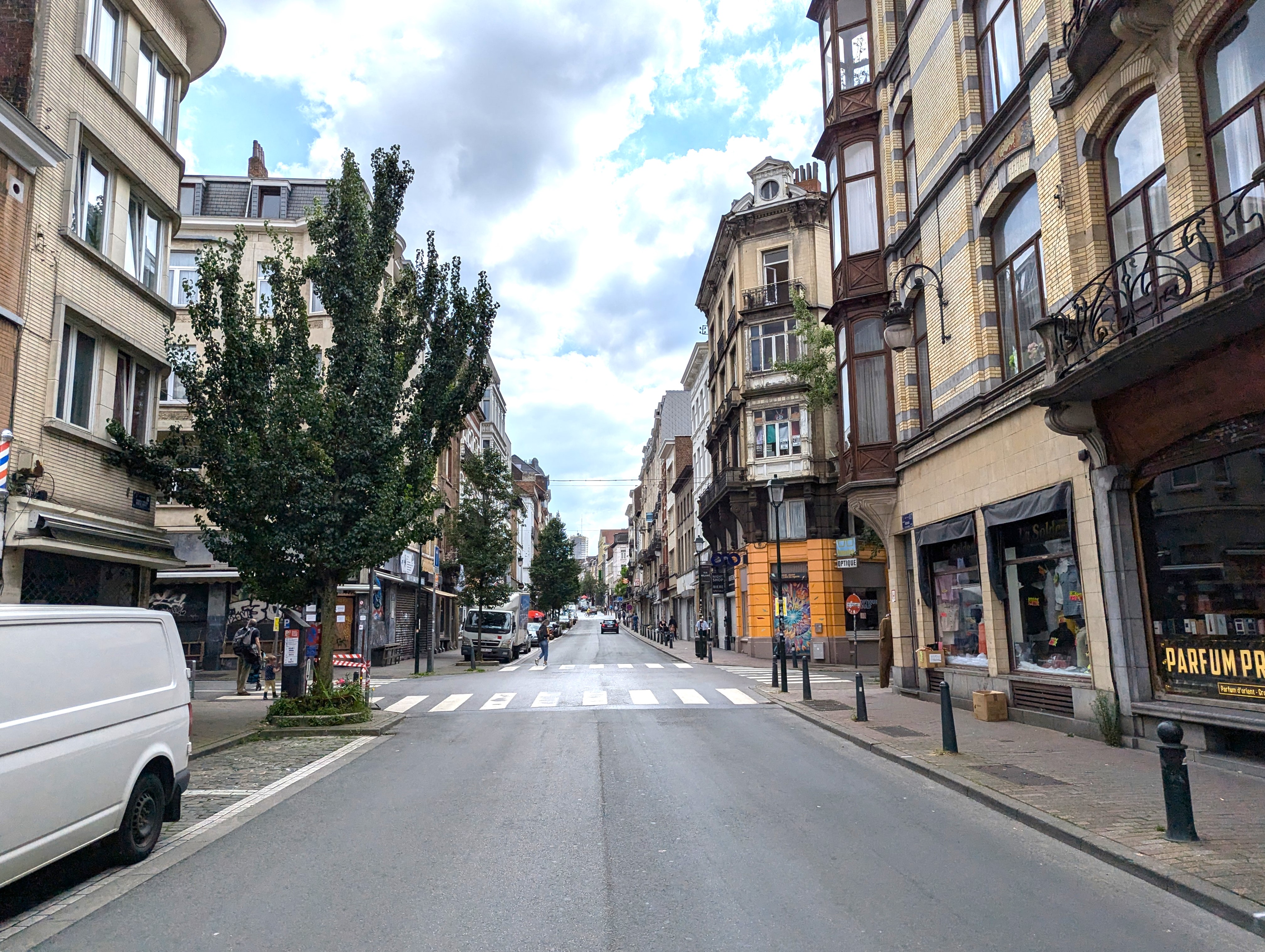
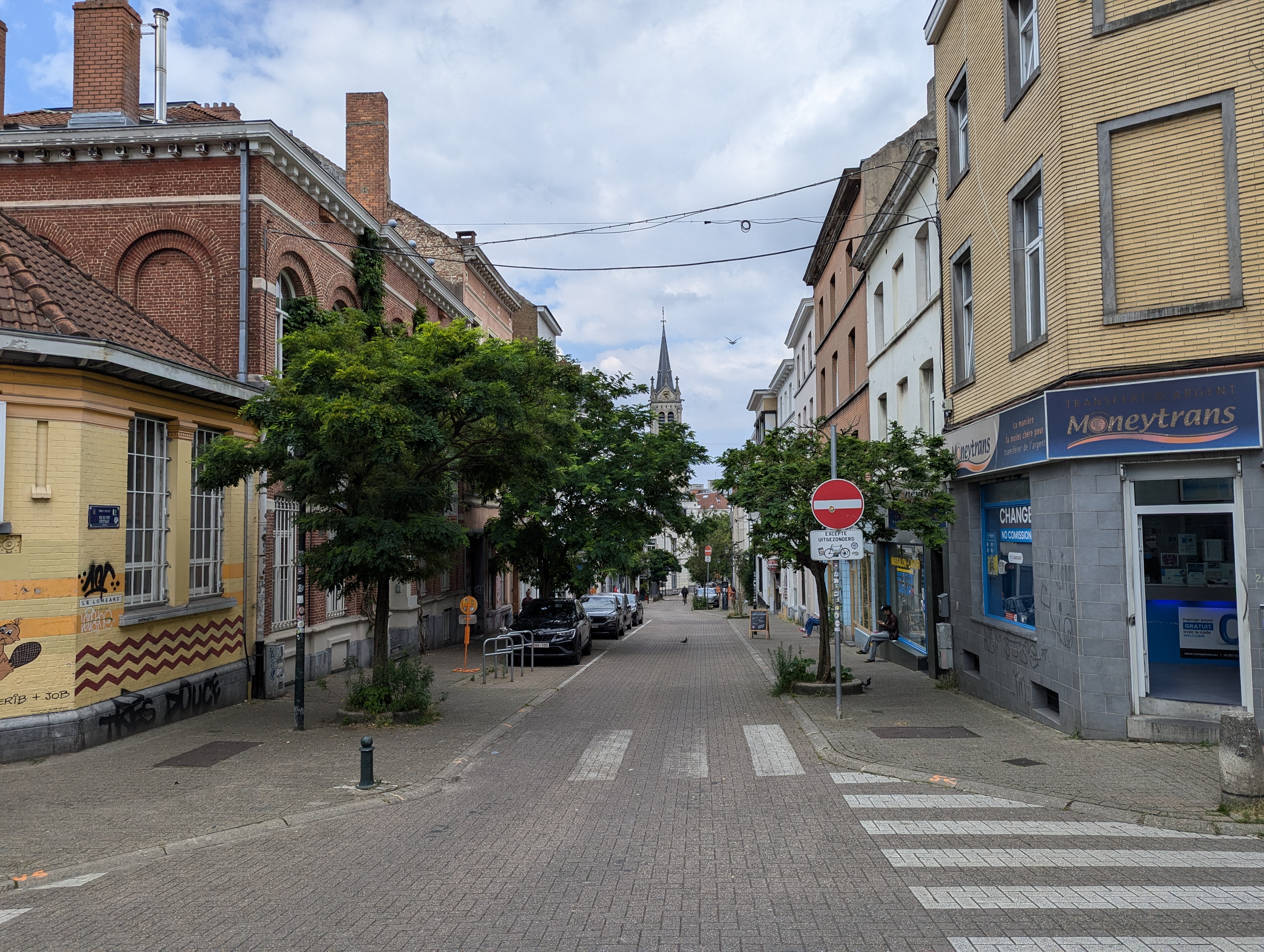
It is for the same reason why the street leading up to the Obbrusselpoort was and still is called the “Hoogstraat” (High Street).
The name “Hallepoort” (Halle Gate) only appeared as an alternative well into the 16th century, referring to the city of Halle to which the road leads as Brussels rose in economic importance.
The “Kuulkappers” of Obbrussel
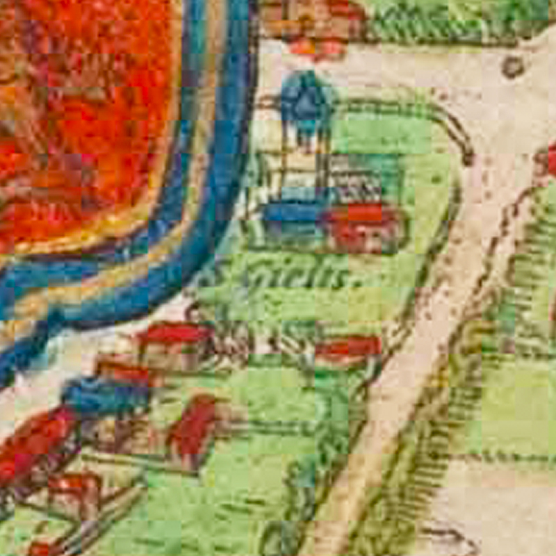
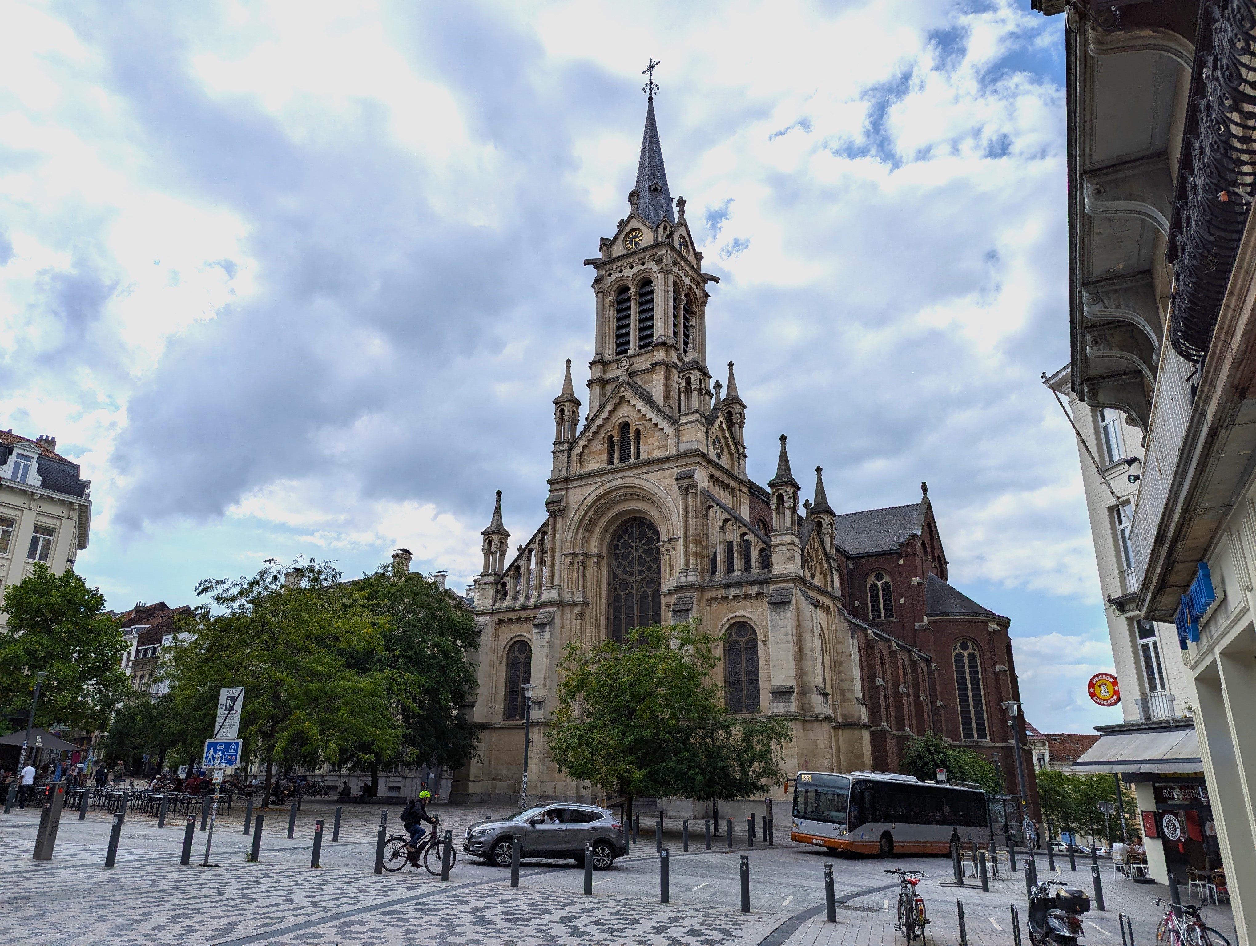
Obbrussel, known today as Sint-Gillis (“Saint-Gilles” in French), has a rich history that dates back to the early 13th century. Initially, it was a small village because of the hill on which it commanded a panoramic view over Brussels. This village became a parish in 1216, with a church dedicated to Saint Gilles the Hermit. Originally, it was a rural area located outside the first city walls of Brussels. By the Middle Ages, it had begun to urbanise, partly due to its proximity to the city. Already, the name “Obbrussel” reflects its early ties with Brussels, highlighting its role as an outer suburb before being incorporated into the expanding city.
The hamlet belonged in 1296 to the “Kuip (Kuype in old Dutch) van Brussel“. The “Kuip” of Brussels (a “kuip” is a large open tub) is the area that fell under the urban freedoms of Brussels from the 13th to the 18th century, made of the surrounding villages. Together, these formed an economic, political and legal unity with the city, where the customs (rights and responsibilities) of Brussels also applied in this area.
During the 14th century, the construction of the second city wall of Brussels brought significant changes to Obbrussel. With the new Obbrusselpoort, the area grew as a result of the increased security and its strategic location along trade routes. The name change from Obbrusselpoort to Hallepoort reflects this transformation. By the 17th century, Obbrussel had already developed into a more densely populated area, parallel with the broader urbanisation of Brussels as the capital of Habsburg Netherlands.
It was during this time when Obbrussel also became a vibrant agricultural community.
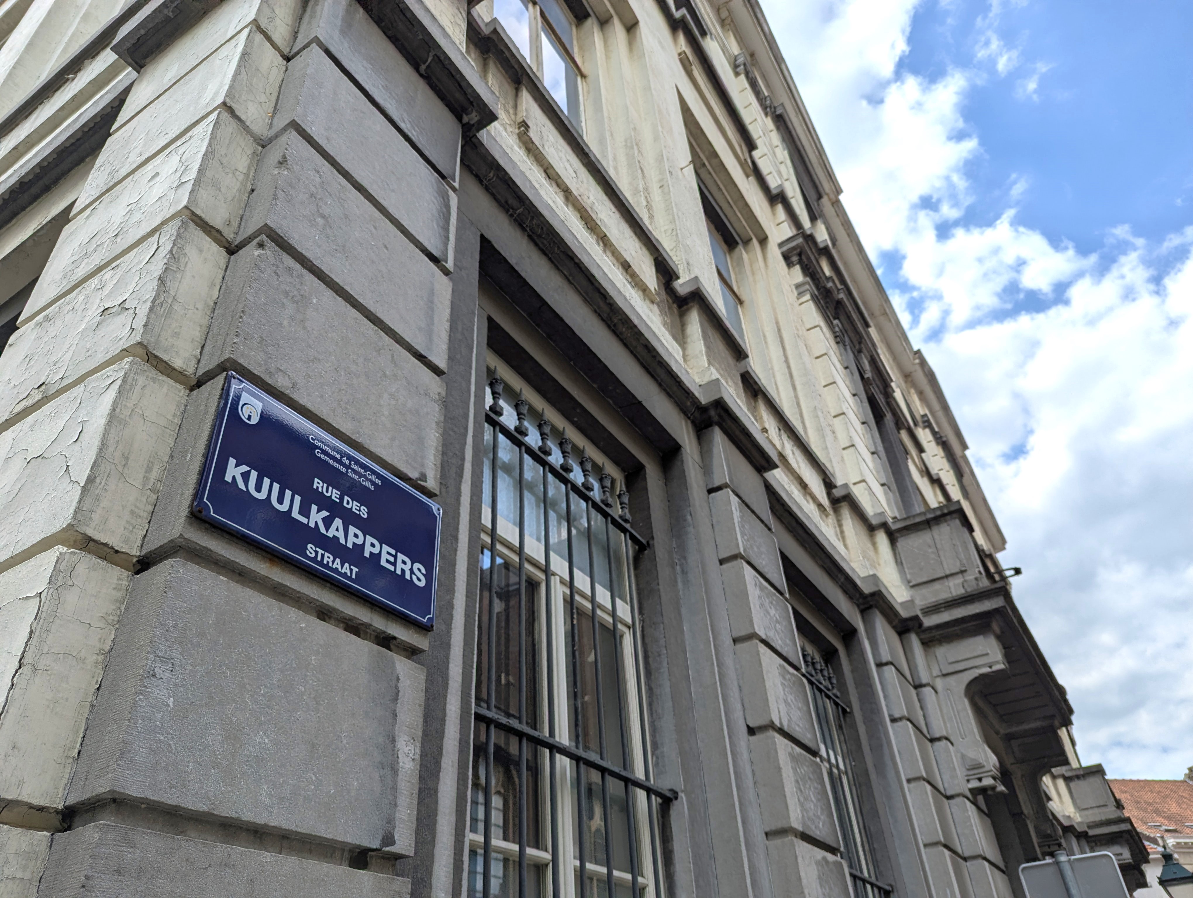
Farmers here cultivated a brand new crop, that later became known as ‘Brussels sprouts‘ from ‘spruitjes’ in Dutch. Because of this specialty, the Obbrussel inhabitants were nicknamed “Kuulkappers” meaning “cabbage cutters“!
Today, the street beside the church is still called the “Kuulkappersstraat” although no Brussels sprouts farm can be found, which is an immense pity.
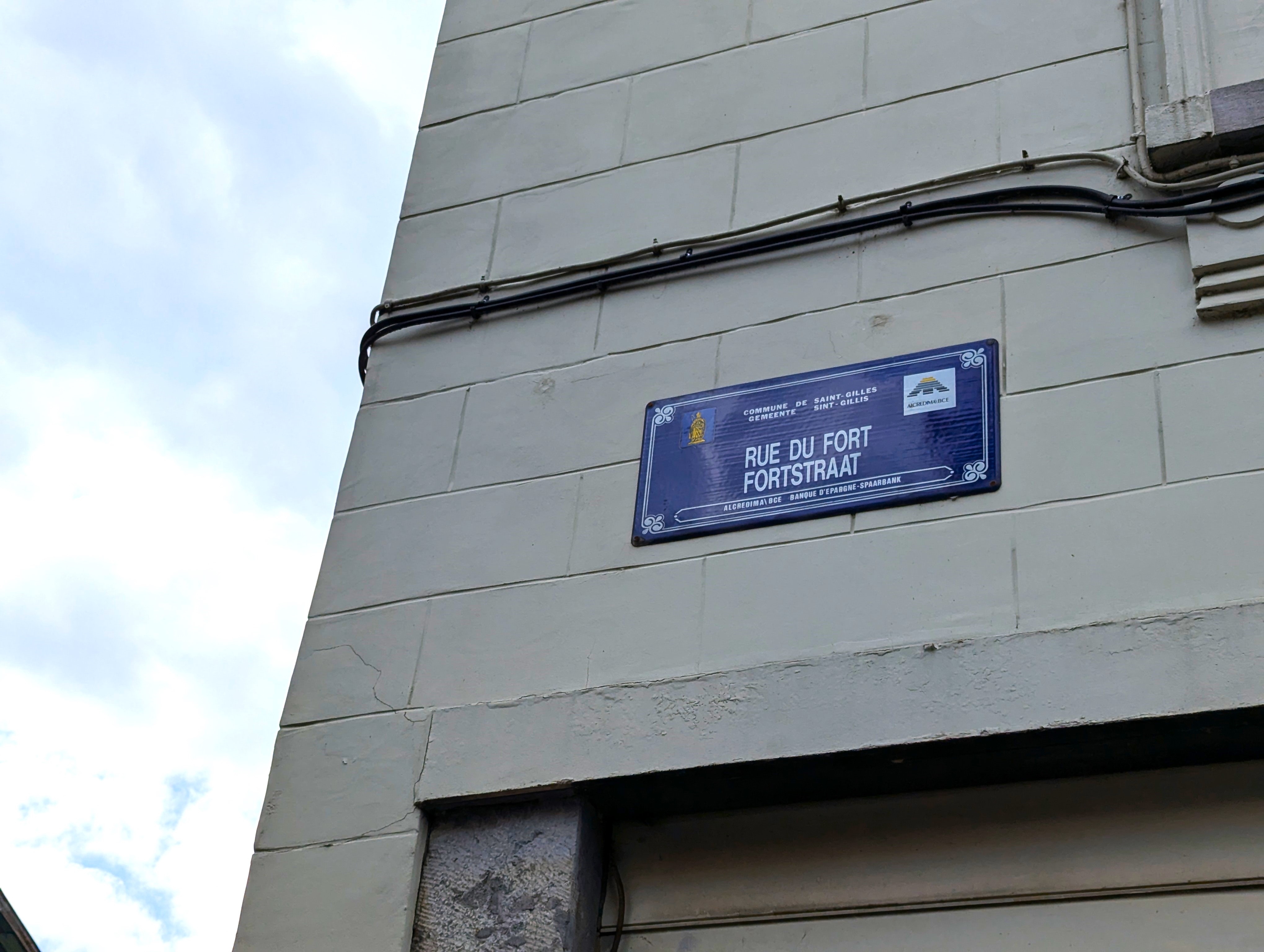
The Lost Fort of Monterey
One of the notable historical landmarks of Obbrussel was the “Fort van Monterey“, constructed in 1672 under the orders of the Spanish Habsburg Governor Juan Domingo Méndez de Haro y Fernández de Córdoba, Count of Monterey. This fortification was built to protect Brussels from potential invasions and served as a military stronghold. However, by the late 18th century, the fort had lost its strategic importance and was sold to private individuals in 1782 for dismantling.
The last remnants of the fort disappeared by 1860, but you can get a sense of its size with the current Vorstse Steenweg (Chaussée de Forest) that outlines one side of the former “Fort van Monterey“.
Walk uphill from the Fortstraat (Rue du Fort) from the Sint-Gillis church until you reach the intersection with the Vorstse Steenweg. From here, you can appreciate how high this area of Obbrussel is and why a fort was built here.
From Obbrussel to Sint-Gillis/Saint-Gilles
Under the French occupation, the village received in 1795 its current name “Sint-Gillis” (“Saint Gilles” in French) referring to the patron saint of its parish church.
In the 19th century, the industrial revolution transformed the town of Sint-Gillis, with the establishment of the Brussels South Station (Gare du Midi), factories, and significant urban development. This period saw the rise of Art Nouveau architecture, with many buildings from this era still standing today. The local government focused on modernising the municipality, promoting education, and providing public utilities like gas and electricity. The construction of Sint-Gillis’ iconic Town Hall (built in 1896) is a testament to this era’s architectural and economic advancement.
How did it look like?
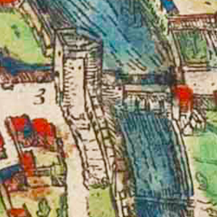
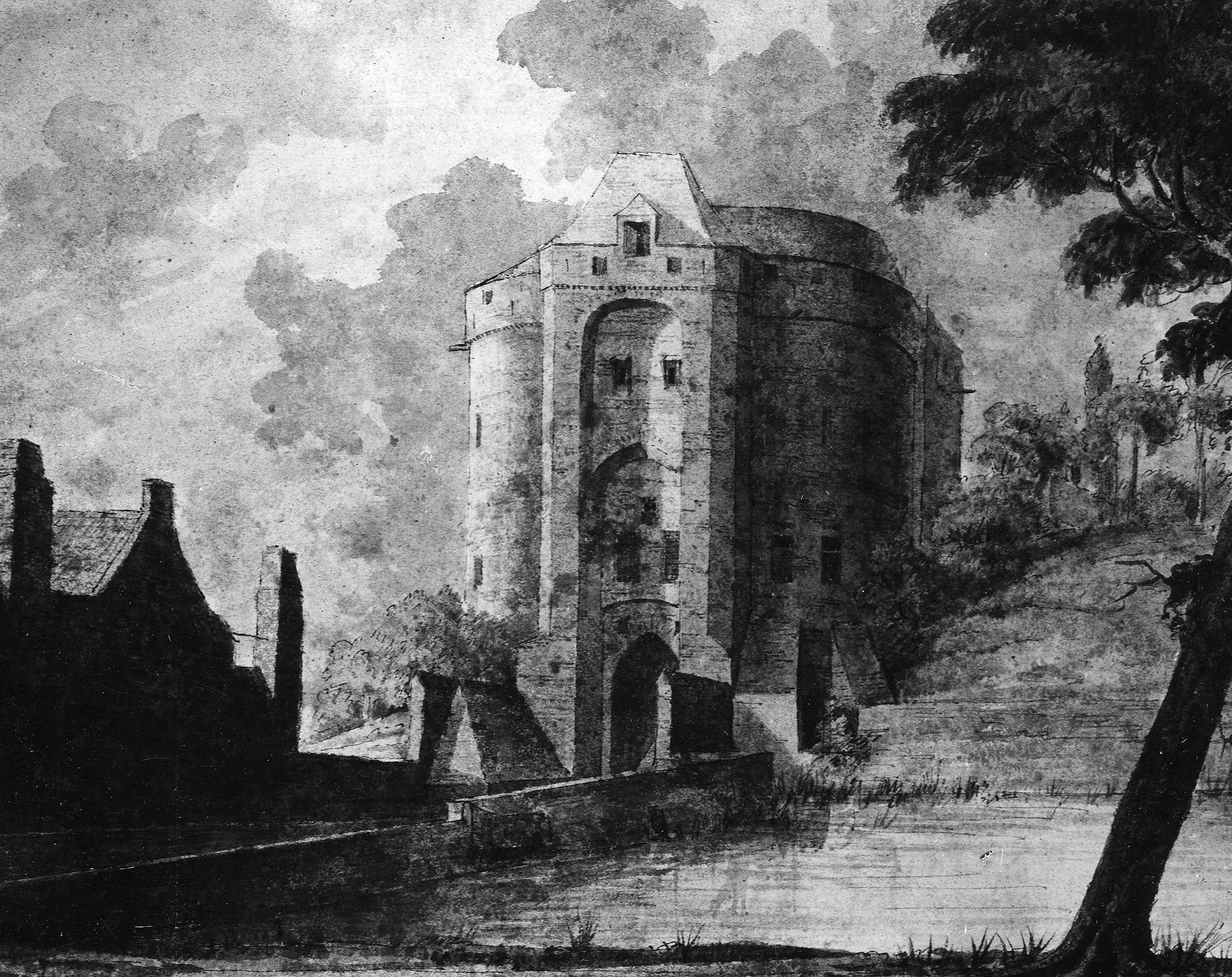
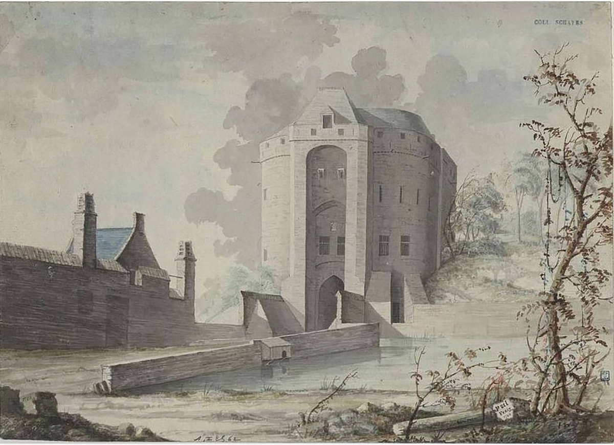
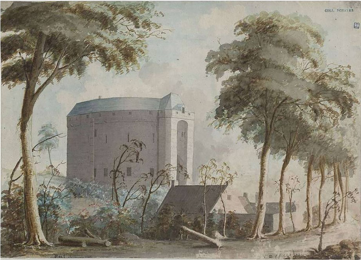
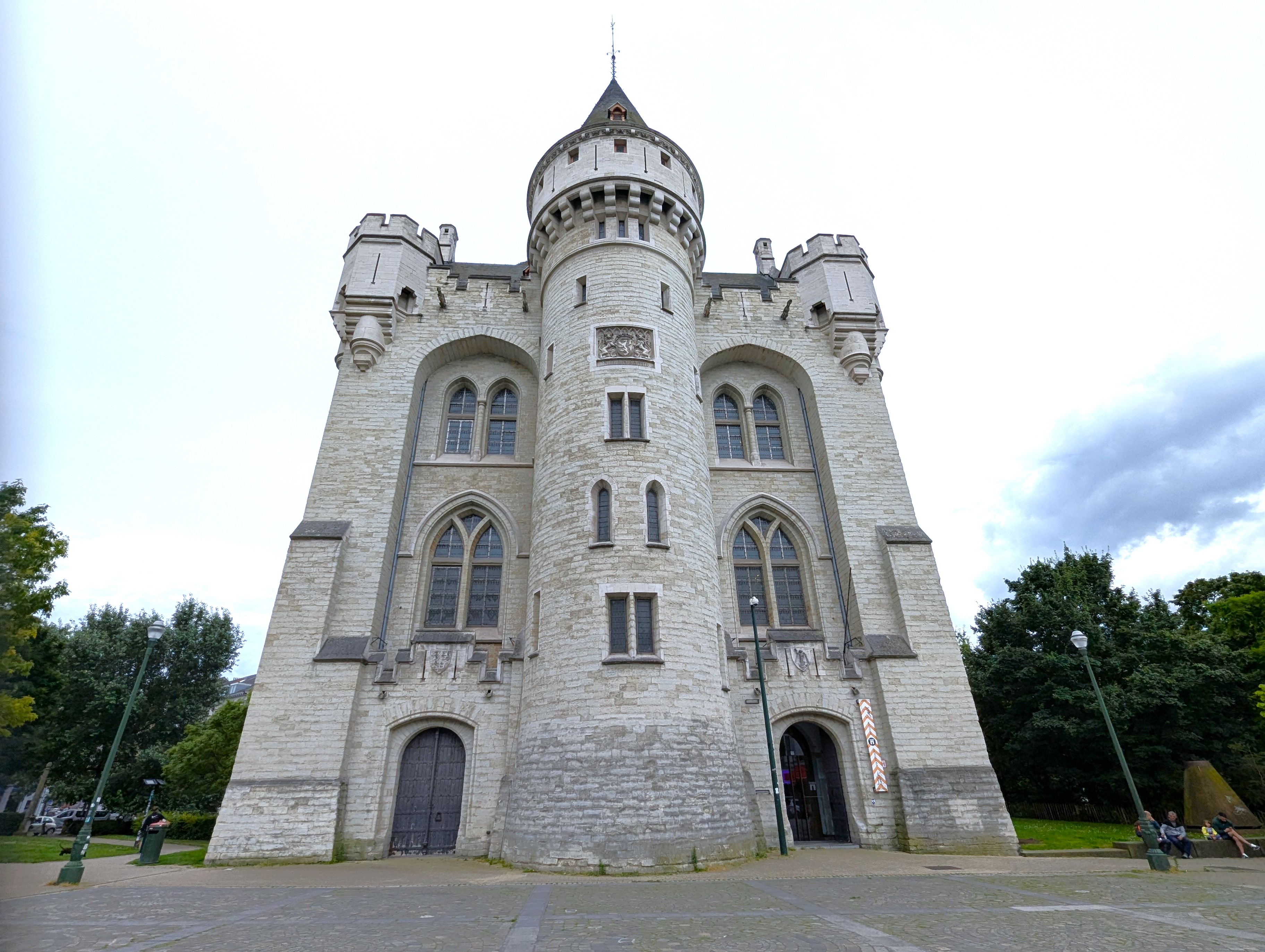
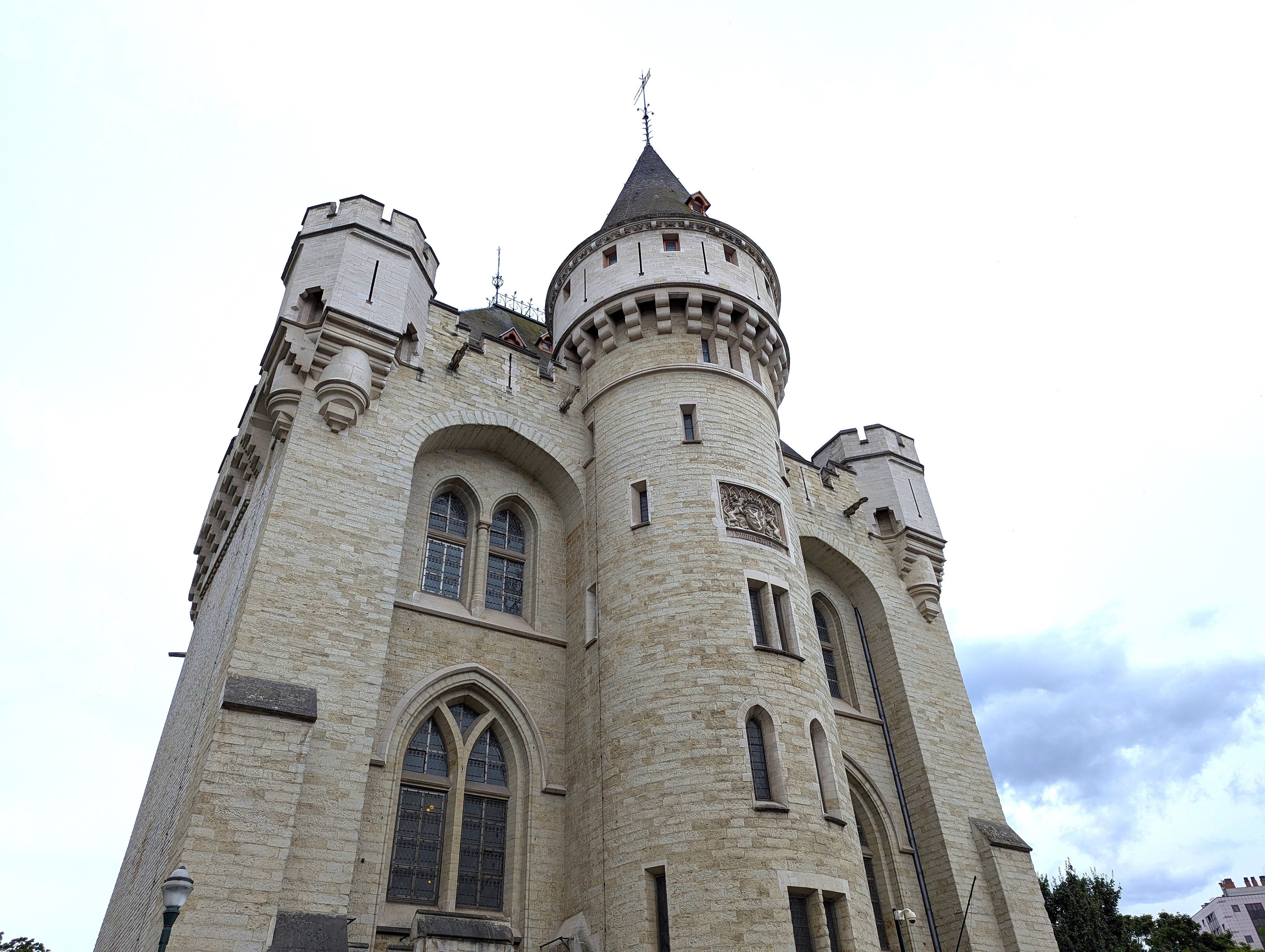
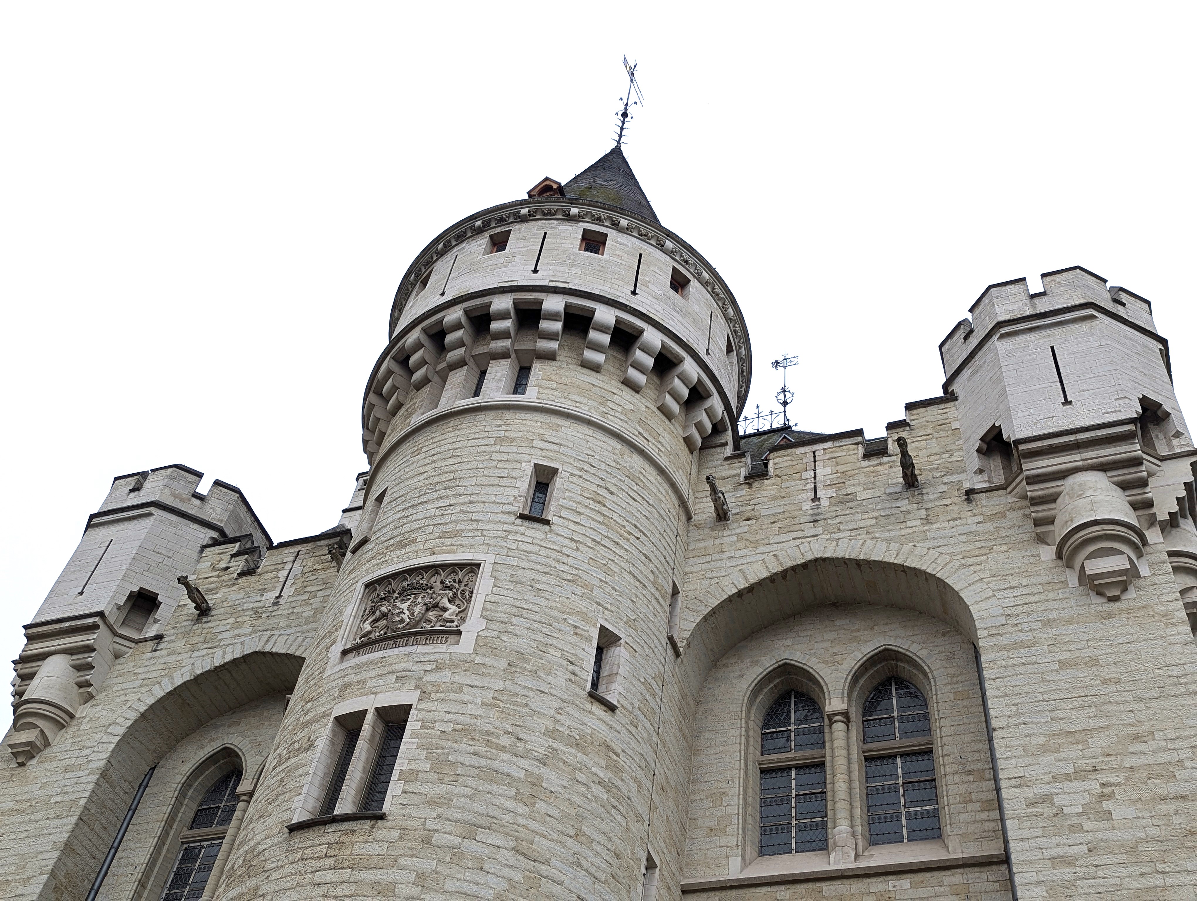
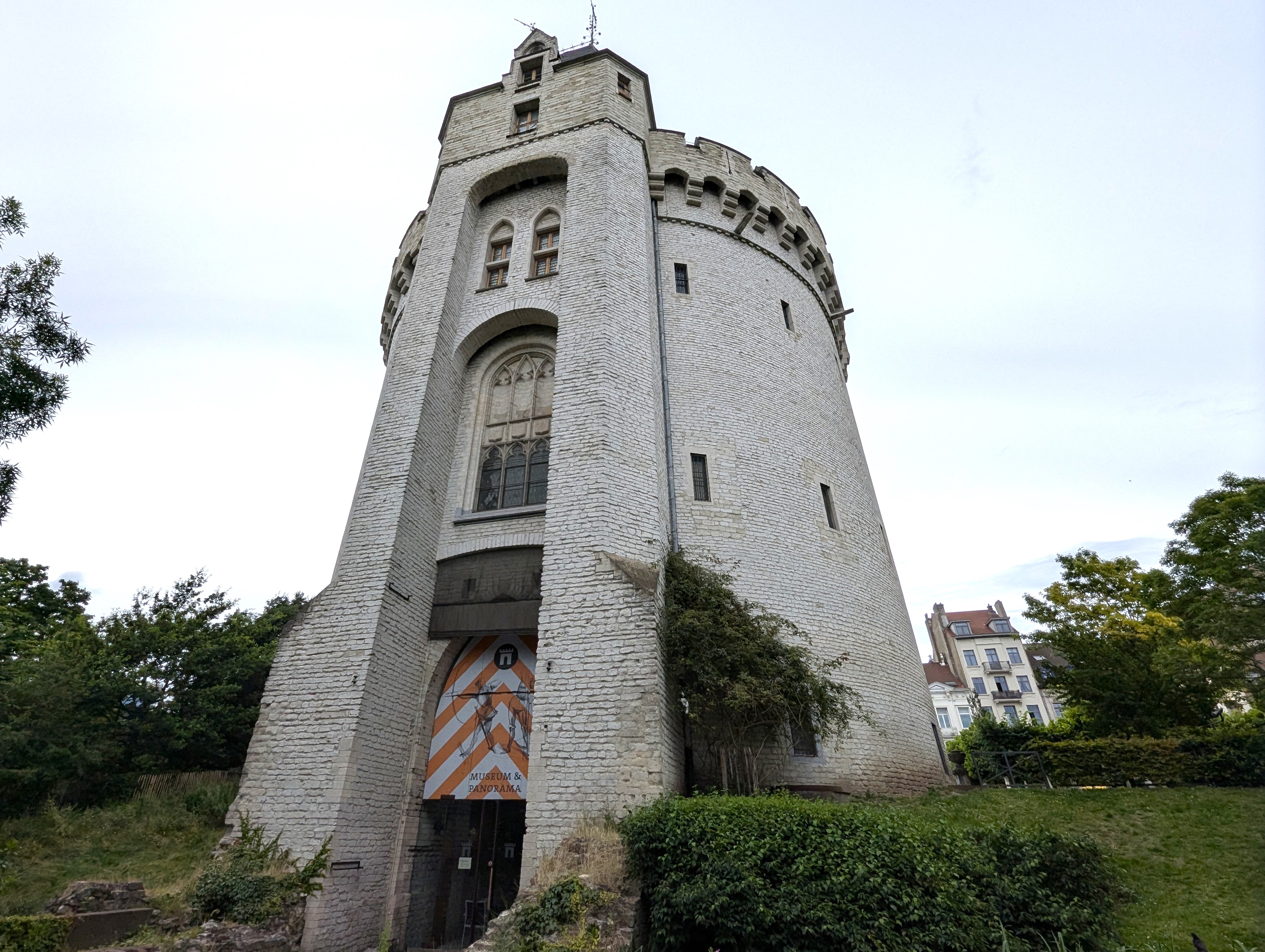
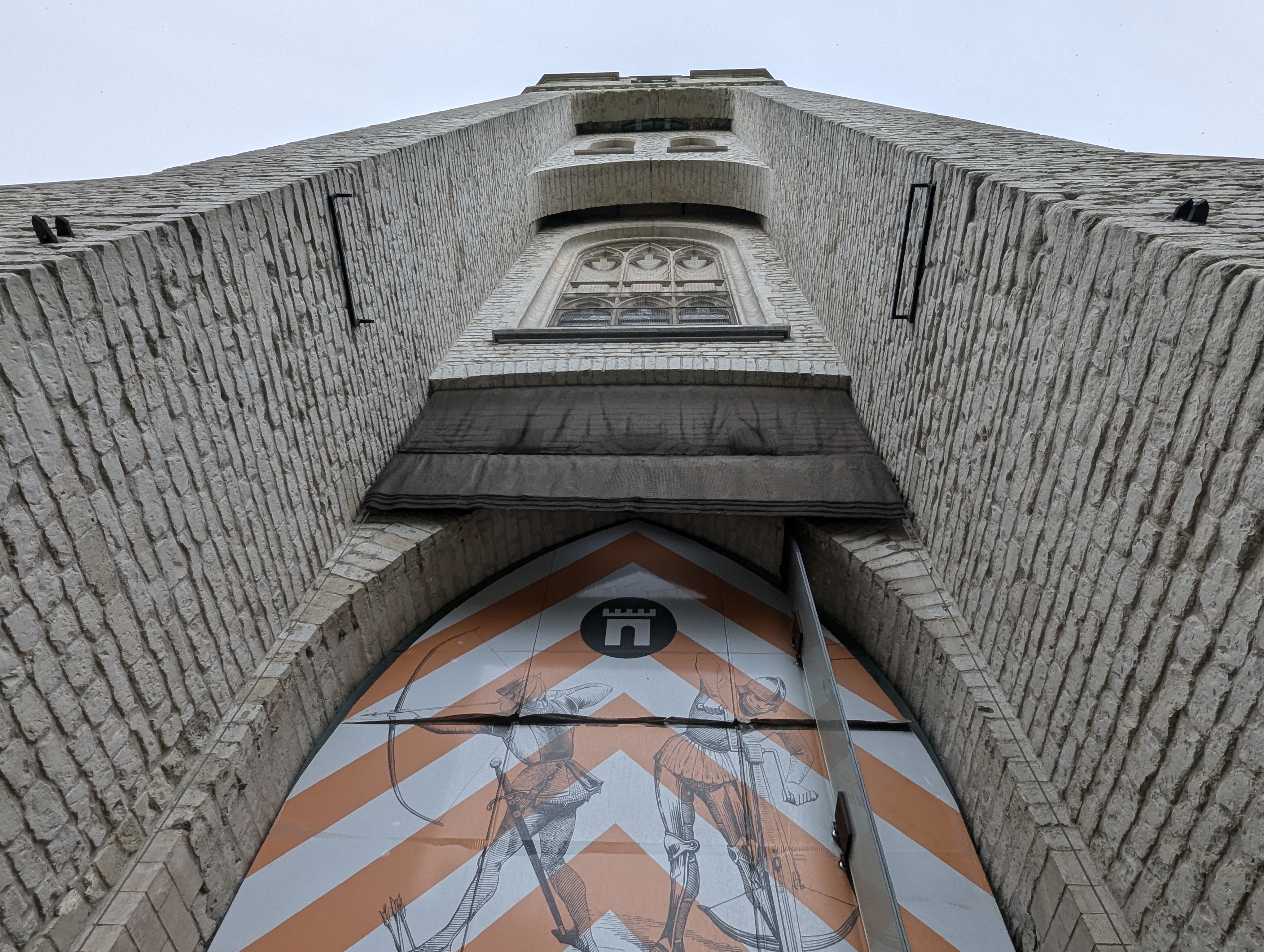
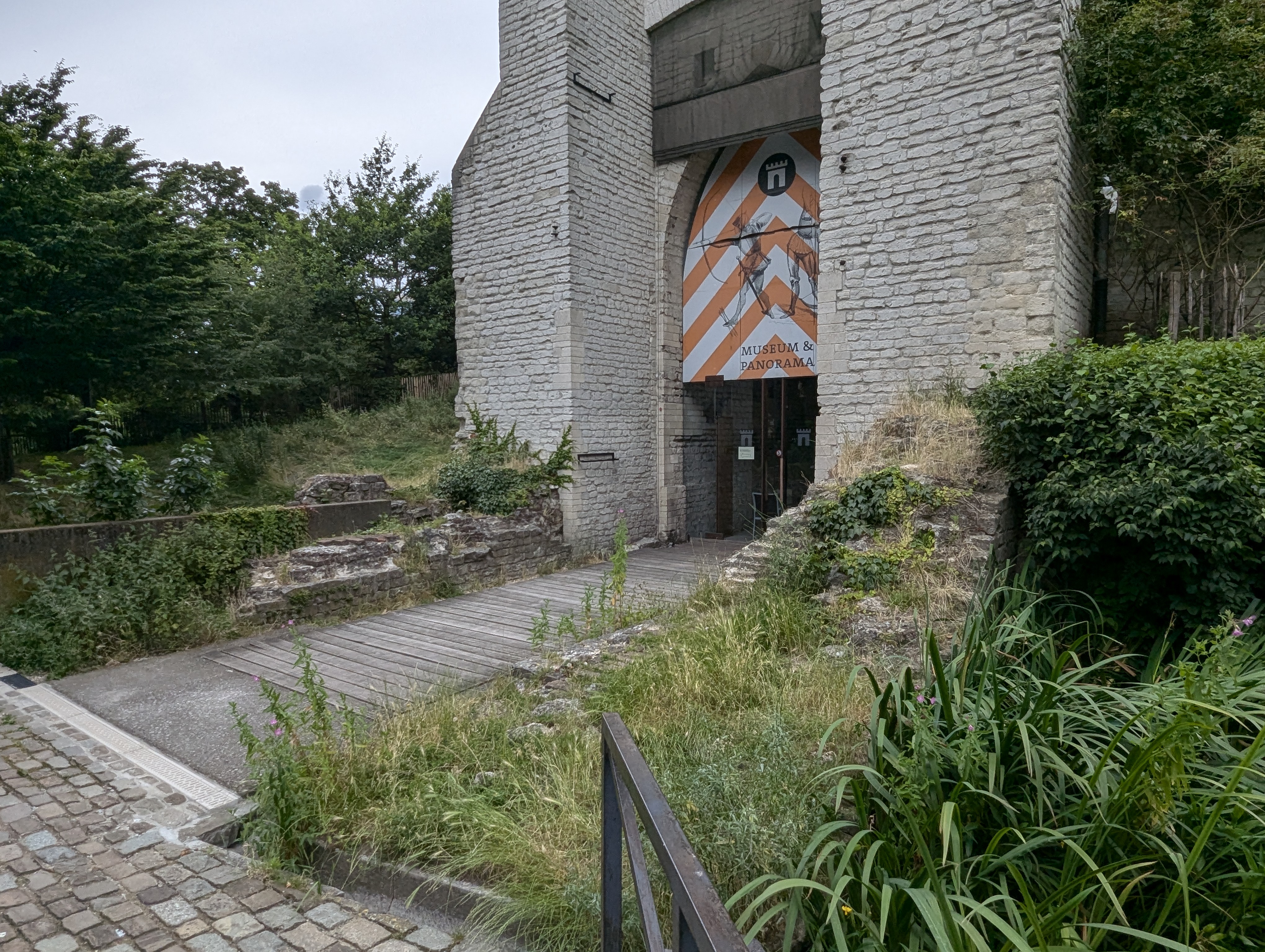
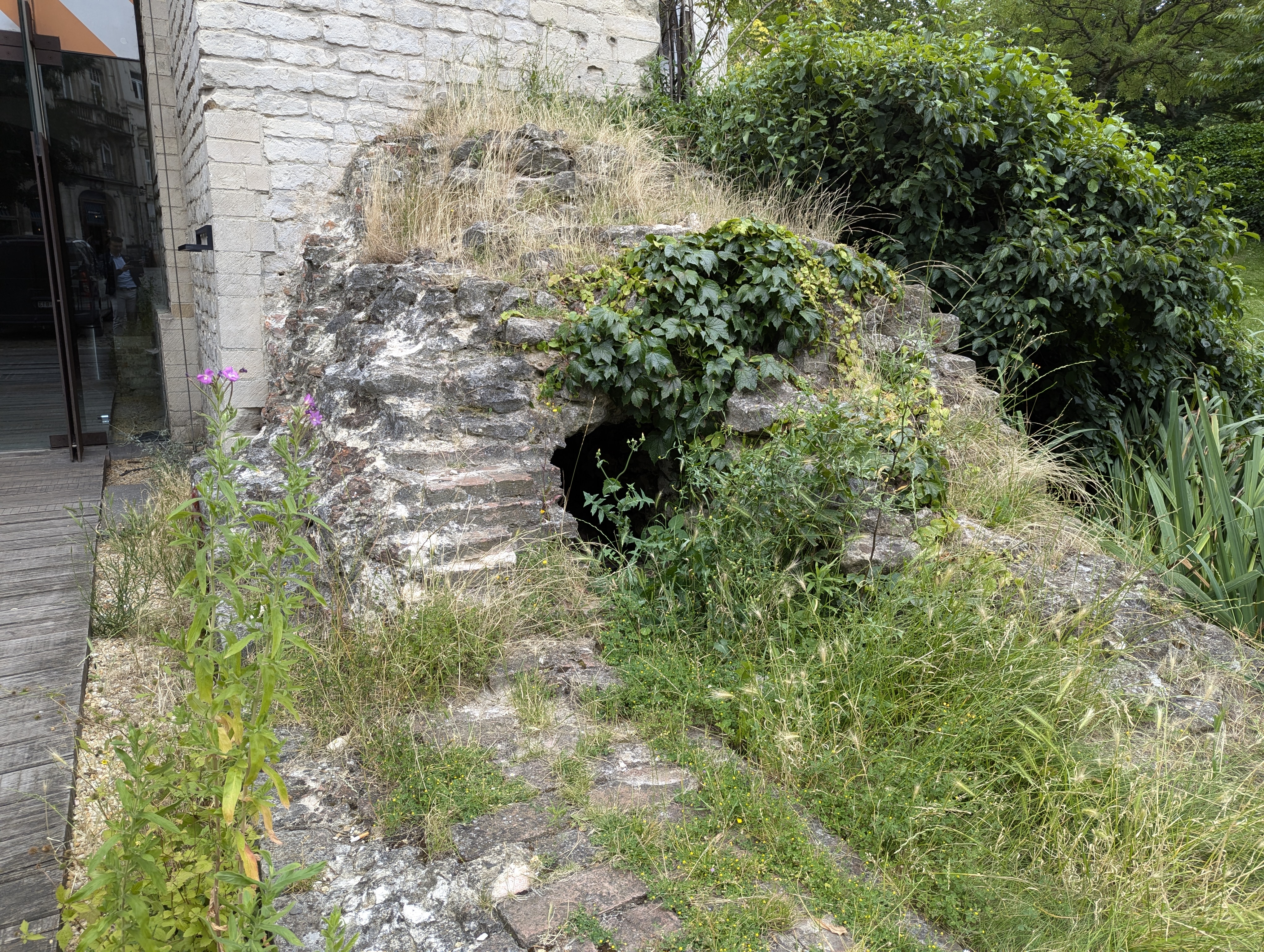
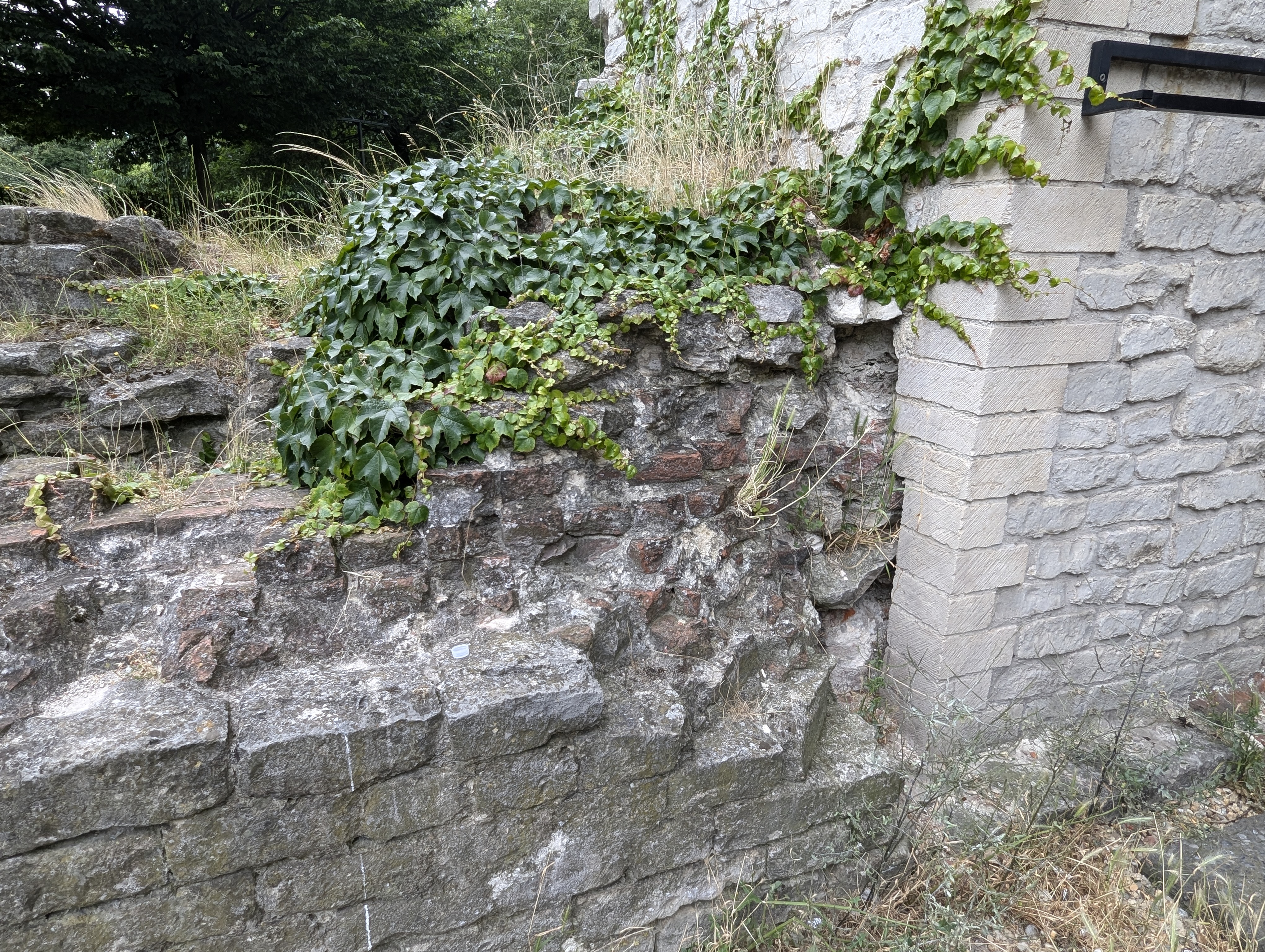
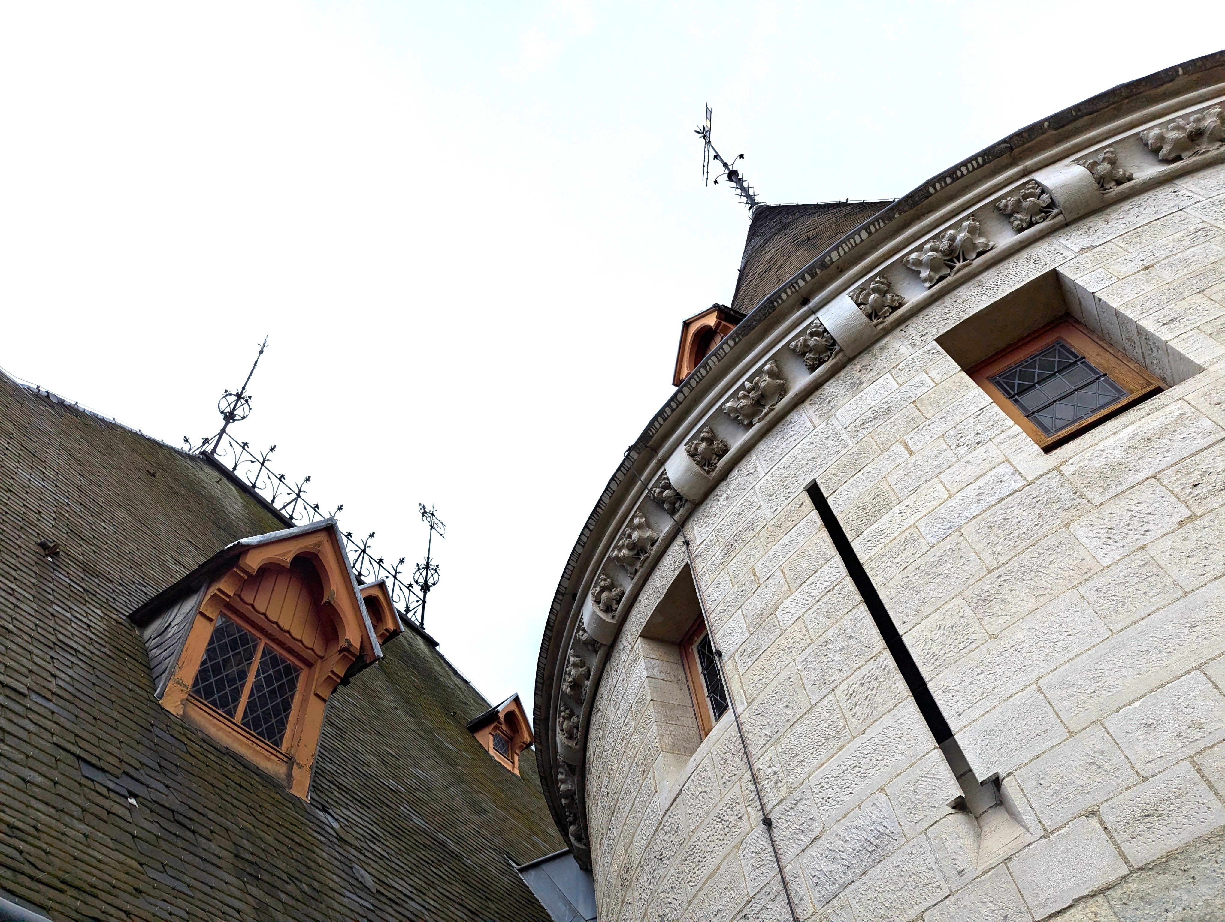
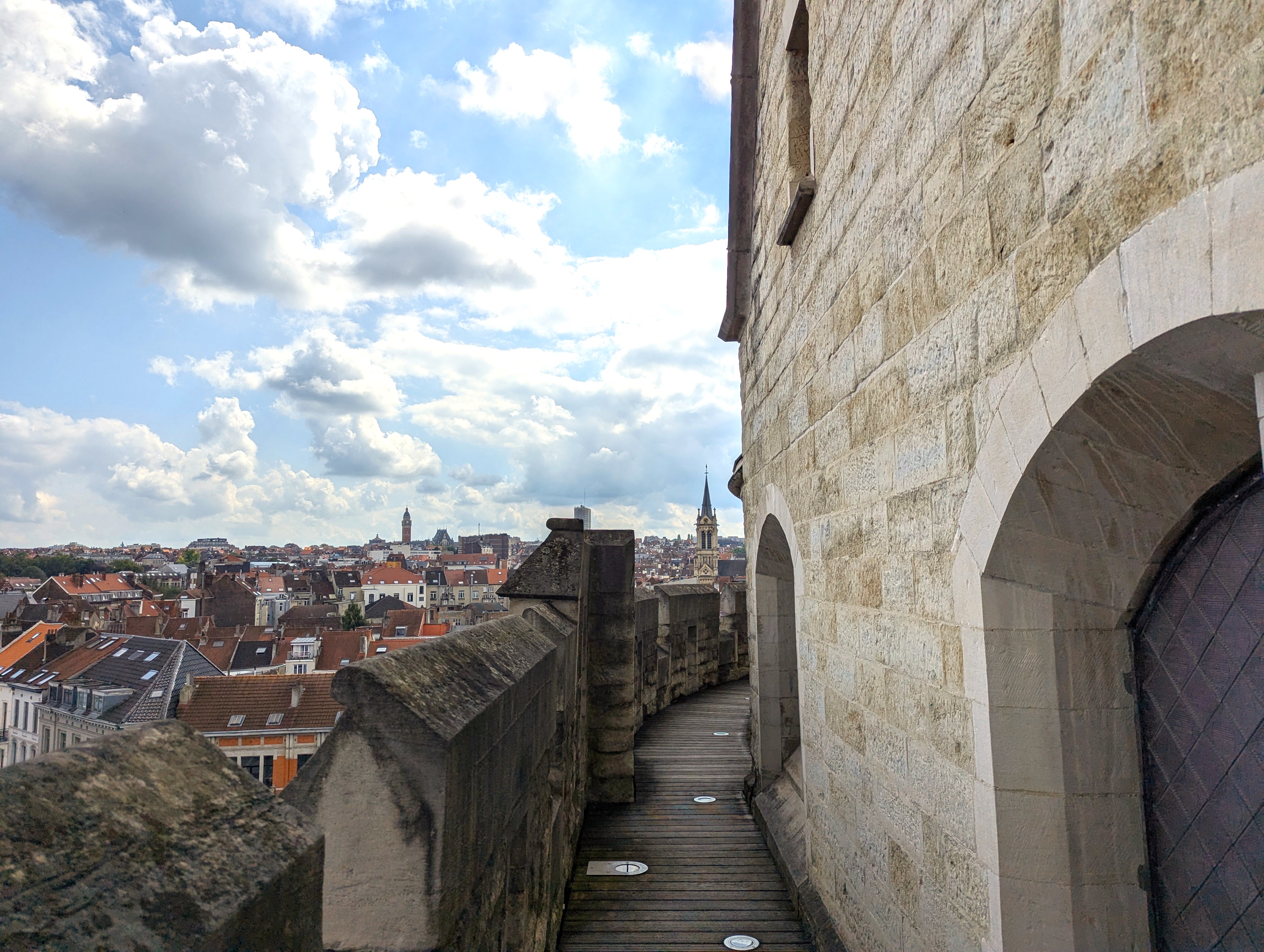
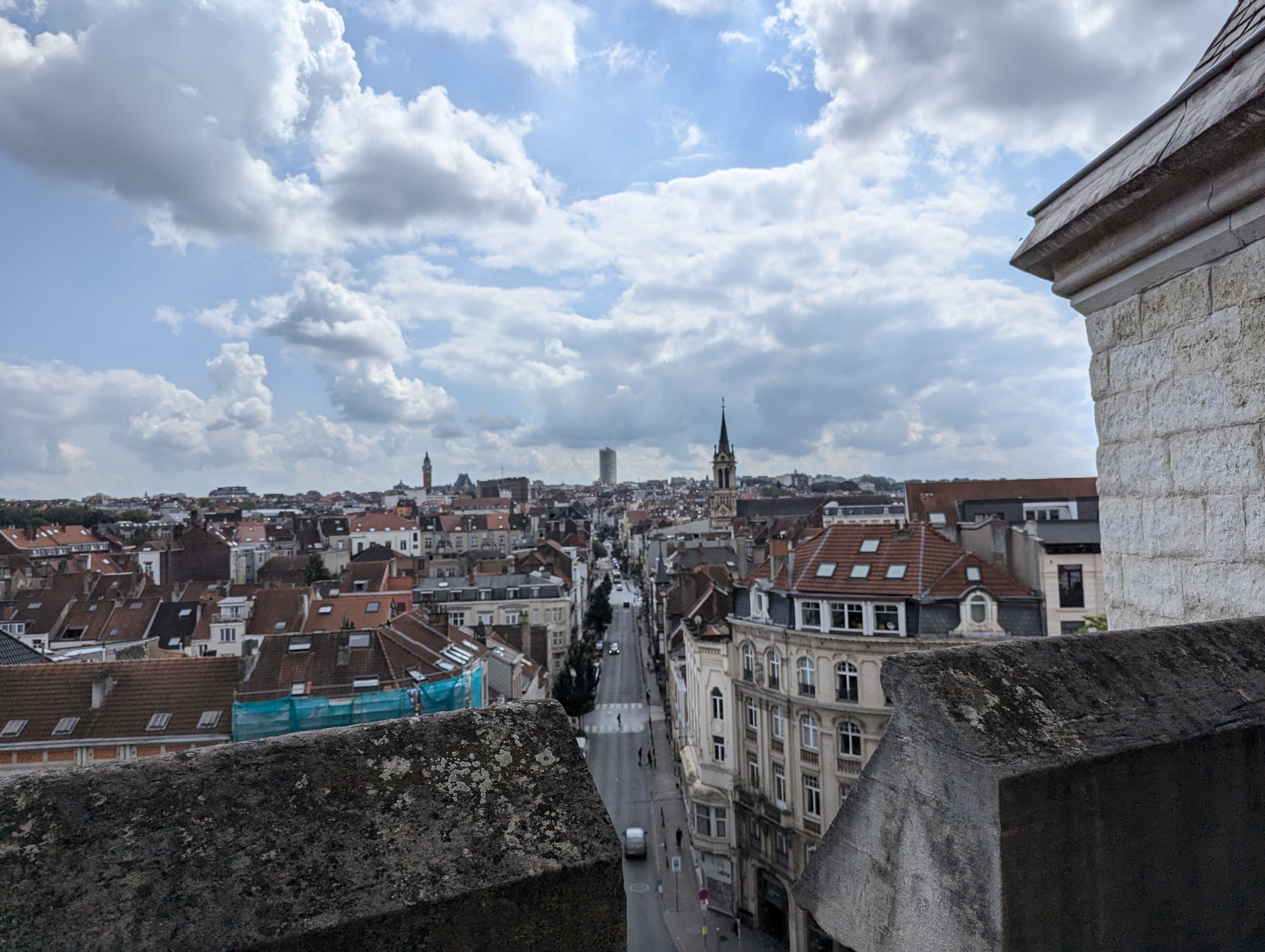
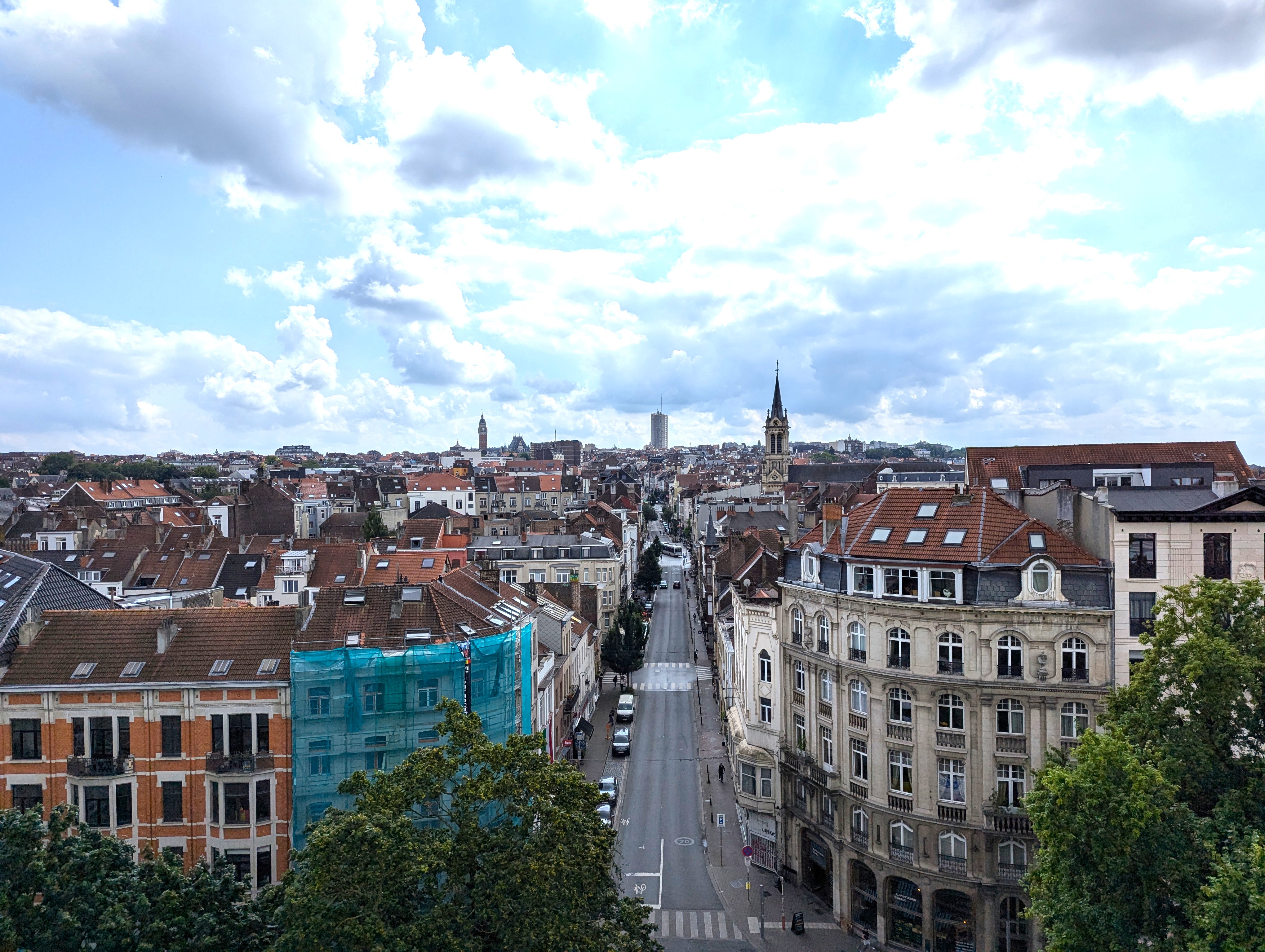
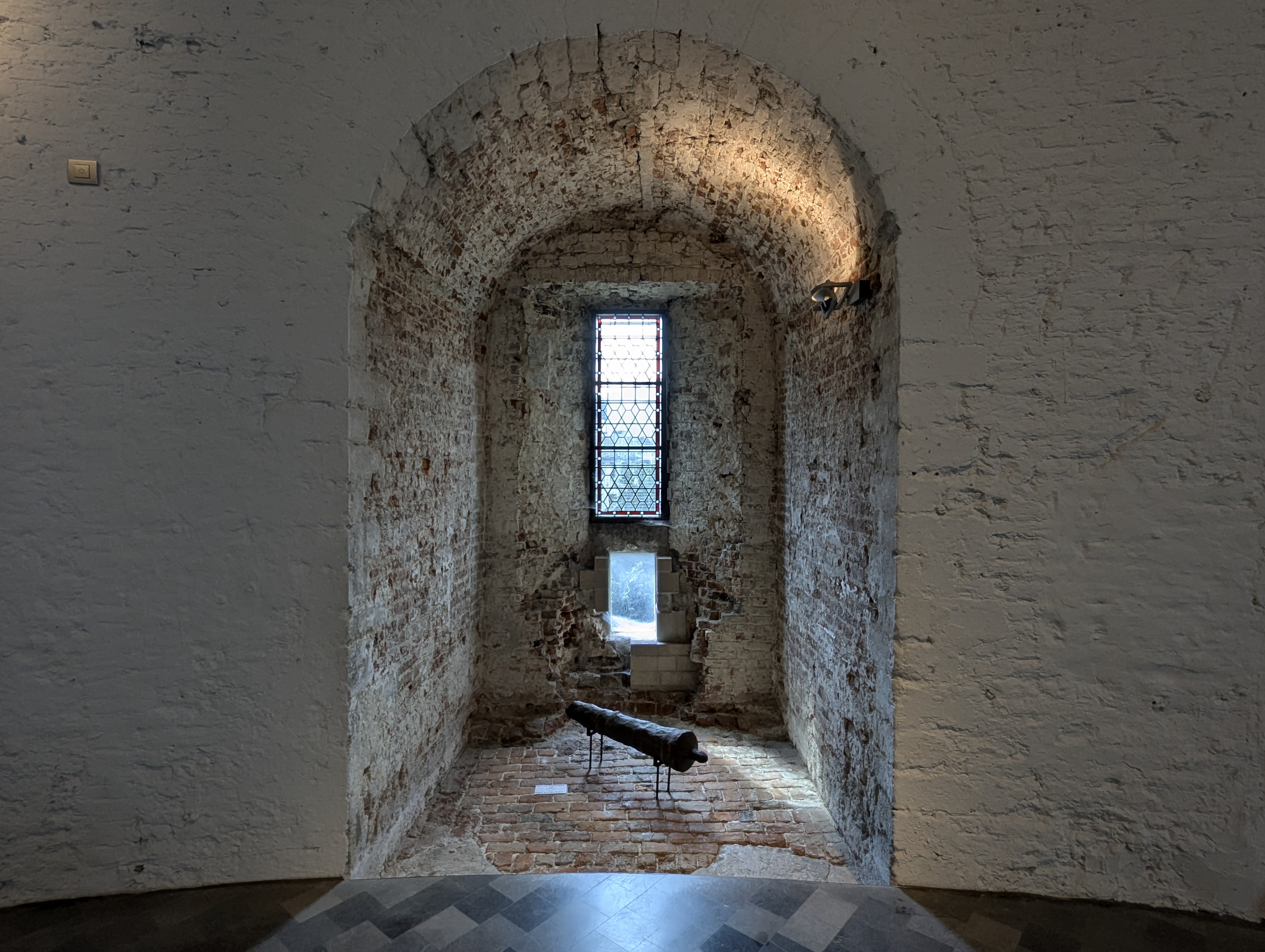
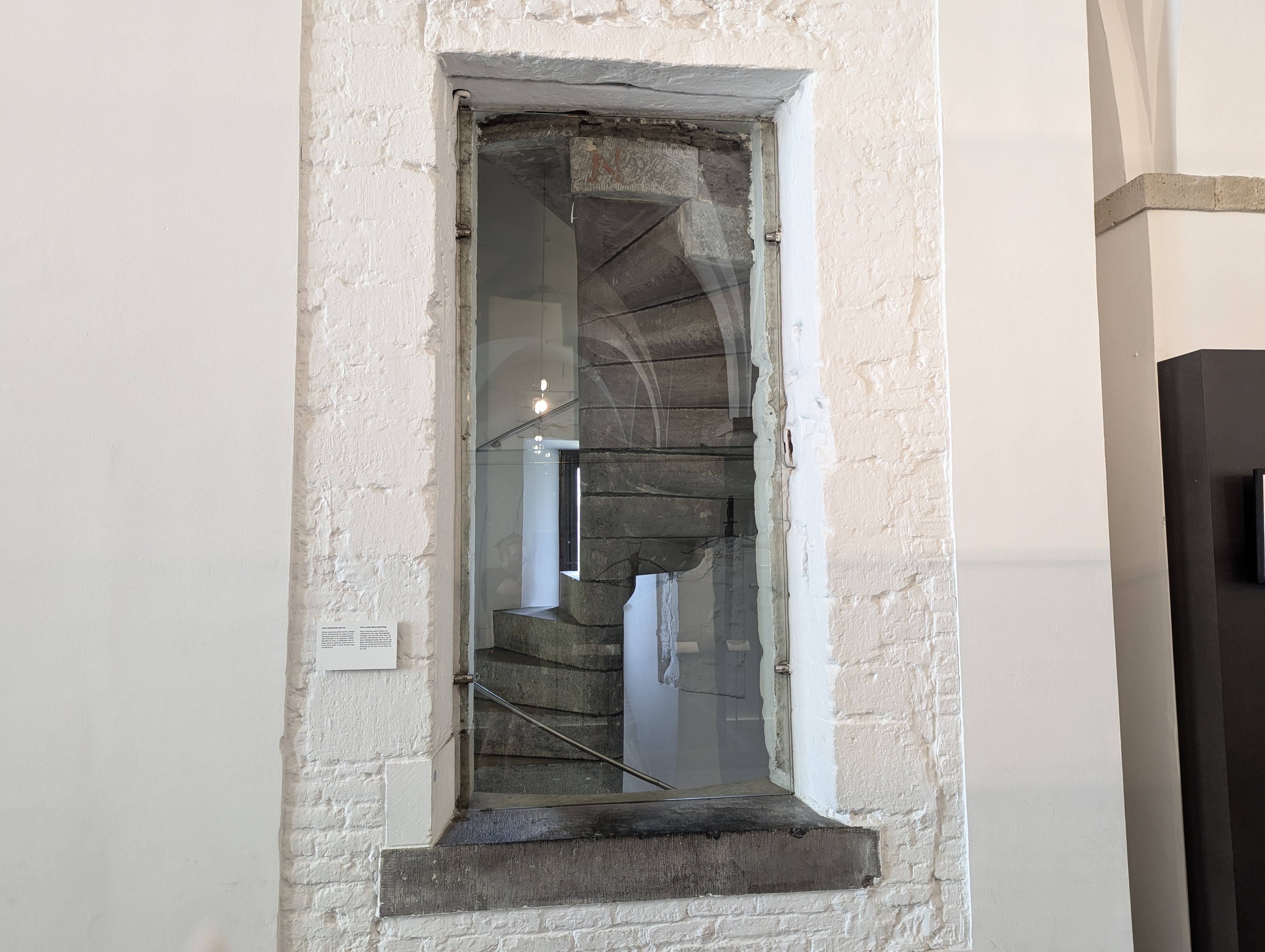
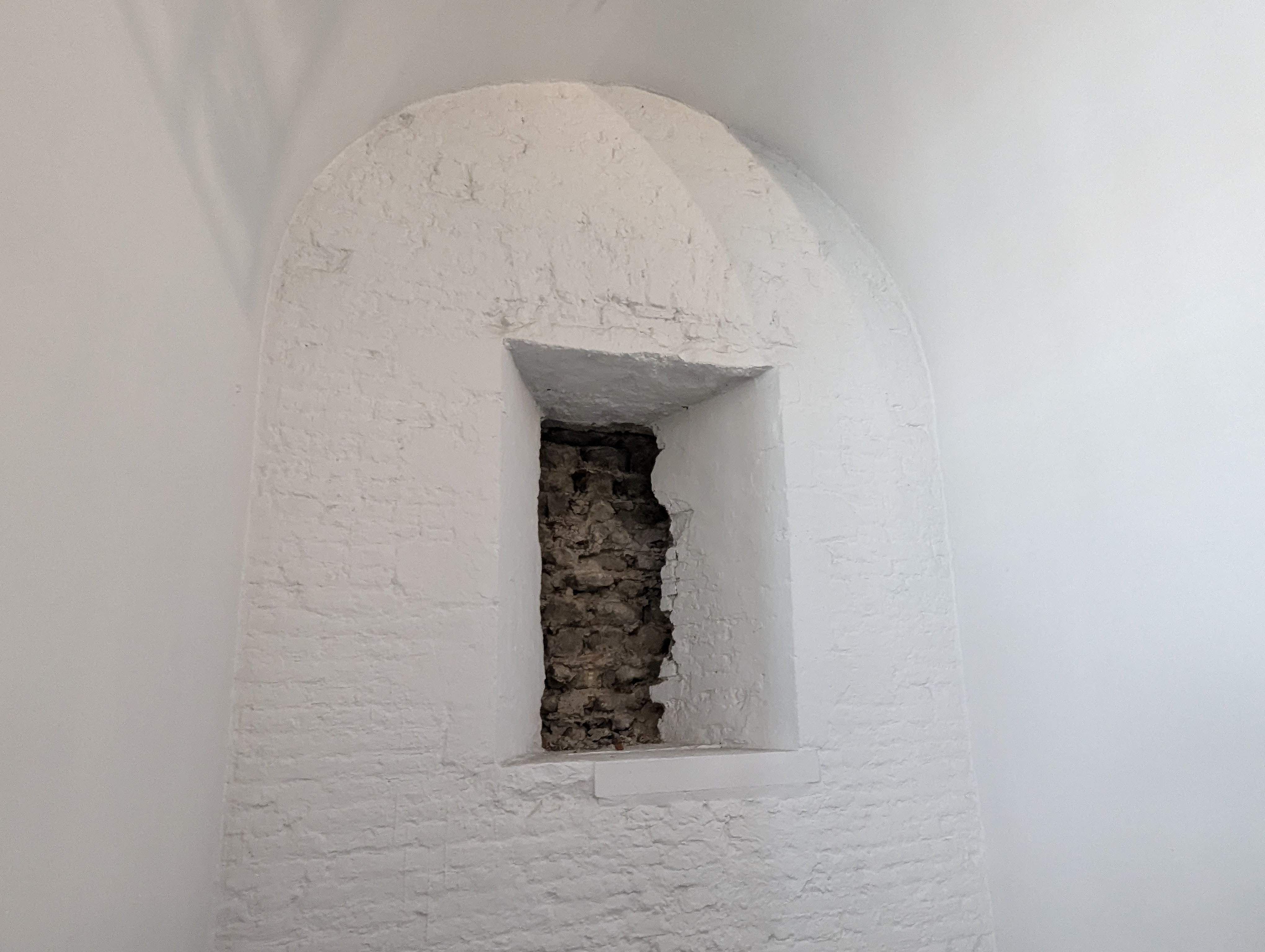
The Obbrusselpoort/Hallepoort is the only medieval city gate of Brussels that has been preserved in situ, despite looking quite different from its original self.
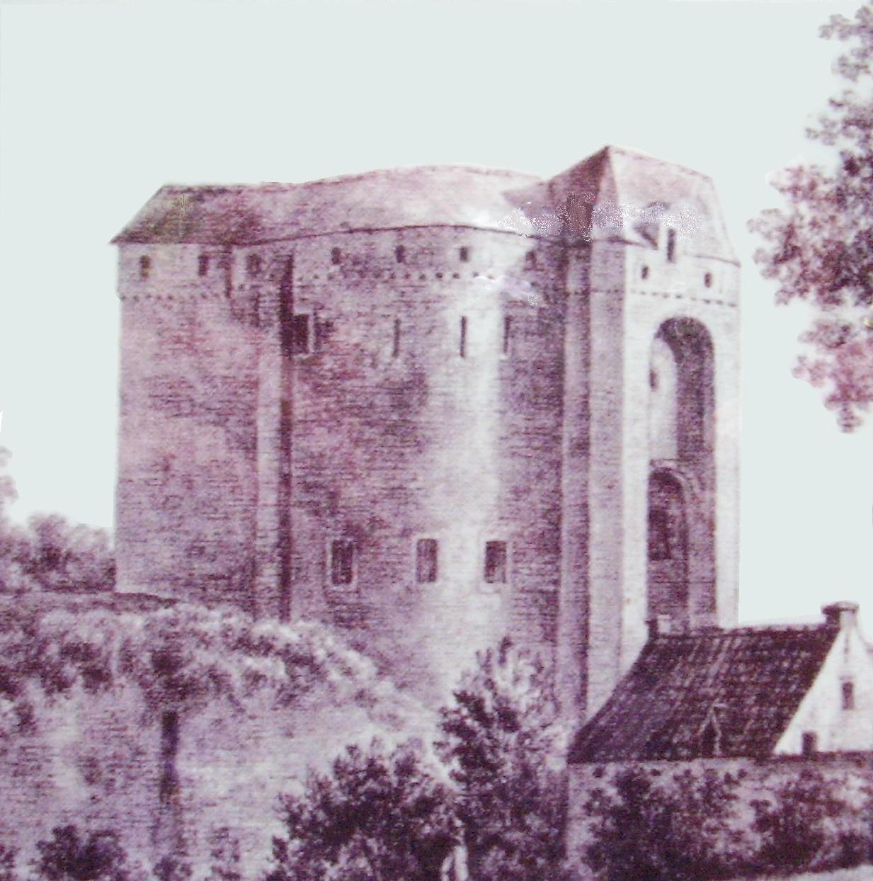
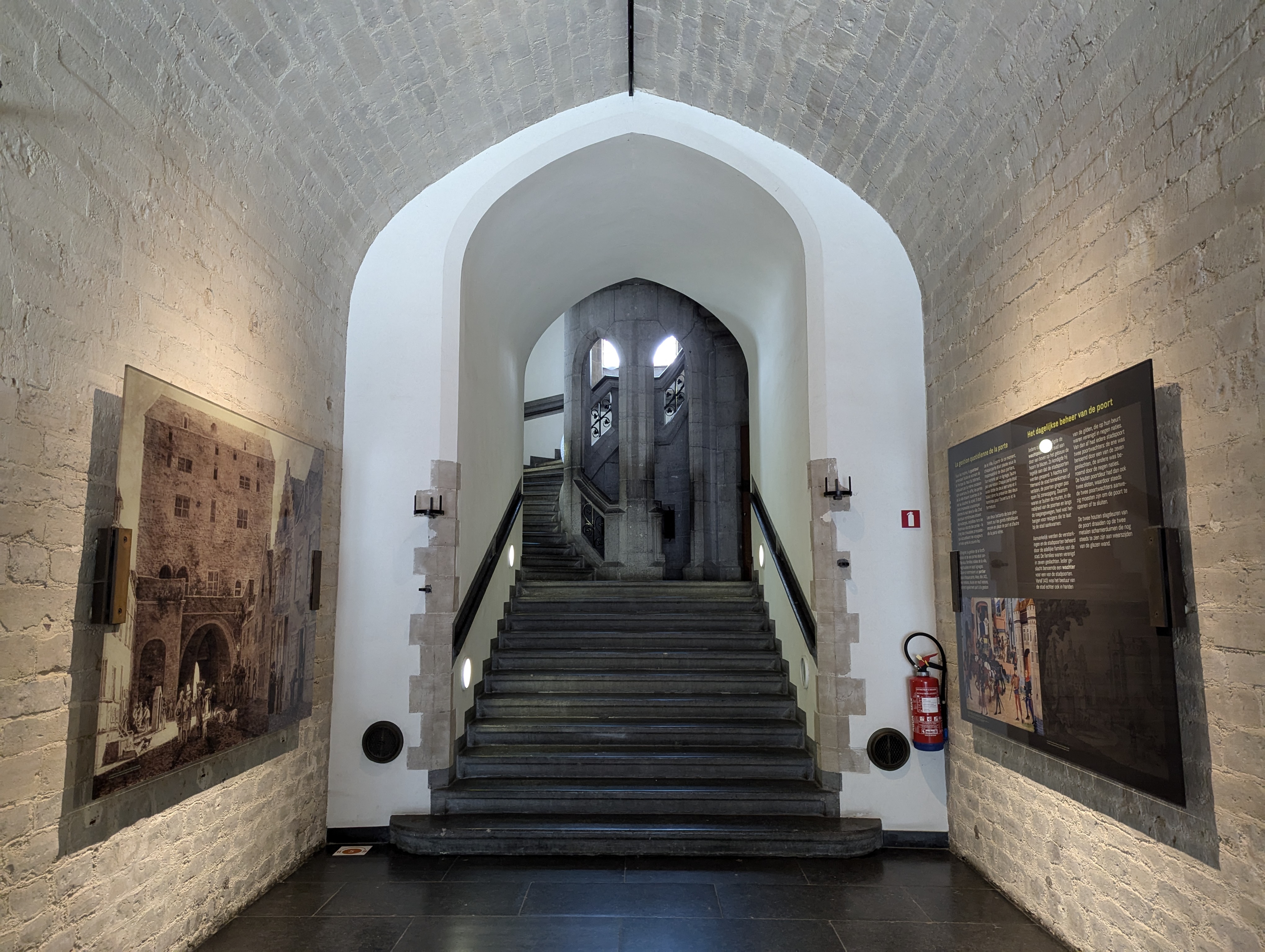
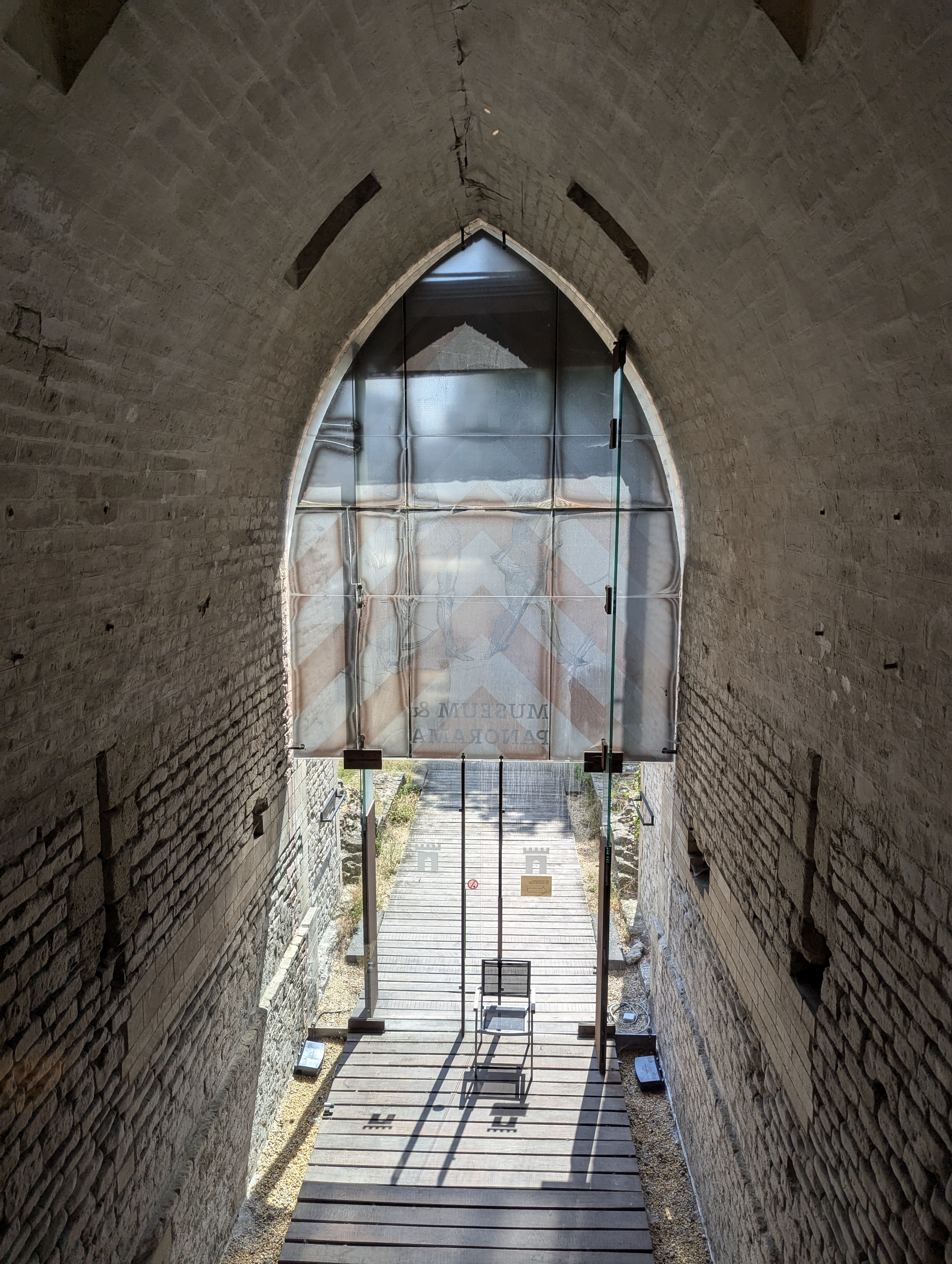
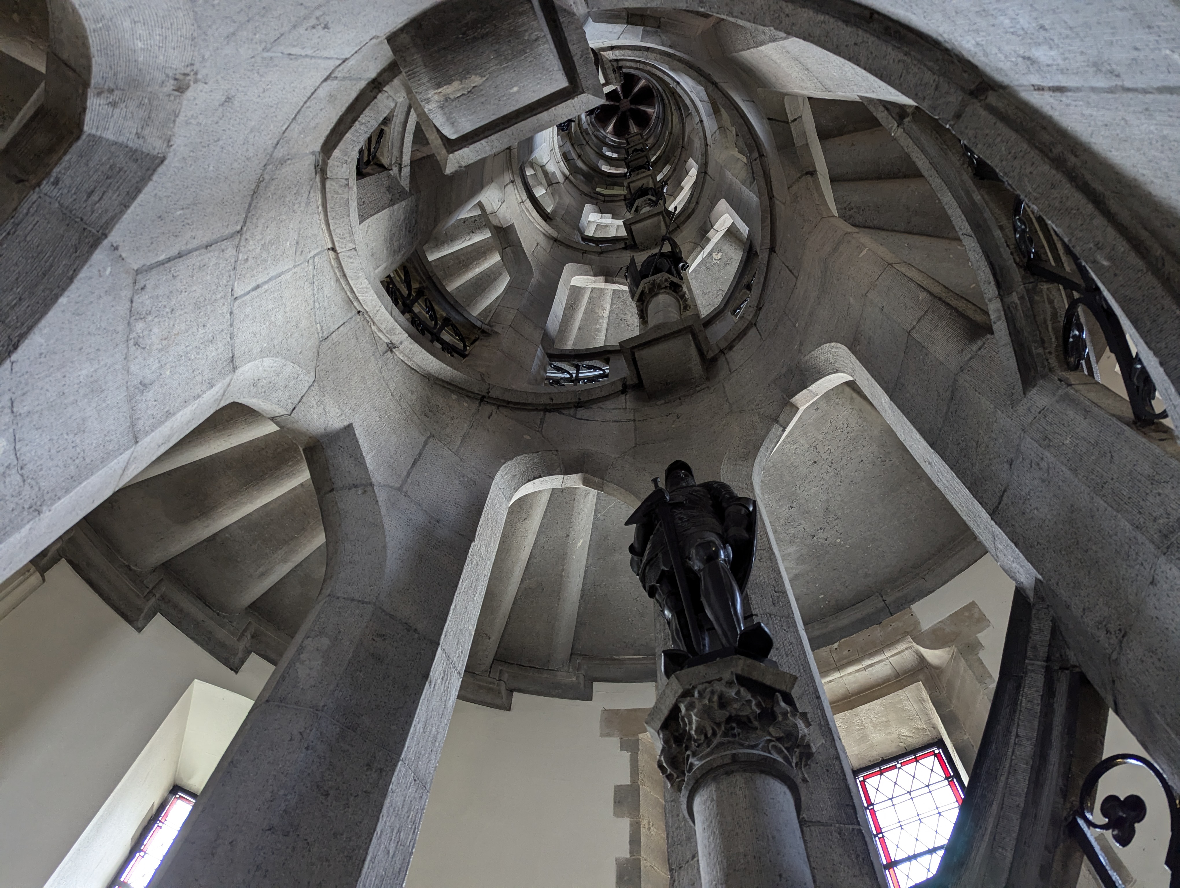
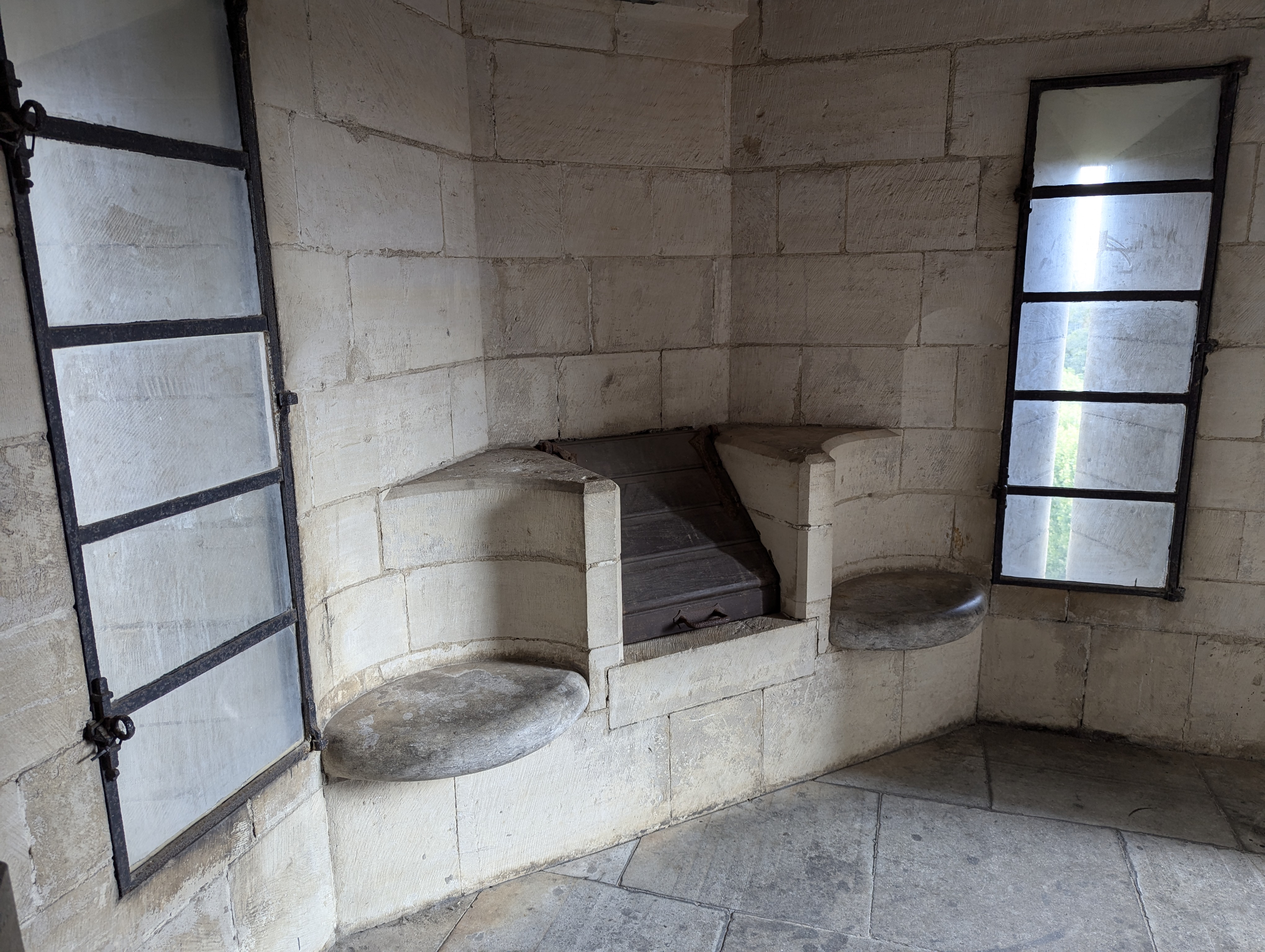
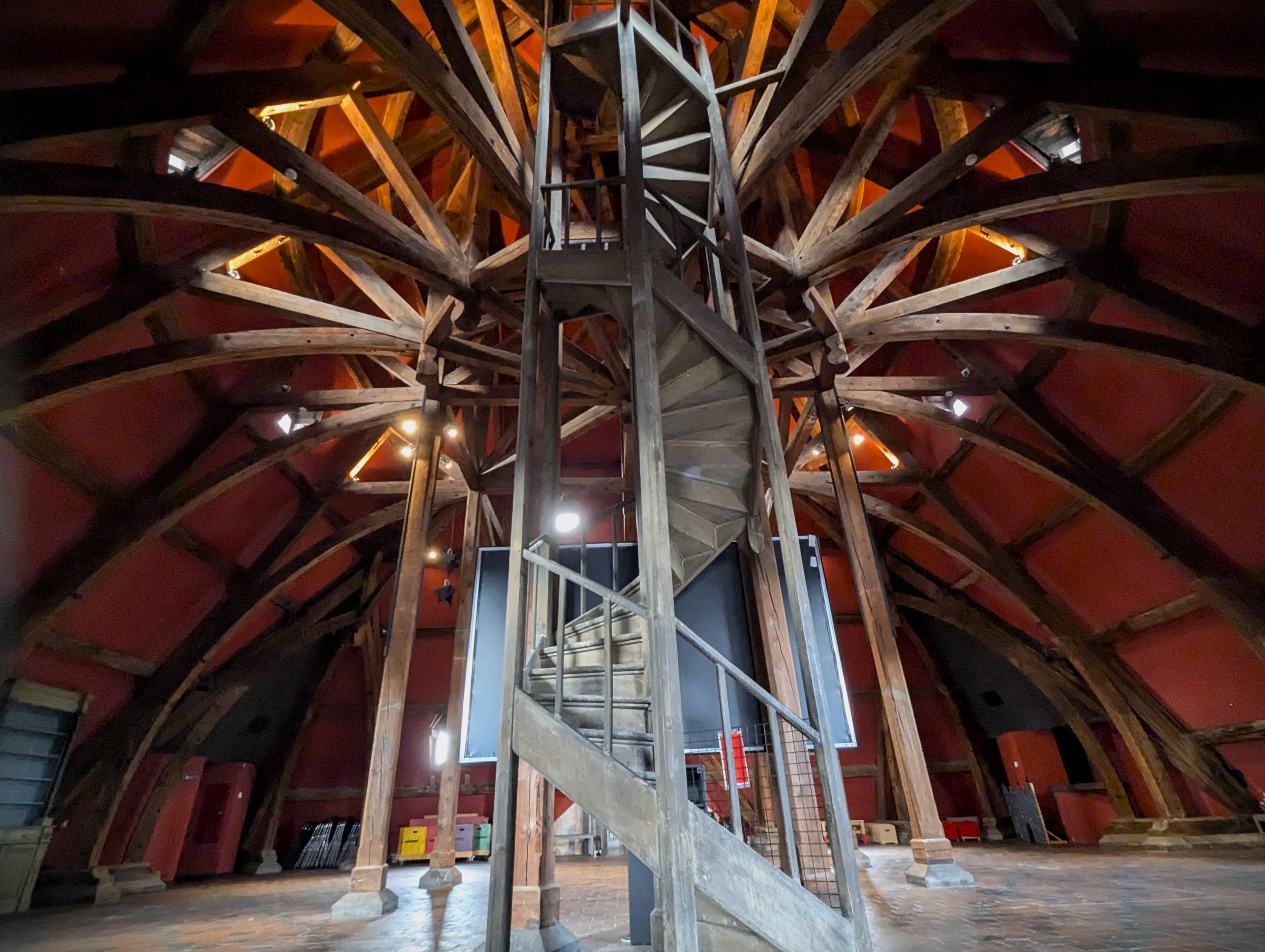
Originally, the Obbrusselpoort/Hallepoort was a formidable structure featuring a large central tower flanked by two smaller side towers. Its design included a portcullis, a drawbridge over a surrounding moat, and a fortified gatehouse. The interior comprised multiple levels, each serving different defensive and administrative functions. The gate’s exterior was adorned with crenellations and arrow slits, typical of medieval military architecture.
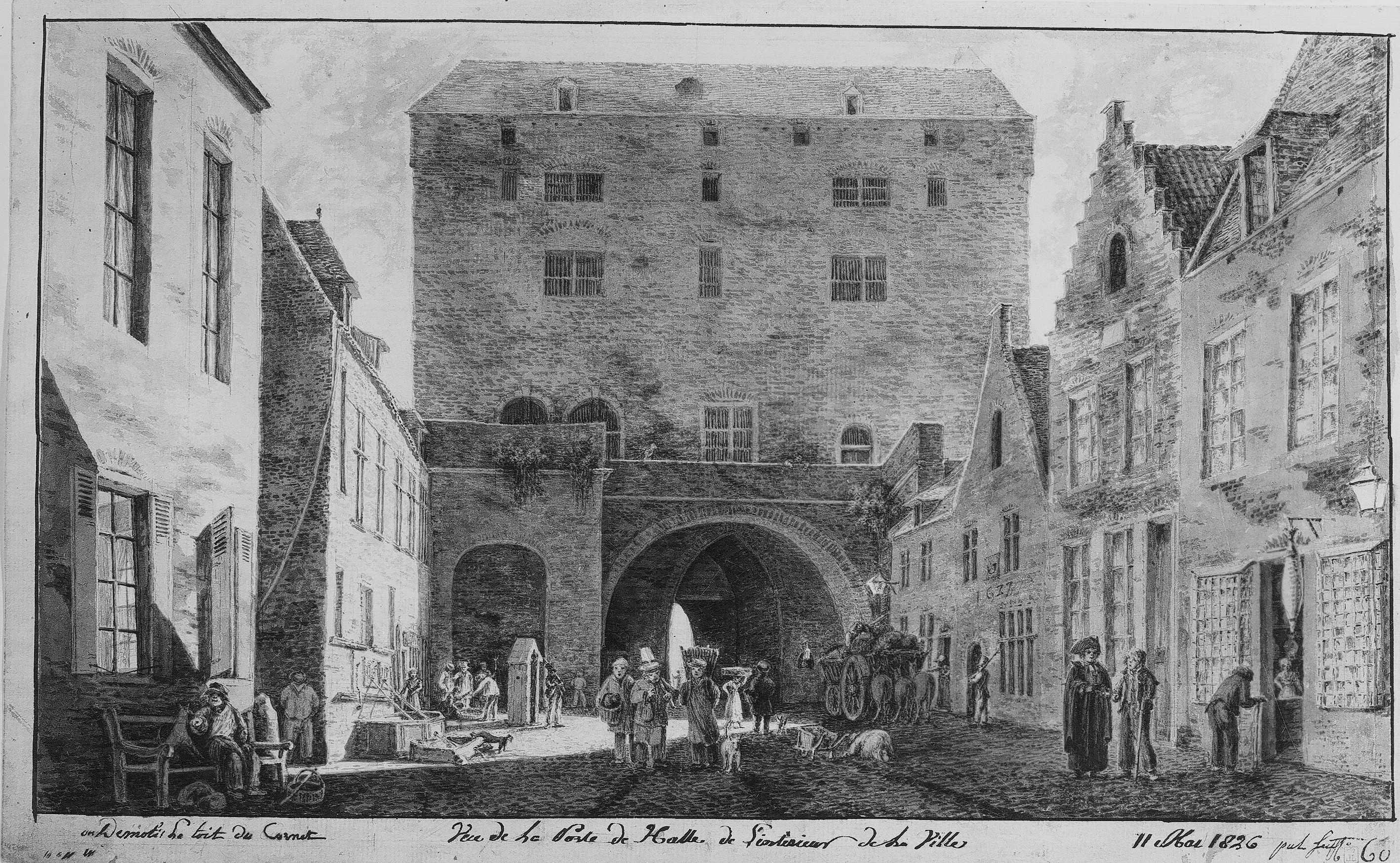
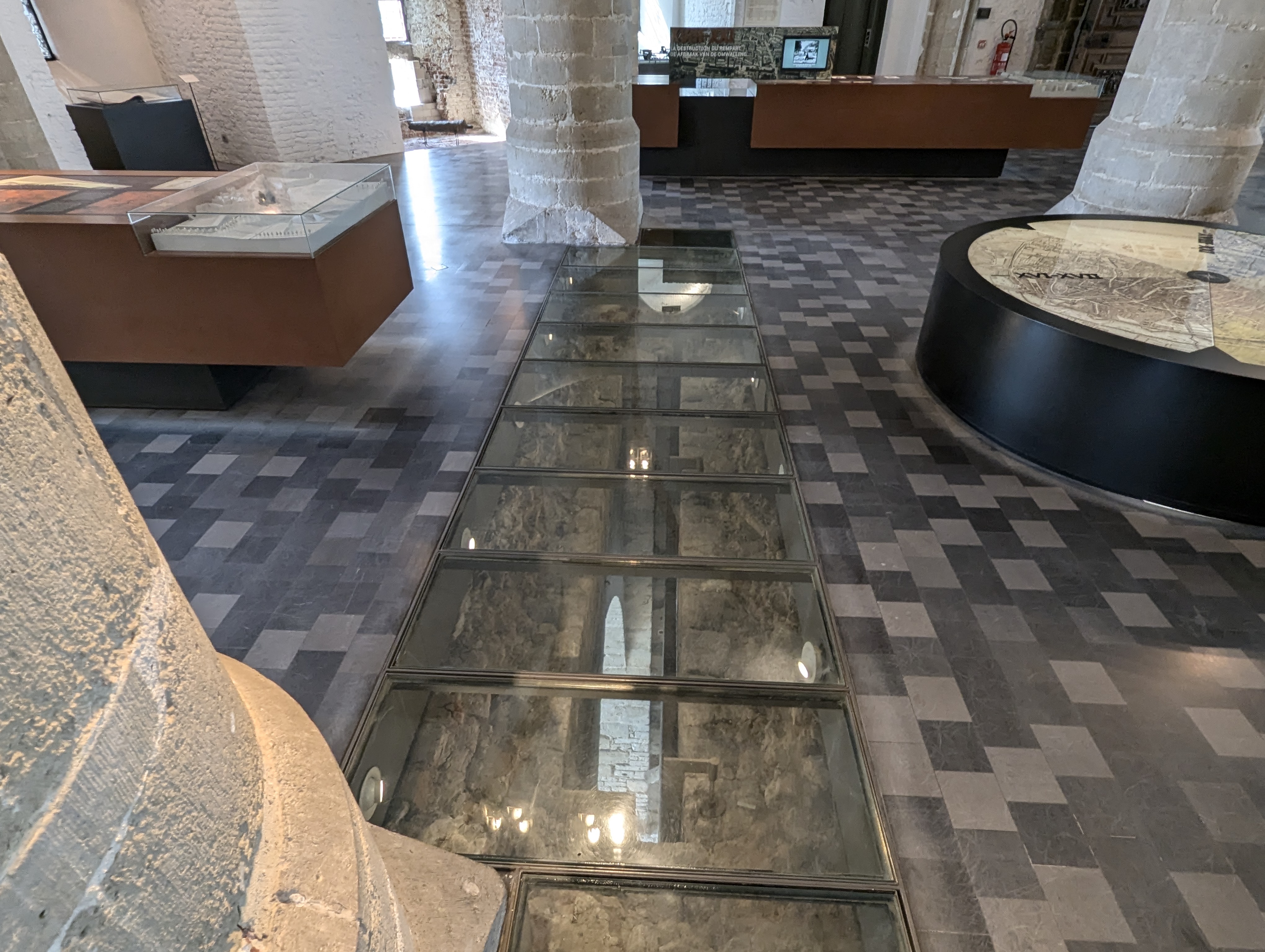
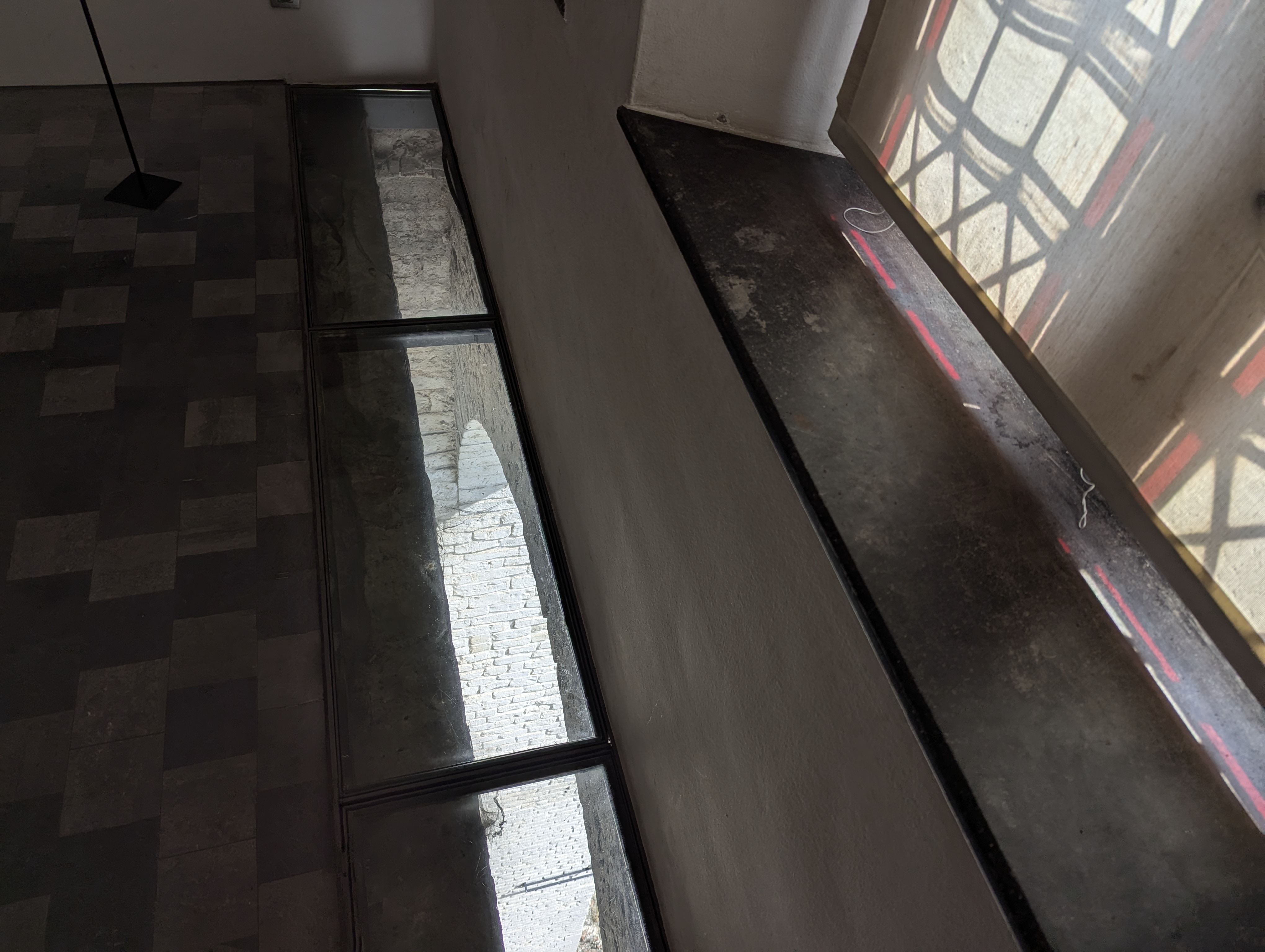
Excavations from 1991 provide insights into the flow of traffic through the Obbrusselpoort/Hallepoort. The narrow passage resembled a double funnel rather than a seamless link between city and countryside, likely creating a claustrophobic sensation during peak times. Entering Brussels from Obbrussel (Sint-Gilles/Saint-Gilles) involved navigating multiple defence systems: a wooden drawbridge over the moat, metal portcullises, a heavy wooden gate, and a final massive wooden gate. These barriers, along with trap holes in the walls for attacking enemies, made the entry process arduous and heavily fortified. The gate’s restricted accessibility was further controlled by regulated opening hours since 1423 and a strict service schedule for the guards, reflecting its role in city defence and traffic regulation.
The city gates were not just defensive structures but also crucial points for controlling trade and collecting taxes. Porters meticulously inspected and recorded incoming goods, like millstones, bags of wool, and barrels of beer and wine, under strict city regulations. The gate’s central passage was flanked by premises likely used for registering merchandise and detaining suspicious individuals. This multi-functional infrastructure highlights the blend of military, administrative, and economic roles that city gates played in medieval Brussels. The surviving structure and historical records from the Hallepoort Museum provide a detailed understanding of these complex mechanisms.
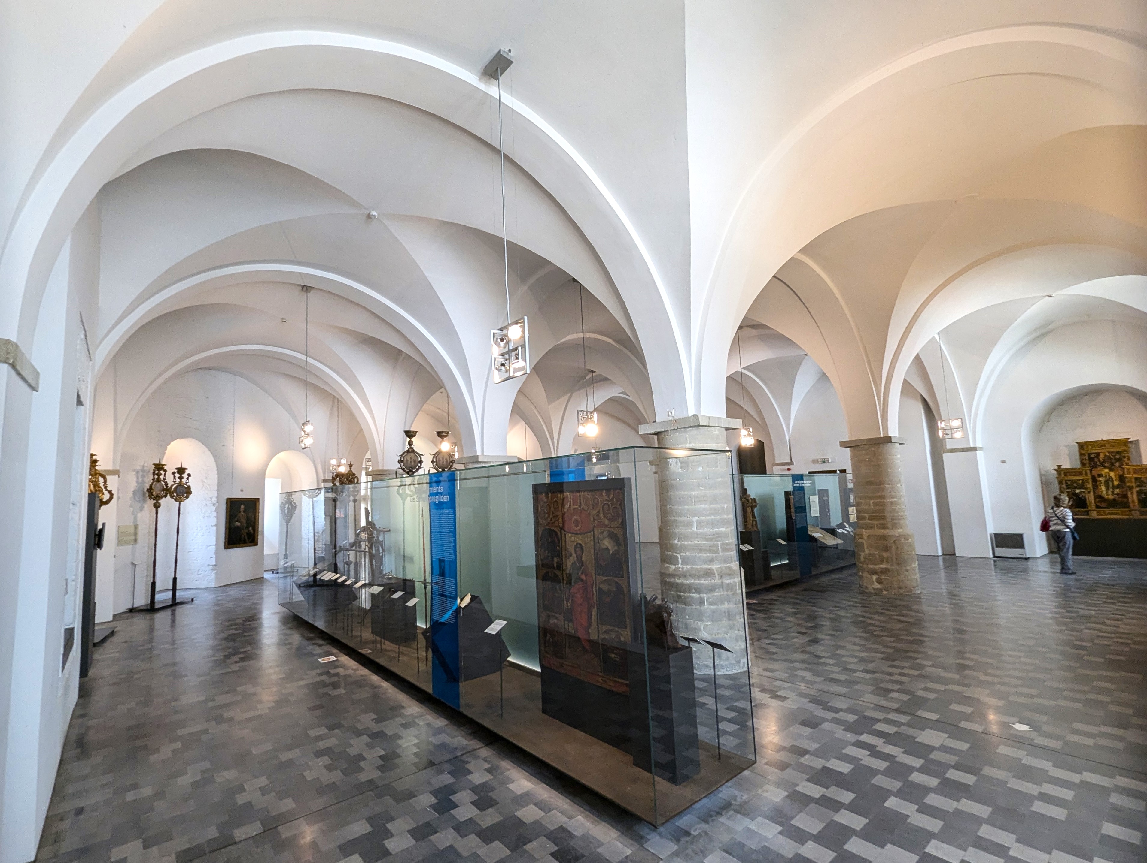
The Hallepoort Museum is definitely worth a visit. The first floor called the Gothic Hall retained its appearance from since its construction. To get a sense of how narrow the passage way once was, look towards the back entrance of the building once you enter the modern entrance.
Current situation
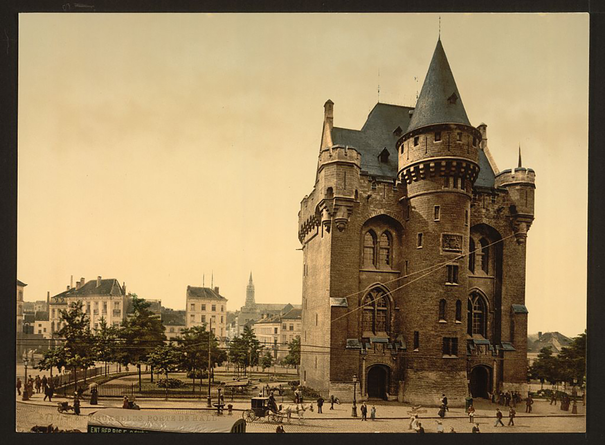
The Obbrusselpoort/Hallepoort has undergone several significant renovations that have ensured its survival and adaptation into a historical monument. Initially spared from demolition during the 19th century, also thanks to its repurposing as a prison, the gate was restored by architect Henri Beyaert, who added a Gothic-style roof and decorative elements, giving it the appearance it has today. Further renovations in the 20th century focused on structural reinforcement and adaptation for public use as a museum. These efforts were part of a broader initiative to preserve Brussels’ medieval heritage, with the Obbrusselpoort/Hallepoort now housing the Halle Gate Museum, which showcases the city’s history. The preservation work has maintained the gate’s historical integrity while adapting it for educational and cultural purposes, ensuring that this medieval structure continues to be a prominent landmark in Brussels.
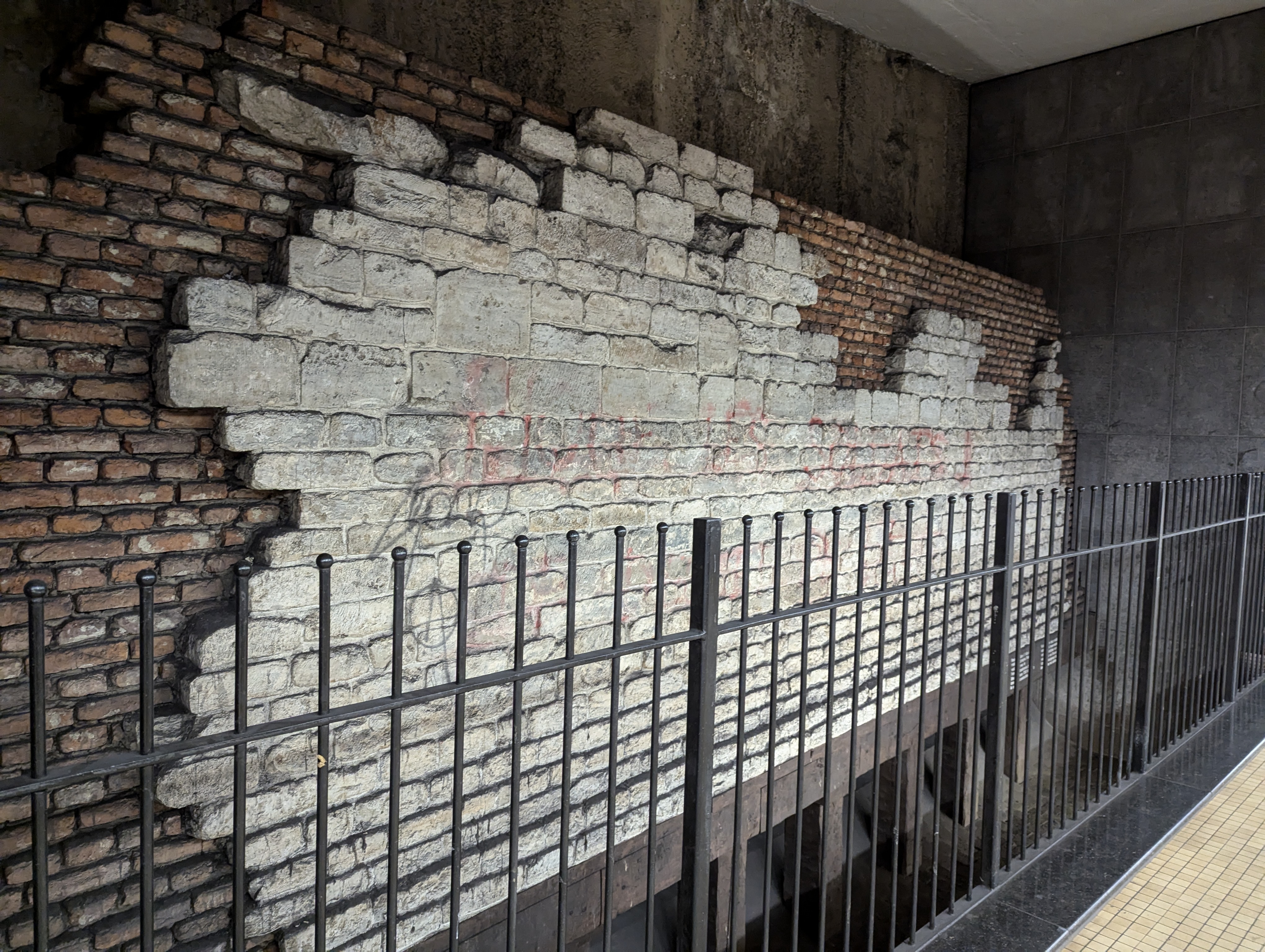
In the nearby metro station “Munthof”, in the direction of “Delacroix”, there is a reconstruction of a piece of wall belonging to the ravelin of the Hallepoort using actual remnants discovered in the 1990s called the Sint-Clara ravelin (Saint Claire’s ravelin). You can visit this wall on the platform.
Sources:
Vannieuwenhuyze, B. (2011) “Brussel, de Ontwikkeling van een middeleeuwse stedelijke ruimte.” Amsterdam: Amsterdam University Press.
De Waha, M., De Poorter, A. (1992) “De Hallepoort in Brussel (Brab.)”, in : Archaeologia Mediaevalis 15. Namur: Crédit Communal.
https://nl.wikipedia.org/wiki/Stadspoorten_van_Brussel
https://nl.wikipedia.org/wiki/Hallepoort
https://www.hallegatemuseum.be
[Erfgoed Brussel](https://erfgoed.brussels/links/digitale-publicaties/pdf-versies/artikels-van-het-tijdschrift-erfgoed-brussel/nummer-2/artikel-2-5/at_download/file)
https://nl.wikipedia.org/wiki/Sint-Gillis
https://nl.wikipedia.org/wiki/Kuip_van_Brussel
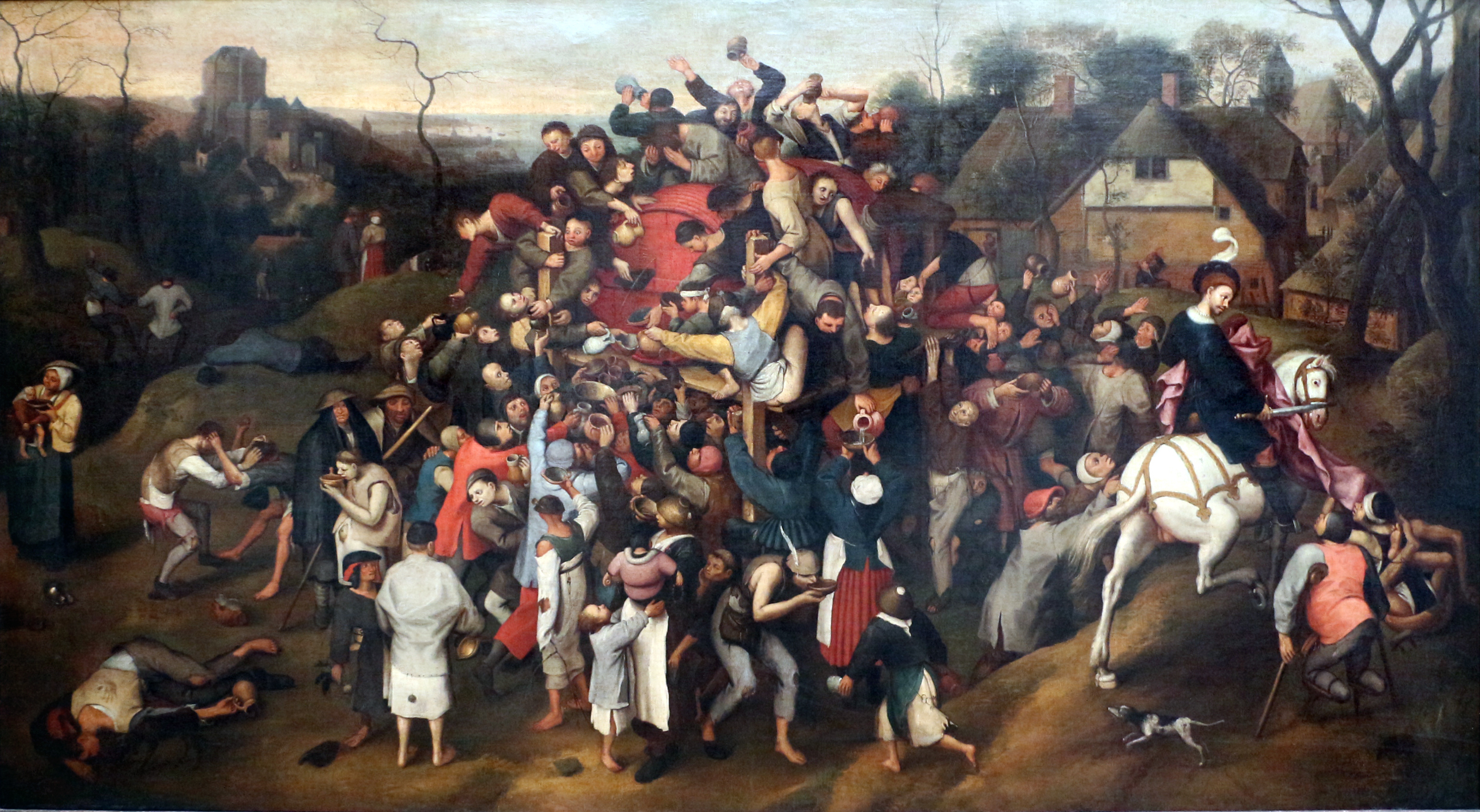
01 Naar Pieter Bruegel de Oude. (1550-1599) “Sint-Maartensfeest” https://nl.wikipedia.org/wiki/Bestand:Copy_after_Pieter_Bruegel_the_Elder_-_The_Wine_of_Saint_Martin%27s_Day.jpg (image)
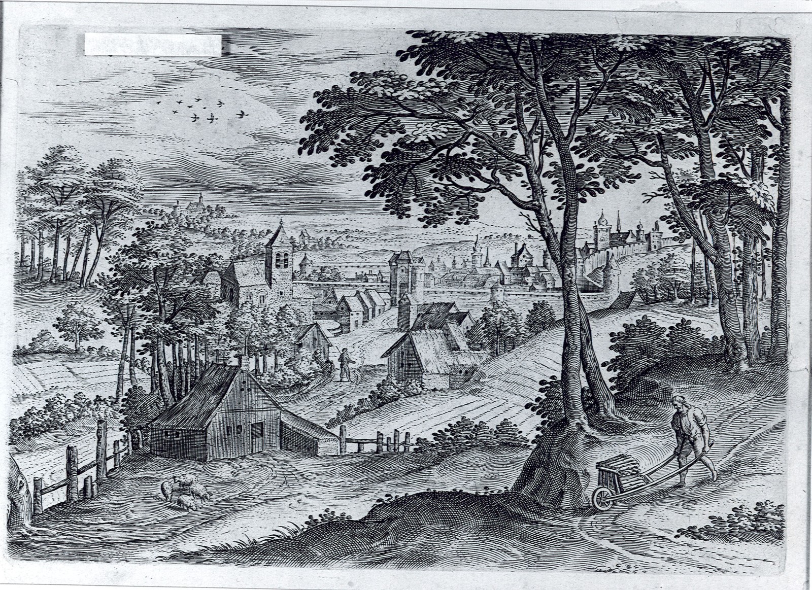
02 Burijngravure door Hens Collaerd, 1560 (Prentenkabinet) https://monument.heritage.brussels/nl/streets/10601132 (image)
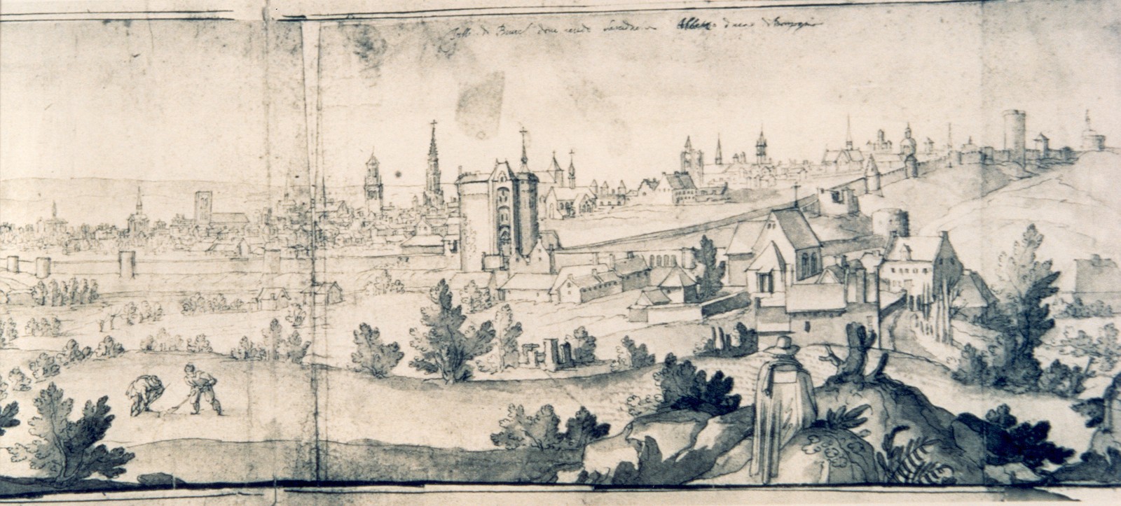
03 Unknown. “Zicht op de stad en zijn omwalling, tussen Hallepoort en Naamsepoort, 1612, gravure van Remigio Cantagallina, uit “Album du Vieux Bruxelles” (SAB)” (image)
04 Unknown. “Pul le 11 Avril 1785 porte De hal” https://garystockbridge617.getarchive.net/media/pul-le-11-avril-1785-porte-de-hal-7df3e4 (image)
05 Vitzthumb, Paul. (1785) “La porte de Hal” https://balat.kikirpa.be/object/20054769 (image)
06 Unknown. (1786) “View of the Halle Gate in Brussels – 1786” https://garystockbridge617.getarchive.net/media/view-of-the-halle-gate-in-brussels-1786-d21b60 (image)
07 Unknown. (1786) “View of the Halle Gate in Brussels, 1786” https://garystockbridge617.getarchive.net/media/view-of-the-halle-gate-in-brussels-1786-9b17d1 (image)
08 Vitzthumb, Paul. (1826) “Vue de la Porte de Hal de l’interieur de la ville avant sa restauration de 1868 à 1870” https://balat.kikirpa.be/object/11049790 (image)
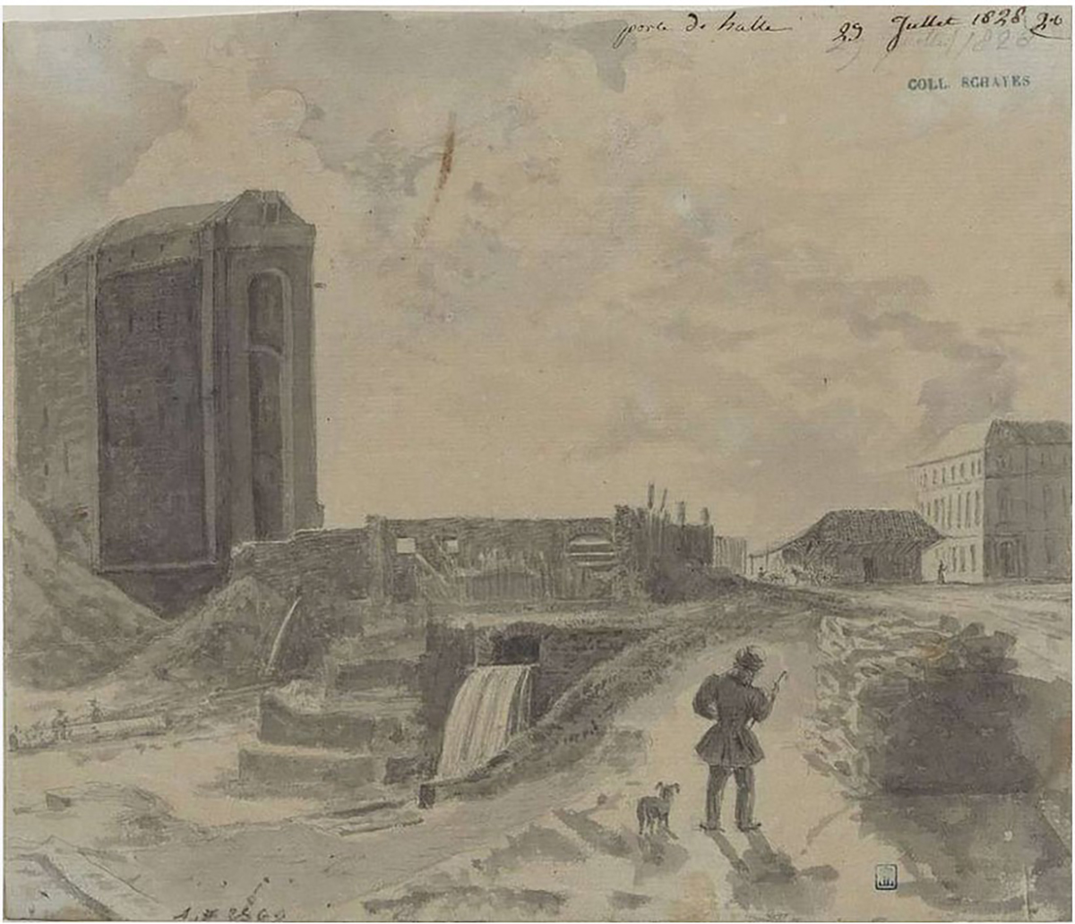
09 Unknown. (1828) “Porte de halle, 29 juillet 1828” https://garystockbridge617.getarchive.net/media/porte-de-halle-29-juillet-1828-b72331 (image)
10 Unknown. (image)
11 Unknown. (1890-1900) “Porte_de_Hal_(Hallepoort),_Brussels,_Belgium_(ca._1890-1900)” (image)
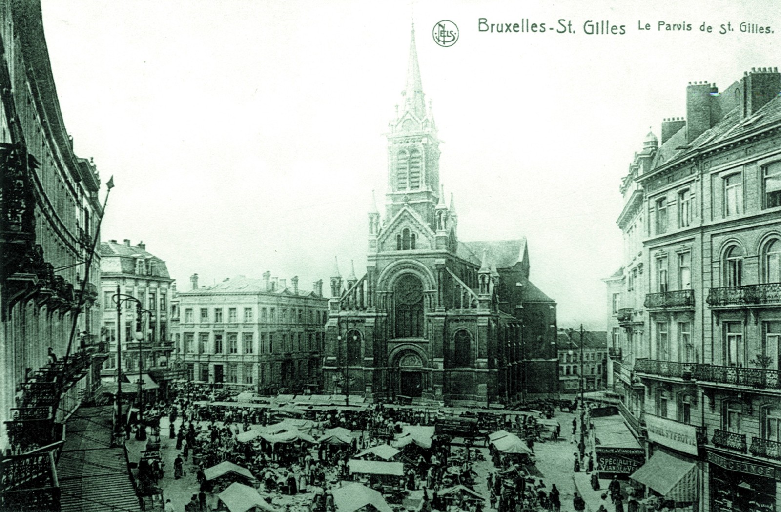
12 Unknown. “Le Parvis de St Gilles-Bruxelles (Verzameling van Dexia Bank, s.d.)” (image)
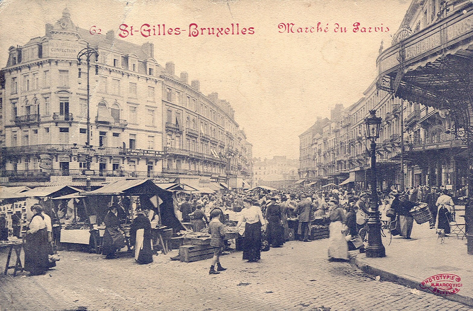
13 Unknown. “St Gilles-Bruxelles – Marché du Parvis (Verzameling van Dexia Bank, s.d.)” (image)
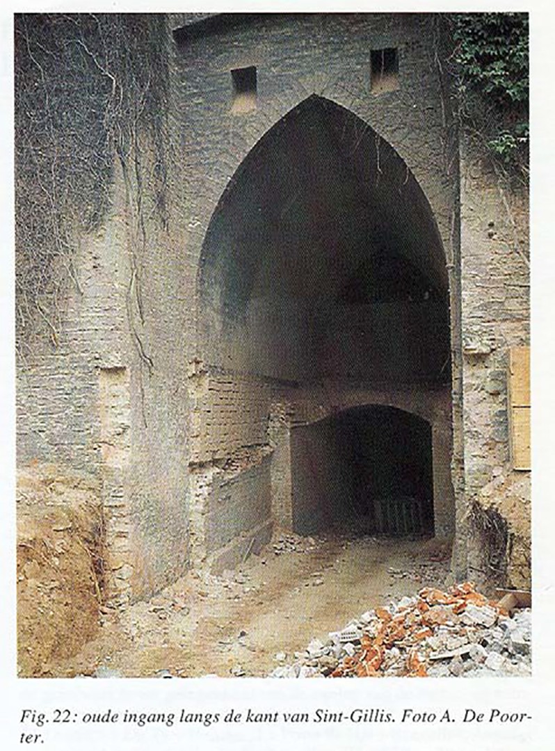
14 De Poorter, A. (1992) “Fig 22: Oude ingang langs de kant van Sint-Gillis”, in De Hallepoort in Brussel (Brab.) (image)
HOW IT LOOKS LIKE TODAY
Click on the zoom icon to view the full size.


